Randonnée Marche Lhez - Lhez-Les ponts G4 fait en 2021 - Photo

Lhez-Les ponts G4 fait en 2021

 mitch1952
mitch1952

Utilisateur

© OpenStreetMap contributors
Longueur
Longueur
11,2 km
Altitude max
Altitude max
441 m
Dénivelé positif
Dénivelé positif
244 m
Km-Effort
Km-Effort  
14,4 km
Altitude min
Altitude min
271 m
Dénivelé négatif
Dénivelé négatif
244 m
Boucle
Boucle
Oui
Date de création :
2021-10-29 07:50:20.58
Dernière modification :
2021-10-29 15:42:57.564

(0 Avis)

Marche
Marche
3h22
Difficulté : Difficile

Scannez ce code QR pour ouvrir la randonnée dans l'application SityTrail

Application GPS de randonnée GRATUITE

Logo SityTrail SityTrail

IGN / Instituts géographiques

Télécharger SityTrail sur l'App Store Télécharger SityTrail sur Google Play

Logo SityTrail SityTrail World

Le monde est à vous

Télécharger SityTrail sur l'App Store Télécharger SityTrail sur Google Play Télécharger SityTrail sur Huawei AppGallery

À propos

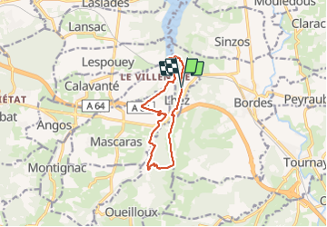
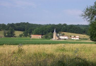
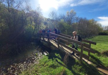
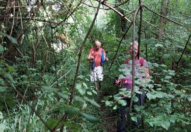
Randonnée Marche de 11,2 km à découvrir à Occitanie, Hautes-Pyrénées, Lhez. Cette randonnée est proposée par mitch1952.

Description

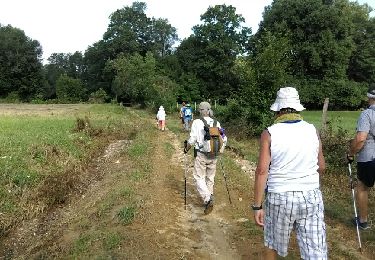
Parking Mairie de Lhez. Départ rando prendre direction nord.

Profil altimétrique

Photos

Localisation

Pays :
France
Région :
Occitanie
Département/Province :
Hautes-Pyrénées
Commune :
Lhez
Localité :
Unknown
Départ:(UTM)
272300 ; 4787348 (31T) N.

Randonnées à proximité

Randonnée Marche Lhez - lhezlespontsfaif - Photo
Marche
LouisROGER

Marche

Très facile
Lhez, Occitanie, Hautes-Pyrénées, France
11,6 km | 14,9 km-effort
3h 15min
Oui
Randonnée Marche Lhez - lhezlespontsfaif - Photo
Marche
LouisROGER

Marche

Très facile
(1)
Lhez, Occitanie, Hautes-Pyrénées, France
11,6 km | 14,9 km-effort
3h 15min
Oui
Randonnée A pied Coussan - Le Tour du Lac - Photo
A pied
PRO

A pied

Facile
Coussan, Occitanie, Hautes-Pyrénées, France
8,6 km | 11 km-effort
2h 30min
Oui
Randonnée Marche Lhez - lhezfaiapied - Photo
Marche
LouisROGER

Marche

Très facile
Lhez, Occitanie, Hautes-Pyrénées, France
9,5 km | 12,4 km-effort
2h 59min
Oui
Randonnée V.T.T. Angos - Angos - Bordes - Bois de Peyraube - Photo
V.T.T.
tracegps

V.T.T.

Difficile
Angos, Occitanie, Hautes-Pyrénées, France
35 km | 46 km-effort
2h 30min
Oui
Randonnée V.T.T. Angos - Angos - Sarouilles - Lac de l'Arrêt Darré - Photo
V.T.T.
tracegps

V.T.T.

Difficile
Angos, Occitanie, Hautes-Pyrénées, France
26 km | 34 km-effort
1h 49min
Oui
Randonnée V.T.T. Angos - Angos via Orleix - Photo
V.T.T.
tracegps

V.T.T.

Difficile
Angos, Occitanie, Hautes-Pyrénées, France
40 km | 50 km-effort
3h 0min
Oui
Randonnée Marche Lhez - LHEZG42021 - Photo
Marche
LouisROGER

Marche

Moyen
Lhez, Occitanie, Hautes-Pyrénées, France
7,9 km | 9,7 km-effort
5h 22min
Oui
Randonnée Marche Lhez - lhez les ponts G4 2022  - Photo
Marche
LouisROGER

Marche

Difficile
Lhez, Occitanie, Hautes-Pyrénées, France
11,9 km | 15,5 km-effort
5h 17min
Oui


Fermer
Mes abonnements