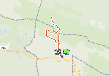
Pic d' Escurets depuis le col de Marie Blanque - G3

mitch1952
Utilisateur


2h30
Difficulté : Moyen

Application GPS de randonnée GRATUITE
 SityTrail
IGN / Instituts géographiques
SityTrail Plus
Le monde est à vous
À propos
Randonnée Marche de 5,8 km à découvrir à Nouvelle-Aquitaine, Pyrénées-Atlantiques, Bilhères. Cette randonnée est proposée par mitch1952.
Description
A steady climb for the first kilometer, and it's necessary to take it easy in the begining until the muscles warm up.
Beautiful scenery with some fantastic views overlooking the plateau de Benou and Oloron Saint Marie. It can get quite windy and cloudy once you reach the summit.
The climb down is quite steep and the path is stony so you need to be careful.
A short but sportive hike.
Localisation
Commentaires