Randonnée Marche Unknown - chemin du coq - Photo
 Nordic33
Nordic33

Utilisateur GUIDE

© OpenStreetMap contributors
Longueur
Longueur
6 km
Altitude max
Altitude max
1778 m
Dénivelé positif
Dénivelé positif
143 m
Km-Effort
Km-Effort  
8,6 km
Altitude min
Altitude min
1530 m
Dénivelé négatif
Dénivelé négatif
354 m
Boucle
Boucle
Non
Date de création :
2021-11-24 11:56:33.723
Dernière modification :
2021-11-24 14:40:43.373

(0 Avis)

Marche
Marche
1h57
Difficulté : Moyen

Scannez ce code QR pour ouvrir la randonnée dans l'application SityTrail

Application GPS de randonnée GRATUITE

Logo SityTrail SityTrail

IGN / Instituts géographiques

Télécharger SityTrail sur l'App Store Télécharger SityTrail sur Google Play

Logo SityTrail SityTrail World

Le monde est à vous

Télécharger SityTrail sur l'App Store Télécharger SityTrail sur Google Play Télécharger SityTrail sur Huawei AppGallery

À propos

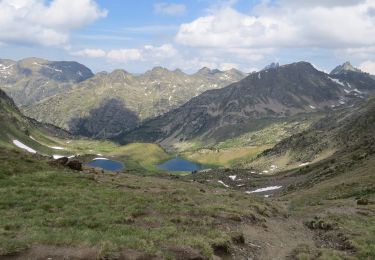
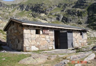
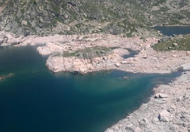
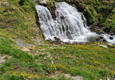
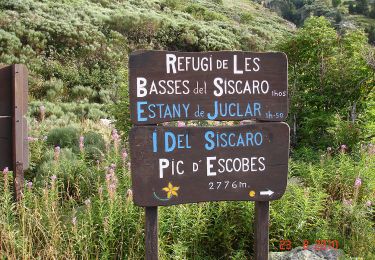
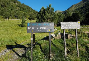
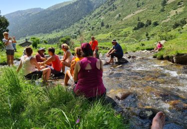
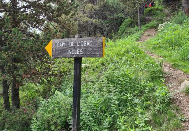
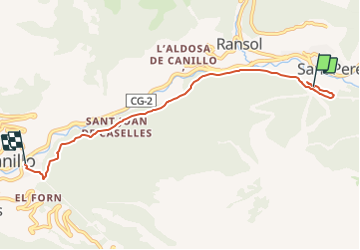
Randonnée Marche de 6 km à découvrir à Andorre. Cette randonnée est proposée par Nordic33.

Description

Enregistré en juillet 2017 Modifié avec openrunner.

Profil altimétrique

Photos

23 photos au total. Cliquez sur une photo pour les afficher toutes dans la galerie.

Localisation

Pays :
Andorre
Région :
Unknown
Département/Province :
Unknown
Commune :
Unknown
Localité :
Unknown
Départ:(Dec)
Départ:(UTM)
389221 ; 4714629 (31T) N.

Randonnées à proximité

Randonnée Marche  - Lac de Siscaro - Photo
Marche
GUIDE
Nordic33

Marche

Difficile
(2)
, , , Andorre
11 km | 21 km-effort
4h 51min
Oui
Randonnée Marche  - La Cabane-a-Jan - Photo
Marche
GUIDE
Nordic33

Marche

Moyen
(2)
, , , Andorre
3,9 km | 7,5 km-effort
1h 42min
Oui
Randonnée Marche  - estany de jugla - Photo
Marche
F_Fred

Marche

Très facile
(1)
, , , Andorre
6,8 km | 12,8 km-effort
2h 6min
Non
Randonnée Marche  - jan - Photo
Marche
GUIDE
Nordic33

Marche

Moyen
, , , Andorre
4,1 km | 7,8 km-effort
2h 59min
Oui
Randonnée Marche  - Le Lac de Juclar - Photo
Marche
GUIDE
Nordic33

Marche

Difficile
, , , Andorre
11,9 km | 21 km-effort
4h 45min
Oui
Randonnée Marche  - Le Pic de la Serrera - Photo
Marche
GUIDE
Nordic33

Marche

Très difficile
, , , Andorre
8,9 km | 22 km-effort
4h 55min
Oui
Randonnée Marche  - siscaro 18_06  - Photo
Marche
GUIDE
Nordic33

Marche

Très difficile
, , , Andorre
13,8 km | 23 km-effort
10h 30min
Oui
Randonnée Marche  - incles - Photo
Marche
GUIDE
Nordic33

Marche

Difficile
, , , Andorre
12,5 km | 18,8 km-effort
5h 58min
Non
Randonnée Marche  - Reco-siscaro-2022-05-27-ajusté - Photo
Marche
GUIDE
Nordic33

Marche

Difficile
, , , Andorre
10,7 km | 21 km-effort
5h 0min
Oui


Fermer
Mes abonnements