


hanches poiny

topophil
Utilisateur
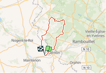

Longueur
41 km

Altitude max
191 m

Dénivelé positif
452 m
Km-Effort
47 km

Altitude min
107 m

Dénivelé négatif
451 m
Boucle
Oui
Date de création :
2021-12-02 13:04:55.329
Dernière modification :
2021-12-02 15:41:32.717
2h36
Difficulté : Très difficile

Application GPS de randonnée GRATUITE
 SityTrail
IGN / Instituts géographiques
SityTrail Plus
Le monde est à vous
À propos
Randonnée V.T.C. de 41 km à découvrir à Centre-Val de Loire, Eure-et-Loir, Hanches. Cette randonnée est proposée par topophil.
Localisation
Pays :
France
Région :
Centre-Val de Loire
Département/Province :
Eure-et-Loir
Commune :
Hanches
Localité :
Unknown
Départ:(Dec)
Départ:(UTM)
399585 ; 5384171 (31U) N.
Commentaires