Randonnée Marche Langogne - 48_J3-langogne-laveyrune - Photo

48_J3-langogne-laveyrune

 jab31
jab31

Utilisateur

© OpenStreetMap contributors
Longueur
Longueur
23 km
Altitude max
Altitude max
1236 m
Dénivelé positif
Dénivelé positif
649 m
Km-Effort
Km-Effort  
32 km
Altitude min
Altitude min
909 m
Dénivelé négatif
Dénivelé négatif
588 m
Boucle
Boucle
Non
Date de création :
2021-12-25 08:42:44.899
Dernière modification :
2022-01-30 16:50:27.714

(0 Avis)

Marche
Marche
7h09
Difficulté : Très difficile

Scannez ce code QR pour ouvrir la randonnée dans l'application SityTrail

Application GPS de randonnée GRATUITE

Logo SityTrail SityTrail

IGN / Instituts géographiques

Télécharger SityTrail sur l'App Store Télécharger SityTrail sur Google Play

Logo SityTrail SityTrail World

Le monde est à vous

Télécharger SityTrail sur l'App Store Télécharger SityTrail sur Google Play Télécharger SityTrail sur Huawei AppGallery

À propos

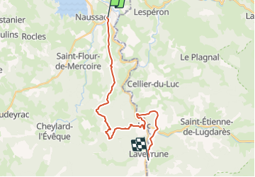
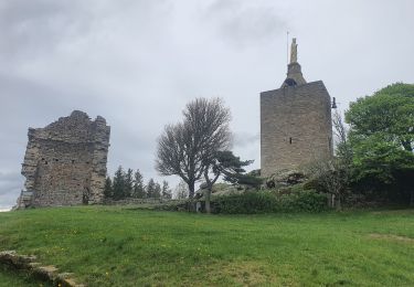
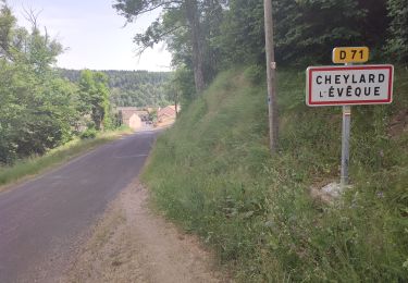
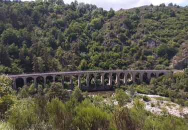
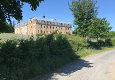
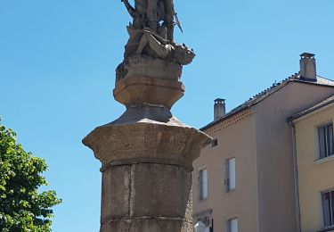
Randonnée Marche de 23 km à découvrir à Occitanie, Lozère, Langogne. Cette randonnée est proposée par jab31.

Description

Mis en route 4,7 km après départ

Profil altimétrique

Localisation

Pays :
France
Région :
Occitanie
Département/Province :
Lozère
Commune :
Langogne
Localité :
Unknown
Départ:(UTM)
567734 ; 4952971 (31T) N.

Randonnées à proximité

Randonnée Marche Naussac-Fontanes - naussac - Photo
Marche
olivier78000

Marche

Facile
(1)
Naussac-Fontanes, Occitanie, Lozère, France
7,9 km | 10,2 km-effort
2h 6min
Oui
Randonnée V.T.T. Langogne - Espace VTT FFC du Gévaudan - n°08 - Circuit  du Ras Chambon - Photo
V.T.T.
tracegps

V.T.T.

Difficile
(2)
Langogne, Occitanie, Lozère, France
17,2 km | 22 km-effort
2h 15min
Oui
Randonnée Marche Langogne - E4 Langogne - Luc GR70 - Photo
Marche
GUIDE
Kargil

Marche

Difficile
Langogne, Occitanie, Lozère, France
28 km | 38 km-effort
7h 6min
Non
Randonnée Marche Pradelles - Etape 3 Pradelles  Haut cheylard l évêque  - Photo
Marche
Nathalie. Mercier

Marche

Difficile
Pradelles, Auvergne-Rhône-Alpes, Haute-Loire, France
23 km | 30 km-effort
5h 46min
Non
Randonnée Marche Langogne - 09-05-2023 E4 Langogne - Luc - Photo
Marche
GUIDE
Kargil

Marche

Difficile
Langogne, Occitanie, Lozère, France
28 km | 38 km-effort
8h 35min
Non
Randonnée Marche Saint-Flour-de-Mercoire - le chélard - Photo
Marche
jeanjean35

Marche

Difficile
Saint-Flour-de-Mercoire, Occitanie, Lozère, France
11 km | 14,9 km-effort
3h 6min
Non
Randonnée Vélo de route Langogne - Langogne, le nouveau monde - Photo
Vélo de route
nadd73

Vélo de route

Moyen
Langogne, Occitanie, Lozère, France
68 km | 85 km-effort
4h 31min
Oui
Randonnée Marche Saint-Flour-de-Mercoire - L’Herm Notre dame des neiges - Photo
Marche
GUIDE
Roger Philippe Wallez

Marche

Très difficile
Saint-Flour-de-Mercoire, Occitanie, Lozère, France
34 km | 46 km-effort
8h 51min
Non
Randonnée Vélo de route Langogne - NAUSSAC - COL DE LA PIERRE PLANTEE - Photo
Vélo de route
jean-marie.parachini

Vélo de route

Facile
Langogne, Occitanie, Lozère, France
76 km | 91 km-effort
6h 20min
Oui


Fermer
Mes abonnements