Randonnée Marche Saint-Jean-de-Luz - JFT YB ETAPE 23 21-5-2014 - Photo
 jeff2
jeff2

Utilisateur

© OpenStreetMap contributors
Longueur
Longueur
17,3 km
Altitude max
Altitude max
58 m
Dénivelé positif
Dénivelé positif
321 m
Km-Effort
Km-Effort  
22 km
Altitude min
Altitude min
-2 m
Dénivelé négatif
Dénivelé négatif
324 m
Boucle
Boucle
Non
Date de création :
2014-12-10 00:00:00.0
Dernière modification :
2014-12-10 00:00:00.0

(0 Avis)

Marche
Marche
5h10
Difficulté : Facile

Scannez ce code QR pour ouvrir la randonnée dans l'application SityTrail

Application GPS de randonnée GRATUITE

Logo SityTrail SityTrail

IGN / Instituts géographiques

Télécharger SityTrail sur l'App Store Télécharger SityTrail sur Google Play

Logo SityTrail SityTrail World

Le monde est à vous

Télécharger SityTrail sur l'App Store Télécharger SityTrail sur Google Play Télécharger SityTrail sur Huawei AppGallery

À propos

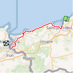
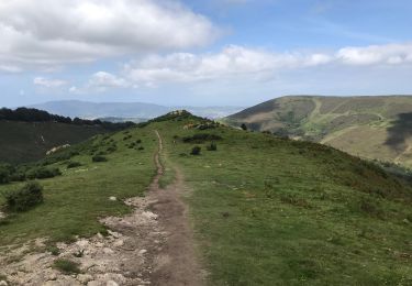
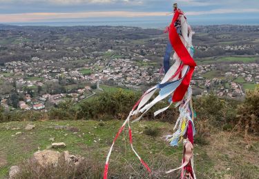
Randonnée Marche de 17,3 km à découvrir à Nouvelle-Aquitaine, Pyrénées-Atlantiques, Saint-Jean-de-Luz. Cette randonnée est proposée par jeff2.

Description

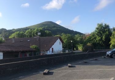
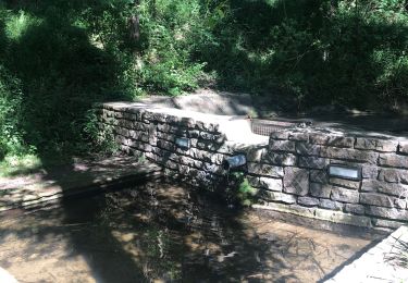
ST JEAN DE LUZ À IRUN

Profil altimétrique

Photos

Points d'intérêt

Point d'intérêt Hendaye - Point 9 - Photo
jeff2
HENDAYE 
Point d'intérêt Hendaye - . Point 10 - Photo
jeff2
HENDAYE 
Point d'intérêt Hendaye - Point 11 - Photo
jeff2
HENDAYE 

Localisation

Pays :
France
Région :
Nouvelle-Aquitaine
Département/Province :
Pyrénées-Atlantiques
Commune :
Saint-Jean-de-Luz
Localité :
Unknown
Départ:(Dec)
Départ:(UTM)
608389 ; 4805095 (30T) N.

Randonnées à proximité

Randonnée Marche Ascain - ascain Sare ascain - Photo
Marche
RayFab

Marche

Moyen
(1)
Ascain, Nouvelle-Aquitaine, Pyrénées-Atlantiques, France
18,8 km | 27 km-effort
4h 39min
Oui
Randonnée Marche Saint-Jean-de-Luz - 64 SAINT-JEAN-DE-LUZ, front de mer, pointe ste Barbe, sentier littoral - Photo
Marche
jeff66

Marche

Moyen
(1)
Saint-Jean-de-Luz, Nouvelle-Aquitaine, Pyrénées-Atlantiques, France
6,9 km | 8,4 km-effort
1h 57min
Oui
Randonnée Marche Saint-Pée-sur-Nivelle - Uhartea 22   - Photo
Marche
tracegps

Marche

Très difficile
(1)
Saint-Pée-sur-Nivelle, Nouvelle-Aquitaine, Pyrénées-Atlantiques, France
22 km | 31 km-effort
7h 0min
Oui
Randonnée V.T.T. Urrugne - la rhune - Photo
V.T.T.
PierreBellevaux

V.T.T.

Très difficile
(2)
Urrugne, Nouvelle-Aquitaine, Pyrénées-Atlantiques, France
32 km | 45 km-effort
3h 42min
Oui
Randonnée V.T.T. Ascain - Ibardin 10/8/23 - Photo
V.T.T.
CEFAMALI

V.T.T.

Ascain, Nouvelle-Aquitaine, Pyrénées-Atlantiques, France
40 km | 58 km-effort
3h 52min
Non
Randonnée Marche Ascain - Cascade de l' Uzkaingo Erreka - Photo
Marche
jaja64

Marche

Moyen
Ascain, Nouvelle-Aquitaine, Pyrénées-Atlantiques, France
13,3 km | 21 km-effort
5h 55min
Oui
Randonnée Marche Ascain - Sentier 3 sommets Ascain - Photo
Marche
jaja64

Marche

Facile
Ascain, Nouvelle-Aquitaine, Pyrénées-Atlantiques, France
8,8 km | 14,4 km-effort
3h 6min
Oui
Randonnée Marche Ascain - Cascade Uzkaingo Erreka - Photo
Marche
jaja64

Marche

Facile
(1)
Ascain, Nouvelle-Aquitaine, Pyrénées-Atlantiques, France
12,6 km | 20 km-effort
4h 36min
Oui
Randonnée Marche Urrugne - SOCOA HENDAYE par sentier du littoral - Photo
Marche
jaja64

Marche

Facile
Urrugne, Nouvelle-Aquitaine, Pyrénées-Atlantiques, France
17 km | 22 km-effort
4h 24min
Oui


Fermer
Mes abonnements