Randonnée A pied Ohlweiler - Traumschleife Domblick - Photo

Tous les sentiers balisés d’Europe PRO

© OpenStreetMap contributors
Longueur
Longueur
10,7 km
Altitude max
Altitude max
393 m
Dénivelé positif
Dénivelé positif
204 m
Km-Effort
Km-Effort  
13,5 km
Altitude min
Altitude min
307 m
Dénivelé négatif
Dénivelé négatif
205 m
Boucle
Boucle
Oui
Balise
Balise
Date de création :
2022-02-11 15:58:22.089
Dernière modification :
2022-02-11 15:58:22.089

(0 Avis)

A pied
A pied
3h03
Difficulté : Facile

Scannez ce code QR pour ouvrir la randonnée dans l'application SityTrail

Application GPS de randonnée GRATUITE

Logo SityTrail SityTrail

IGN / Instituts géographiques

Télécharger SityTrail sur l'App Store Télécharger SityTrail sur Google Play

Logo SityTrail SityTrail World

Le monde est à vous

Télécharger SityTrail sur l'App Store Télécharger SityTrail sur Google Play Télécharger SityTrail sur Huawei AppGallery

À propos

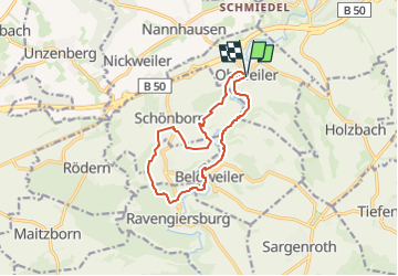
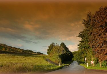
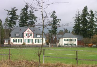
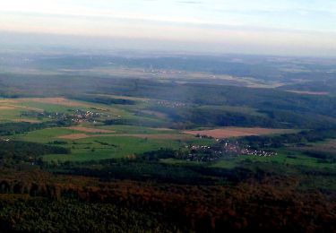
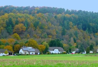
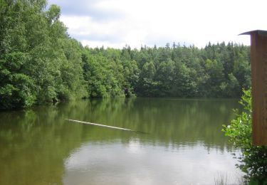
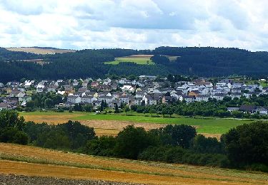
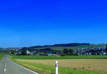
Randonnée A pied de 10,7 km à découvrir à Rhénanie-Palatinat, Rhein-Hunsrück-Kreis, Ohlweiler. Cette randonnée est proposée par SityTrail - itinéraires balisés pédestres.

Description

2018-09-02 bearbeitet nach tatsächlicher Markierung im Gelände. Die veröffentlichten GPXe weichen teilweise ab.

Photos

Localisation

Pays :
Allemagne
Région :
Rhénanie-Palatinat
Département/Province :
Rhein-Hunsrück-Kreis
Commune :
Ohlweiler
Localité :
Unknown
Départ:(UTM)
392289 ; 5535787 (32U) N.

Randonnées à proximité

Randonnée Marche Mörsdorf - Promenade vers le pont de Geierlay   - Photo
Marche
GUIDE+

Marche

Difficile
(2)
Mörsdorf, Rhénanie-Palatinat, Rhein-Hunsrück-Kreis, Allemagne
9 km | 12,1 km-effort
2h 45min
Oui
Randonnée A pied Niedert - Traumschleife Oberes Baybachtal - Photo
A pied
PRO

A pied

Facile
Niedert, Rhénanie-Palatinat, Rhein-Hunsrück-Kreis, Allemagne
15,4 km | 19,6 km-effort
4h 27min
Oui
Randonnée A pied Auen - Auen 3 - Photo
A pied
PRO

A pied

Facile
Auen, Rhénanie-Palatinat, Landkreis Bad Kreuznach, Allemagne
3,5 km | 5,5 km-effort
1h 14min
Non
Randonnée A pied Bad Sobernheim - Entenpfuhl 2 - Photo
A pied
PRO

A pied

Facile
Bad Sobernheim, Rhénanie-Palatinat, Landkreis Bad Kreuznach, Allemagne
6,8 km | 8,8 km-effort
1h 59min
Oui
Randonnée A pied Bad Sobernheim - Jäger-aus-Kurpfalz-Weg (Entenpfuhl 3) - Photo
A pied
PRO

A pied

Facile
Bad Sobernheim, Rhénanie-Palatinat, Landkreis Bad Kreuznach, Allemagne
10,5 km | 13,7 km-effort
3h 6min
Oui
Randonnée A pied Mengerschied - Traumschleife Soonwald - Photo
A pied
PRO

A pied

Facile
Mengerschied, Rhénanie-Palatinat, Rhein-Hunsrück-Kreis, Allemagne
10 km | 13 km-effort
2h 57min
Oui
Randonnée A pied Argenthal - Traumschleife Schanzerkopf-Tour - Photo
A pied
PRO

A pied

Facile
Argenthal, Rhénanie-Palatinat, Rhein-Hunsrück-Kreis, Allemagne
14,6 km | 18,8 km-effort
4h 16min
Oui
Randonnée A pied Rhaunen - Traumschleife Stumm-Orgel-Weg - Photo
A pied
PRO

A pied

Facile
Rhaunen, Rhénanie-Palatinat, Landkreis Birkenfeld, Allemagne
14 km | 18 km-effort
4h 5min
Oui
Randonnée A pied Horbruch - Traumschleife Via Molarum - Photo
A pied
PRO

A pied

Moyen
Horbruch, Rhénanie-Palatinat, Landkreis Birkenfeld, Allemagne
16 km | 20 km-effort
4h 36min
Oui


Fermer
Mes abonnements