


6,8 km | 9,2 km-effort


Tous les sentiers balisés d’Europe PRO


Application GPS de randonnée GRATUITE
 SityTrail
IGN / Instituts géographiques
SityTrail World
Le monde est à vous
Randonnée A pied de 3,4 km à découvrir à Rhénanie-Palatinat, Landkreis Mainz-Bingen, Gau-Bischofsheim. Cette randonnée est proposée par SityTrail - itinéraires balisés pédestres.
Symbole: gelber Römer auf weißem Grund


A pied
A pied
A pied
A pied
A pied
A pied
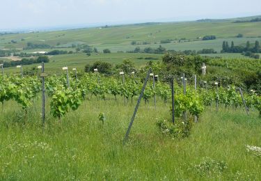
![Randonnée A pied Klein-Winternheim - [Rotes Eichenblatt] Mainz (Hbf) - Marienborn - Zahlbach - Photo](https://media.geolcdn.com/t/375/260/ext.jpg?maxdim=2&url=https%3A%2F%2Fmedia.geolcdn.com%2Ff%2F29f95c8a-1e3d-4c7e-9ab0-7a1f3486a7e7.jpeg)
A pied
A pied
A pied