Randonnée A pied Simmerath - Flurheckenweg Eicherscheid - Photo

Tous les sentiers balisés d’Europe PRO

© OpenStreetMap contributors
Longueur
Longueur
7,8 km
Altitude max
Altitude max
561 m
Dénivelé positif
Dénivelé positif
95 m
Km-Effort
Km-Effort  
9,1 km
Altitude min
Altitude min
506 m
Dénivelé négatif
Dénivelé négatif
94 m
Boucle
Boucle
Oui
Balise
Balise
Date de création :
2022-02-11 17:08:57.419
Dernière modification :
2022-02-11 17:08:57.419

(0 Avis)

A pied
A pied
2h03
Difficulté : Facile

Scannez ce code QR pour ouvrir la randonnée dans l'application SityTrail

Application GPS de randonnée GRATUITE

Logo SityTrail SityTrail

IGN / Instituts géographiques

Télécharger SityTrail sur l'App Store Télécharger SityTrail sur Google Play

Logo SityTrail SityTrail World

Le monde est à vous

Télécharger SityTrail sur l'App Store Télécharger SityTrail sur Google Play Télécharger SityTrail sur Huawei AppGallery

À propos

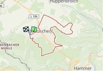
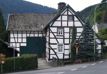
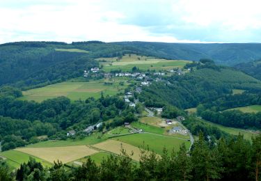
Randonnée A pied de 7,8 km à découvrir à Rhénanie-du-Nord-Westphalie, Région urbaine d'Aix-la-Chapelle, Simmerath. Cette randonnée est proposée par SityTrail - itinéraires balisés pédestres.

Description

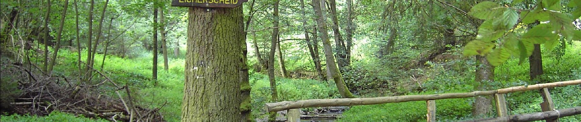
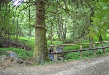
Randonnée créée par Eifelverein Eicherscheid.

Photos

Localisation

Pays :
Allemagne
Région :
Rhénanie-du-Nord-Westphalie
Département/Province :
Région urbaine d'Aix-la-Chapelle
Commune :
Simmerath
Localité :
Unknown
Départ:(UTM)
308741 ; 5606331 (32U) N.

Randonnées à proximité

Randonnée Marche Montjoie - Route des jonquilles  Monschau-Höfen  - Photo
Marche
GUIDE
mumu.larandonneuse

Marche

Moyen
(1)
Montjoie, Rhénanie-du-Nord-Westphalie, Région urbaine d'Aix-la-Chapelle, Allemagne
14,8 km | 18,2 km-effort
4h 8min
Oui
Randonnée Marche Montjoie - Montjoie - Ternell en ligne - Photo
Marche
GUIDE
mumu.larandonneuse

Marche

Moyen
(1)
Montjoie, Rhénanie-du-Nord-Westphalie, Région urbaine d'Aix-la-Chapelle, Allemagne
13,2 km | 17,1 km-effort
3h 52min
Non
Randonnée A pied Simmerath - Rur-Panoramaweg - Photo
A pied
PRO

A pied

Facile
Simmerath, Rhénanie-du-Nord-Westphalie, Région urbaine d'Aix-la-Chapelle, Allemagne
6,5 km | 8,8 km-effort
1h 59min
Oui
Randonnée A pied Simmerath - DE-66 - Photo
A pied
PRO

A pied

Facile
Simmerath, Rhénanie-du-Nord-Westphalie, Région urbaine d'Aix-la-Chapelle, Allemagne
5,8 km | 7,8 km-effort
1h 46min
Oui
Randonnée A pied Simmerath - Eifelverein OG Eicherscheid - Weg 26 - Photo
A pied
PRO

A pied

Facile
Simmerath, Rhénanie-du-Nord-Westphalie, Région urbaine d'Aix-la-Chapelle, Allemagne
7,2 km | 9,4 km-effort
2h 8min
Oui
Randonnée A pied Simmerath - Eichheck-Runde - Photo
A pied
PRO

A pied

Facile
Simmerath, Rhénanie-du-Nord-Westphalie, Région urbaine d'Aix-la-Chapelle, Allemagne
8,1 km | 11,5 km-effort
2h 37min
Oui
Randonnée A pied Simmerath - Eifelverein - Weg 54 - Photo
A pied
PRO

A pied

Facile
Simmerath, Rhénanie-du-Nord-Westphalie, Région urbaine d'Aix-la-Chapelle, Allemagne
11,7 km | 13,9 km-effort
3h 9min
Oui
Randonnée A pied Montjoie - Eifelverein Rohren - Weg 57 - Photo
A pied
PRO

A pied

Moyen
(1)
Montjoie, Rhénanie-du-Nord-Westphalie, Région urbaine d'Aix-la-Chapelle, Allemagne
15,1 km | 20 km-effort
4h 34min
Oui
Randonnée A pied Simmerath - Rursee-Höhenweg - Photo
A pied
PRO

A pied

Facile
Simmerath, Rhénanie-du-Nord-Westphalie, Région urbaine d'Aix-la-Chapelle, Allemagne
11,7 km | 15,6 km-effort
3h 33min
Oui


Fermer
Mes abonnements