Randonnée A pied Boppard - Traumschleife Rheingold - Photo

Tous les sentiers balisés d’Europe PRO

© OpenStreetMap contributors
Longueur
Longueur
11 km
Altitude max
Altitude max
310 m
Dénivelé positif
Dénivelé positif
358 m
Km-Effort
Km-Effort  
15,8 km
Altitude min
Altitude min
143 m
Dénivelé négatif
Dénivelé négatif
359 m
Boucle
Boucle
Oui
Balise
Balise
Date de création :
2022-02-11 20:31:54.029
Dernière modification :
2022-02-11 20:31:54.029

(0 Avis)

A pied
A pied
3h35
Difficulté : Facile

Scannez ce code QR pour ouvrir la randonnée dans l'application SityTrail

Application GPS de randonnée GRATUITE

Logo SityTrail SityTrail

IGN / Instituts géographiques

Télécharger SityTrail sur l'App Store Télécharger SityTrail sur Google Play

Logo SityTrail SityTrail World

Le monde est à vous

Télécharger SityTrail sur l'App Store Télécharger SityTrail sur Google Play Télécharger SityTrail sur Huawei AppGallery

À propos

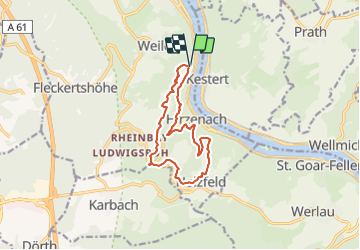
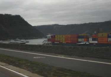
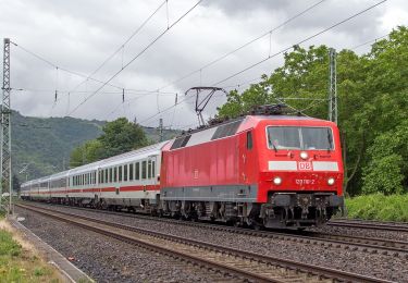
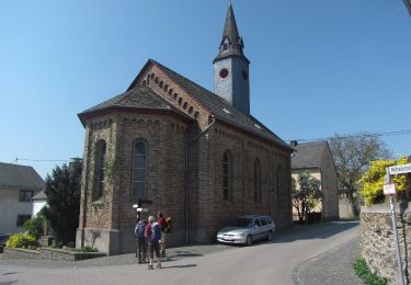
Randonnée A pied de 11 km à découvrir à Rhénanie-Palatinat, Rhein-Hunsrück-Kreis, Boppard. Cette randonnée est proposée par SityTrail - itinéraires balisés pédestres.

Description

Symbole: weiß auf violett: Von den Zinnen eines Burgturmes gekröntes R

Photos

Localisation

Pays :
Allemagne
Région :
Rhénanie-Palatinat
Département/Province :
Rhein-Hunsrück-Kreis
Commune :
Boppard
Localité :
Unknown
Départ:(UTM)
403079 ; 5560501 (32U) N.

Randonnées à proximité

Randonnée A pied Sankt Goarshausen - Rheinsteig-Zuweg Nochem - Photo
A pied
PRO

A pied

Facile
Sankt Goarshausen, Rhénanie-Palatinat, Rhein-Lahn-Kreis, Allemagne
3,8 km | 4,5 km-effort
1h 1min
Non
Randonnée A pied Lykershausen - Rheinsteig-Zuweg Prath - Photo
A pied
PRO

A pied

Facile
Lykershausen, Rhénanie-Palatinat, Rhein-Lahn-Kreis, Allemagne
4,1 km | 4,8 km-effort
1h 6min
Non
Randonnée A pied Boppard - Traumschleife Marienberg - Photo
A pied
PRO

A pied

Facile
Boppard, Rhénanie-Palatinat, Rhein-Hunsrück-Kreis, Allemagne
4 km | 5,5 km-effort
1h 15min
Non
Randonnée A pied Sankt Goarshausen - Bergbau- und Landschaftspfad Ehrenthal-Prath-Wellmich - Photo
A pied
PRO

A pied

Facile
Sankt Goarshausen, Rhénanie-Palatinat, Rhein-Lahn-Kreis, Allemagne
3,5 km | 6,1 km-effort
1h 23min
Non
Randonnée A pied Lykershausen - Rheinsteig-Zuweg Dahlheim - Photo
A pied
PRO

A pied

Facile
Lykershausen, Rhénanie-Palatinat, Rhein-Lahn-Kreis, Allemagne
3,1 km | 3,9 km-effort
52min
Non
Randonnée A pied Boppard - Traumschleife Fünfseenblick - Photo
A pied
PRO

A pied

Facile
Boppard, Rhénanie-Palatinat, Rhein-Hunsrück-Kreis, Allemagne
10,9 km | 16,7 km-effort
3h 47min
Oui
Randonnée A pied Kestert - Rheinsteig [Kestert - St. Goarshausen] - Photo
A pied
PRO

A pied

Facile
Kestert, Rhénanie-Palatinat, Rhein-Lahn-Kreis, Allemagne
12,1 km | 17,9 km-effort
4h 4min
Non
Randonnée A pied Kamp-Bornhofen - Rheinsteig [Kramp-Bornhofen - Kestert] - Photo
A pied
PRO

A pied

Facile
Kamp-Bornhofen, Rhénanie-Palatinat, Rhein-Lahn-Kreis, Allemagne
10,3 km | 15 km-effort
3h 24min
Non
Randonnée Marche Kestert - w-duitsland-rheinsteig - Photo
Marche
gpstracks

Marche

Très facile
Kestert, Rhénanie-Palatinat, Rhein-Lahn-Kreis, Allemagne
70 km | 106 km-effort
Inconnu
Non


Fermer
Mes abonnements