Randonnée Marche Saint-Pierre-de-Chandieu - 69-st-pierre-de-chandieu-boucle-ozon-9km - Photo

69-st-pierre-de-chandieu-boucle-ozon-9km

 SyMA
SyMA

Utilisateur

© OpenStreetMap contributors
Longueur
Longueur
8,6 km
Altitude max
Altitude max
332 m
Dénivelé positif
Dénivelé positif
139 m
Km-Effort
Km-Effort  
10,5 km
Altitude min
Altitude min
261 m
Dénivelé négatif
Dénivelé négatif
140 m
Boucle
Boucle
Oui
Date de création :
2022-02-13 13:45:02.824
Dernière modification :
2022-02-13 17:32:34.902

(1 Avis)

Marche
Marche
2h08
Difficulté : Facile

Scannez ce code QR pour ouvrir la randonnée dans l'application SityTrail

Application GPS de randonnée GRATUITE

Logo SityTrail SityTrail

IGN / Instituts géographiques

Télécharger SityTrail sur l'App Store Télécharger SityTrail sur Google Play

Logo SityTrail SityTrail World

Le monde est à vous

Télécharger SityTrail sur l'App Store Télécharger SityTrail sur Google Play Télécharger SityTrail sur Huawei AppGallery

À propos

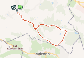
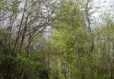
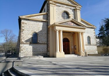
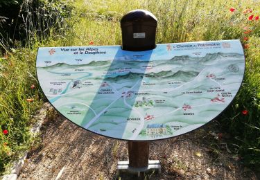
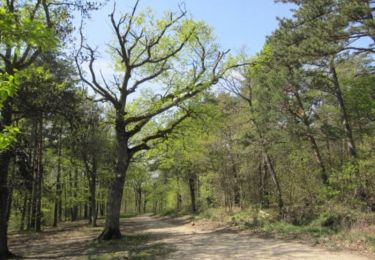
Randonnée Marche de 8,6 km à découvrir à Auvergne-Rhône-Alpes, Rhône, Saint-Pierre-de-Chandieu. Cette randonnée est proposée par SyMA.

Description

Parking le long chemin de Villeneuve
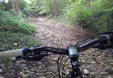
Passage  pont ok

Profil altimétrique

Photos

Localisation

Pays :
France
Région :
Auvergne-Rhône-Alpes
Département/Province :
Rhône
Commune :
Saint-Pierre-de-Chandieu
Localité :
Unknown
Départ:(UTM)
655664 ; 5055345 (31T) N.

Commentaires

Veuillez vous connecter pour laisser un commentaire ou une note


Randonnées à proximité

Randonnée V.T.T. Chaponnay - Chaponnay - Valencin - Photo
V.T.T.
marc6262

V.T.T.

Moyen
(1)
Chaponnay, Auvergne-Rhône-Alpes, Rhône, France
25 km | 31 km-effort
3h 50min
Oui
Randonnée Marche Chaponnay - 69-chaponnay-a-luzinay-20KM-430m-sensH-mai21 - Photo
Marche
SyMA

Marche

Difficile
Chaponnay, Auvergne-Rhône-Alpes, Rhône, France
20 km | 26 km-effort
5h 56min
Oui
Randonnée Marche Toussieu - 69 Toussieu poypes 2 vallons 21km 420m - Photo
Marche
SyMA

Marche

Moyen
Toussieu, Auvergne-Rhône-Alpes, Rhône, France
21 km | 27 km-effort
5h 54min
Oui
Randonnée Marche Saint-Pierre-de-Chandieu - 69-Saint Pierre de Chandieu 17km 400m MAI 2020 - Photo
Marche
SyMA

Marche

Facile
Saint-Pierre-de-Chandieu, Auvergne-Rhône-Alpes, Rhône, France
17,4 km | 23 km-effort
4h 48min
Oui
Randonnée V.T.T. Chaponnay - Boucle VTT autour de Chaponnay - Photo
V.T.T.
tracegps

V.T.T.

Difficile
Chaponnay, Auvergne-Rhône-Alpes, Rhône, France
29 km | 36 km-effort
2h 30min
Oui
Randonnée V.T.T. Saint-Pierre-de-Chandieu - autour de la ferme de savoye vers luzinay - Photo
V.T.T.
marc6262

V.T.T.

Moyen
Saint-Pierre-de-Chandieu, Auvergne-Rhône-Alpes, Rhône, France
31 km | 38 km-effort
Inconnu
Oui
Randonnée Marche Saint-Pierre-de-Chandieu - 69 Saint Pierre Chandieu 2 17km 380m - Photo
Marche
SyMA

Marche

Facile
Saint-Pierre-de-Chandieu, Auvergne-Rhône-Alpes, Rhône, France
17,4 km | 23 km-effort
4h 48min
Oui
Randonnée Marche Saint-Pierre-de-Chandieu - 69-Saint Pierre de chandieu 18km 400m - Photo
Marche
SyMA

Marche

Facile
Saint-Pierre-de-Chandieu, Auvergne-Rhône-Alpes, Rhône, France
17,6 km | 23 km-effort
3h 50min
Oui
Randonnée V.T.T. Chaponnay - De Chaponnay à Luzinay - Photo
V.T.T.
tracegps

V.T.T.

Difficile
(1)
Chaponnay, Auvergne-Rhône-Alpes, Rhône, France
23 km | 30 km-effort
2h 30min
Oui


Fermer
Mes abonnements