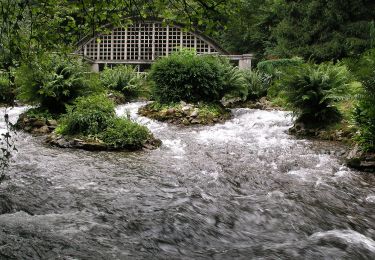
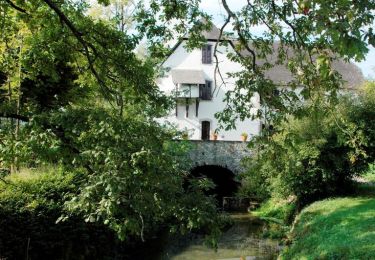
Randonnée A pied Lys - Le piémont ossalois (Circuit patrimoine) - Photo

Le piémont ossalois (Circuit patrimoine)

Tous les sentiers balisés d’Europe PRO

© OpenStreetMap contributors
Longueur
Longueur
3,7 km
Altitude max
Altitude max
458 m
Dénivelé positif
Dénivelé positif
113 m
Km-Effort
Km-Effort  
5,1 km
Altitude min
Altitude min
345 m
Dénivelé négatif
Dénivelé négatif
97 m
Boucle
Boucle
Non
Balise
Balise
Date de création :
2022-02-15 14:23:58.628
Dernière modification :
2022-03-02 16:01:37.065

(0 Avis)

A pied
A pied
1h09
Difficulté : Facile

Scannez ce code QR pour ouvrir la randonnée dans l'application SityTrail

Application GPS de randonnée GRATUITE

Logo SityTrail SityTrail

IGN / Instituts géographiques

Télécharger SityTrail sur l'App Store Télécharger SityTrail sur Google Play

Logo SityTrail SityTrail World

Le monde est à vous

Télécharger SityTrail sur l'App Store Télécharger SityTrail sur Google Play Télécharger SityTrail sur Huawei AppGallery

À propos

Randonnée A pied de 3,7 km à découvrir à Nouvelle-Aquitaine, Pyrénées-Atlantiques, Lys. Cette randonnée est proposée par SityTrail - itinéraires balisés pédestres.

Description

Randonnée créée par Communauté de Communes de la vallée d'Ossau.


Site web: https://www.valleedossau-tourisme.com/randonnees/pedestre/circuits-a-la-journee/

Localisation

Pays :
France
Région :
Nouvelle-Aquitaine
Département/Province :
Pyrénées-Atlantiques
Commune :
Lys
Localité :
Unknown
Départ:(UTM)
716304 ; 4780114 (30T) N.

Randonnées à proximité

Randonnée A pied Bruges-Capbis-Mifaget - BRUGES  BALISAGE gr78 b - Photo
A pied
GUIDE
marmotte65

A pied

Facile
Bruges-Capbis-Mifaget, Nouvelle-Aquitaine, Pyrénées-Atlantiques, France
6 km | 7,7 km-effort
1h 44min
Non
Randonnée A pied Rébénacq - Le vieux Château - Photo
A pied
PRO

A pied

Facile
Rébénacq, Nouvelle-Aquitaine, Pyrénées-Atlantiques, France
3,5 km | 5,2 km-effort
1h 10min
Oui
Randonnée Marche Bruges-Capbis-Mifaget - Chemin du Piémont Pyrénéen - De Bruges à Buzy - Photo
Marche
tracegps

Marche

Difficile
Bruges-Capbis-Mifaget, Nouvelle-Aquitaine, Pyrénées-Atlantiques, France
21 km | 29 km-effort
5h 0min
Non
Randonnée Marche Bruges-Capbis-Mifaget - Bruges Mifaget - Photo
Marche
tracegps

Marche

Moyen
Bruges-Capbis-Mifaget, Nouvelle-Aquitaine, Pyrénées-Atlantiques, France
10,4 km | 12,9 km-effort
3h 45min
Oui
Randonnée Marche Bruges-Capbis-Mifaget - Bruges-capbis_Buzy - Photo
Marche
dagobert5612

Marche

Facile
Bruges-Capbis-Mifaget, Nouvelle-Aquitaine, Pyrénées-Atlantiques, France
19,9 km | 26 km-effort
6h 46min
Non
Randonnée A pied Bruges-Capbis-Mifaget - GR78 (Mon GR préféré) BRUGES / BUZY 17 km  581M+
A pied
GUIDE
marmotte65

A pied

Moyen
Bruges-Capbis-Mifaget, Nouvelle-Aquitaine, Pyrénées-Atlantiques, France
20 km | 29 km-effort
5h 38min
Non
Randonnée Marche Bruges-Capbis-Mifaget - BRUGES MIFAGET 27OCTOBRE - Photo
Marche
jpgaillard

Marche

Difficile
Bruges-Capbis-Mifaget, Nouvelle-Aquitaine, Pyrénées-Atlantiques, France
11,3 km | 13,8 km-effort
3h 8min
Oui
Randonnée Marche Bruges-Capbis-Mifaget - 10 PL4 Bruges Mifaget.kml - Photo
Marche
jpgaillard

Marche

Difficile
Bruges-Capbis-Mifaget, Nouvelle-Aquitaine, Pyrénées-Atlantiques, France
10,5 km | 13 km-effort
2h 56min
Oui
Randonnée A pied Bruges-Capbis-Mifaget - GR 78 - B -   BARAT / LACOMBE / LAMAGNERE - Photo
A pied
GUIDE
marmotte65

A pied

Moyen
Bruges-Capbis-Mifaget, Nouvelle-Aquitaine, Pyrénées-Atlantiques, France
11,4 km | 16,3 km-effort
Inconnu
Non


Fermer
Mes abonnements