Randonnée A pied Berg - Mémoire de pierres et d'eau - Photo

Mémoire de pierres et d'eau

Tous les sentiers balisés d’Europe PRO

© OpenStreetMap contributors
Longueur
Longueur
3,3 km
Altitude max
Altitude max
279 m
Dénivelé positif
Dénivelé positif
36 m
Km-Effort
Km-Effort  
3,8 km
Altitude min
Altitude min
247 m
Dénivelé négatif
Dénivelé négatif
38 m
Boucle
Boucle
Non
Balise
Balise
Date de création :
2022-02-15 16:52:29.391
Dernière modification :
2022-03-02 18:51:23.325

(0 Avis)

A pied
A pied
51m
Difficulté : Facile

Scannez ce code QR pour ouvrir la randonnée dans l'application SityTrail

Application GPS de randonnée GRATUITE

Logo SityTrail SityTrail

IGN / Instituts géographiques

Télécharger SityTrail sur l'App Store Télécharger SityTrail sur Google Play

Logo SityTrail SityTrail World

Le monde est à vous

Télécharger SityTrail sur l'App Store Télécharger SityTrail sur Google Play Télécharger SityTrail sur Huawei AppGallery

À propos

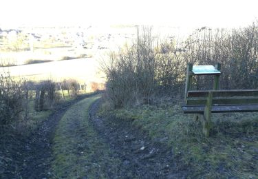
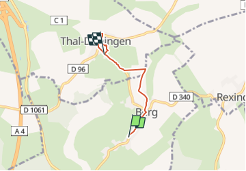
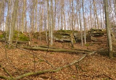
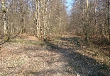
Randonnée A pied de 3,3 km à découvrir à Grand Est, Bas-Rhin, Berg. Cette randonnée est proposée par SityTrail - itinéraires balisés pédestres.

Description

Randonnée créée par Club Vosgien.


Site web: http://www.wanderparadies-wasgau.de/wanderung-berg-kirchberg.php?pk_campaign=osm-kirchberg

Photos

Localisation

Pays :
France
Région :
Grand Est
Département/Province :
Bas-Rhin
Commune :
Berg
Localité :
Unknown
Départ:(UTM)
364612 ; 5417371 (32U) N.

Randonnées à proximité

Randonnée A pied Diemeringen - Mackwiller la romaine - Photo
A pied
PRO

A pied

Facile
Diemeringen, Grand Est, Bas-Rhin, France
4,6 km | 5,4 km-effort
1h 14min
Oui
Randonnée Randonnée équestre Adamswiller - Boucle Adamswiller Kirschberg - Photo
Randonnée équestre
GUIDE+

Randonnée équestre

Moyen
Adamswiller, Grand Est, Bas-Rhin, France
24 km | 30 km-effort
3h 53min
Oui
Randonnée Randonnée équestre Burbach - val2 - Photo
Randonnée équestre
sylviemalo

Randonnée équestre

Très facile
(1)
Burbach, Grand Est, Bas-Rhin, France
10,7 km | 13 km-effort
2h 3min
Oui
Randonnée Marche Mackwiller - mackwiller - Photo
Marche
cricrifran

Marche

Moyen
Mackwiller, Grand Est, Bas-Rhin, France
17,3 km | 22 km-effort
3h 8min
Oui
Randonnée Marche Mackwiller - mackwiller - Photo
Marche
cricrifran

Marche

Facile
(1)
Mackwiller, Grand Est, Bas-Rhin, France
10,4 km | 13,5 km-effort
1h 52min
Oui
Randonnée Vélo Berg - Villages welches (Tronçon Sud) - Wolsthof - Photo
Vélo
tracegps

Vélo

Difficile
Berg, Grand Est, Bas-Rhin, France
44 km | 54 km-effort
3h 30min
Oui
Randonnée Vélo Berg - Villages welches (Tronçon Nord) - Wolsthof - Photo
Vélo
tracegps

Vélo

Difficile
Berg, Grand Est, Bas-Rhin, France
37 km | 44 km-effort
3h 30min
Oui
Randonnée Vélo Berg - Villages welches (Tronçon centre) - Wolsthof - Photo
Vélo
tracegps

Vélo

Moyen
Berg, Grand Est, Bas-Rhin, France
22 km | 27 km-effort
2h 30min
Oui
Randonnée Marche Berg - circuit de Berg - Photo
Marche
jo-da

Marche

Facile
Berg, Grand Est, Bas-Rhin, France
7 km | 8,6 km-effort
3h 11min
Oui


Fermer
Mes abonnements