Randonnée A pied Saint-Point-Lac - La Ronde des Deux Villages - Photo

Tous les sentiers balisés d’Europe PRO

© OpenStreetMap contributors
Longueur
Longueur
5,5 km
Altitude max
Altitude max
982 m
Dénivelé positif
Dénivelé positif
139 m
Km-Effort
Km-Effort  
7,3 km
Altitude min
Altitude min
855 m
Dénivelé négatif
Dénivelé négatif
138 m
Boucle
Boucle
Oui
Balise
Balise
Date de création :
2022-02-15 18:15:37.989
Dernière modification :
2022-03-02 20:40:48.282

(0 Avis)

A pied
A pied
1h40
Difficulté : Facile

Scannez ce code QR pour ouvrir la randonnée dans l'application SityTrail

Application GPS de randonnée GRATUITE

Logo SityTrail SityTrail

IGN / Instituts géographiques

Télécharger SityTrail sur l'App Store Télécharger SityTrail sur Google Play

Logo SityTrail SityTrail World

Le monde est à vous

Télécharger SityTrail sur l'App Store Télécharger SityTrail sur Google Play Télécharger SityTrail sur Huawei AppGallery

À propos

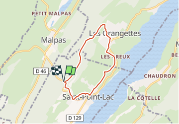
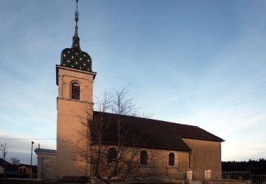
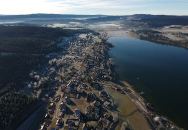
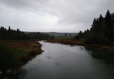
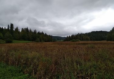
Randonnée A pied de 5,5 km à découvrir à Bourgogne-Franche-Comté, Doubs, Saint-Point-Lac. Cette randonnée est proposée par SityTrail - itinéraires balisés pédestres.

Photos

Localisation

Pays :
France
Région :
Bourgogne-Franche-Comté
Département/Province :
Doubs
Commune :
Saint-Point-Lac
Localité :
Unknown
Départ:(UTM)
293539 ; 5188319 (32T) N.

Randonnées à proximité

Randonnée Marche Métabief - GTJ  Metabief - Pontarlier - Photo
Marche
svp59

Marche

Moyen
(1)
Métabief, Bourgogne-Franche-Comté, Doubs, France
25 km | 35 km-effort
7h 17min
Non
Randonnée Marche Saint-Antoine - Boucle du fort St Antoine  - Photo
Marche
mallovon

Marche

Moyen
Saint-Antoine, Bourgogne-Franche-Comté, Doubs, France
4,8 km | 6,2 km-effort
1h 25min
Oui
Randonnée A pied Les Grangettes - La Pierre qui Tourne - Photo
A pied
PRO

A pied

Facile
Les Grangettes, Bourgogne-Franche-Comté, Doubs, France
8,2 km | 10,7 km-effort
2h 25min
Oui
Randonnée A pied Malpas - Le Tour du Lac de Malpas - Photo
A pied
PRO

A pied

Facile
Malpas, Bourgogne-Franche-Comté, Doubs, France
4,9 km | 5,7 km-effort
1h 17min
Oui
Randonnée A pied Malbuisson - Sentier du Tour du Lac - Photo
A pied
PRO

A pied

Facile
Malbuisson, Bourgogne-Franche-Comté, Doubs, France
16 km | 19,9 km-effort
4h 30min
Non
Randonnée Marche nordique Malbuisson - Fort St Antoine  - Photo
Marche nordique
mallovon

Marche nordique

Facile
Malbuisson, Bourgogne-Franche-Comté, Doubs, France
5,8 km | 7,3 km-effort
2h 21min
Oui
Randonnée Marche Montperreux - Chaon Saint Point - Lac - Photo
Marche
helmut68

Marche

Facile
(1)
Montperreux, Bourgogne-Franche-Comté, Doubs, France
15,1 km | 19,4 km-effort
3h 5min
Oui
Randonnée Marche Montperreux - Sentier de la découverte - Chaon Malbuisson - Photo
Marche
helmut68

Marche

Facile
Montperreux, Bourgogne-Franche-Comté, Doubs, France
9,8 km | 12,3 km-effort
2h 12min
Oui
Randonnée Marche Montperreux -                                     La Gouille - Photo
Marche
helmut68

Marche

Facile
Montperreux, Bourgogne-Franche-Comté, Doubs, France
8 km | 10,1 km-effort
1h 53min
Oui


Fermer
Mes abonnements