


Fond de Quarreux left bank of the Ambléve

Geert H.
Utilisateur
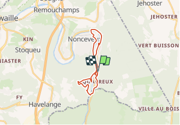

Longueur
9,6 km

Altitude max
315 m

Dénivelé positif
278 m
Km-Effort
13,3 km

Altitude min
154 m

Dénivelé négatif
278 m
Boucle
Oui
Date de création :
2022-03-06 17:29:39.567
Dernière modification :
2022-03-07 09:14:33.851
3h01
Difficulté : Difficile

Application GPS de randonnée GRATUITE
 SityTrail
IGN / Instituts géographiques
SityTrail Plus
Le monde est à vous
À propos
Randonnée Marche de 9,6 km à découvrir à Wallonie, Liège, Aywaille. Cette randonnée est proposée par Geert H..
Description
Walking along thre left bank of the Ambléve but with a bite going up a some hills at the beginning.
Localisation
Pays :
Belgique
Région :
Wallonie
Département/Province :
Liège
Commune :
Aywaille
Localité :
Unknown
Départ:(Dec)
Départ:(UTM)
694620 ; 5592507 (31U) N.
Commentaires