


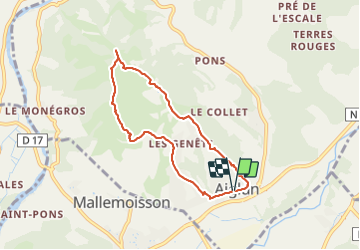

8 km | 12,6 km-effort

Utilisateur


Application GPS de randonnée GRATUITE
 SityTrail
IGN / Instituts géographiques
SityTrail World
Le monde est à vous
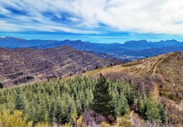
Randonnée Marche de 7 km à découvrir à Provence-Alpes-Côte d'Azur, Alpes-de-Haute-Provence, Aiglun. Cette randonnée est proposée par RobinMicheline.
Super


Marche
Marche
Marche
Marche
![Randonnée V.T.T. Mirabeau - [PAT] Rando Mirabosse 2013 - Photo](https://media.geolcdn.com/t/375/260/ext.jpg?maxdim=2&url=https%3A%2F%2Fstatic1.geolcdn.com%2Fsiteimages%2Fupload%2Ffiles%2F1524743154velo.jpg)
V.T.T.

V.T.T.
Marche
V.T.T.
Marche