Randonnée A pied Naisey-les-Granges - Tracé Rando 3 Naisey les Granges - Photo

Tracé Rando 3 Naisey les Granges

 norbertmarteau
norbertmarteau

Utilisateur

© OpenStreetMap contributors
Longueur
Longueur
7,7 km
Altitude max
Altitude max
484 m
Dénivelé positif
Dénivelé positif
101 m
Km-Effort
Km-Effort  
9,1 km
Altitude min
Altitude min
429 m
Dénivelé négatif
Dénivelé négatif
102 m
Boucle
Boucle
Oui
Date de création :
2022-03-10 13:50:03.96
Dernière modification :
2022-03-10 13:52:11.403

(0 Avis)

A pied
A pied
2h03
Difficulté : Facile

Scannez ce code QR pour ouvrir la randonnée dans l'application SityTrail

Application GPS de randonnée GRATUITE

Logo SityTrail SityTrail

IGN / Instituts géographiques

Télécharger SityTrail sur l'App Store Télécharger SityTrail sur Google Play

Logo SityTrail SityTrail World

Le monde est à vous

Télécharger SityTrail sur l'App Store Télécharger SityTrail sur Google Play Télécharger SityTrail sur Huawei AppGallery

À propos

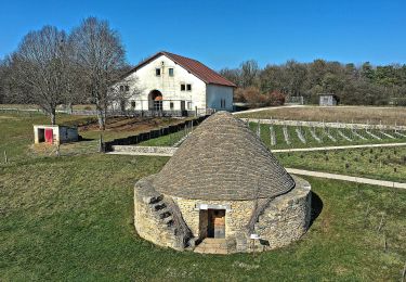
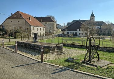
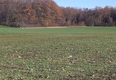
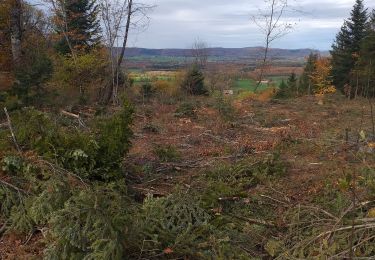
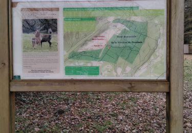
Randonnée A pied de 7,7 km à découvrir à Bourgogne-Franche-Comté, Doubs, Naisey-les-Granges. Cette randonnée est proposée par norbertmarteau.

Description

Circuit varié (route, bois, champ, chemin blanc)
Attention il y a une partie à baliser (non tracé)
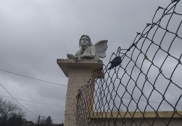
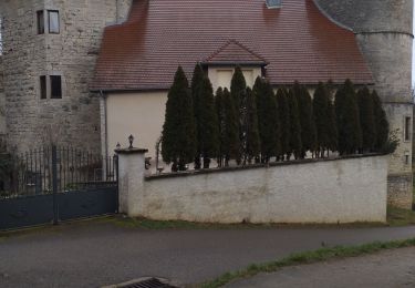
Intérêt : Eglise, chapelle (entrée du village coté Saone), source de Brillin.

Profil altimétrique

Localisation

Pays :
France
Région :
Bourgogne-Franche-Comté
Département/Province :
Doubs
Commune :
Naisey-les-Granges
Localité :
Unknown
Départ:(UTM)
290735 ; 5232452 (32T) N.

Randonnées à proximité

Randonnée A pied Nancray - Circuit du Chêne Président - Photo
A pied
PRO

A pied

Facile
Nancray, Bourgogne-Franche-Comté, Doubs, France
6,4 km | 7,2 km-effort
1h 38min
Oui
Randonnée A pied Nancray - Sentier du Fonteny - Photo
A pied
PRO

A pied

Facile
Nancray, Bourgogne-Franche-Comté, Doubs, France
7,4 km | 9 km-effort
2h 2min
Oui
Randonnée A pied Nancray - Sentier du Moulin - Photo
A pied
PRO

A pied

Facile
Nancray, Bourgogne-Franche-Comté, Doubs, France
9,5 km | 12,5 km-effort
2h 50min
Oui
Randonnée Marche Nancray - Nancray-danse - Photo
Marche
eltonnermou

Marche

Facile
(1)
Nancray, Bourgogne-Franche-Comté, Doubs, France
15,5 km | 18,3 km-effort
4h 9min
Oui
Randonnée Marche Naisey-les-Granges - Naisey les Grande - Photo
Marche
eltonnermou

Marche

Moyen
Naisey-les-Granges, Bourgogne-Franche-Comté, Doubs, France
17,5 km | 23 km-effort
3h 34min
Oui
Randonnée Marche Nancray - Nancray moulin  - Photo
Marche
eltonnermou

Marche

Très facile
(1)
Nancray, Bourgogne-Franche-Comté, Doubs, France
10,1 km | 13,2 km-effort
1h 48min
Oui
Randonnée Marche Bouclans - Bouclans  - Photo
Marche
eltonnermou

Marche

Moyen
Bouclans, Bourgogne-Franche-Comté, Doubs, France
16,4 km | 20 km-effort
2h 32min
Oui
Randonnée Marche Étalans - étalant  - Photo
Marche
lime

Marche

Facile
Étalans, Bourgogne-Franche-Comté, Doubs, France
13,4 km | 16,5 km-effort
4h 44min
Oui
Randonnée V.T.T. Nancray - Téléthon 2023 - Photo
V.T.T.
norbertmarteau

V.T.T.

Moyen
Nancray, Bourgogne-Franche-Comté, Doubs, France
21 km | 25 km-effort
1h 42min
Oui


Fermer
Mes abonnements