


Ritteren

My Switzerland
Optez pour le retour à la nature GUIDE+

Longueur
25 km

Altitude max
1204 m

Dénivelé positif
754 m
Km-Effort
35 km

Altitude min
629 m

Dénivelé négatif
753 m
Boucle
Oui
Date de création :
2014-12-10 00:00:00.0
Dernière modification :
2014-12-10 00:00:00.0
8h58
Difficulté : Inconnu

Application GPS de randonnée GRATUITE
 SityTrail
IGN / Instituts géographiques
SityTrail Plus
Le monde est à vous
À propos
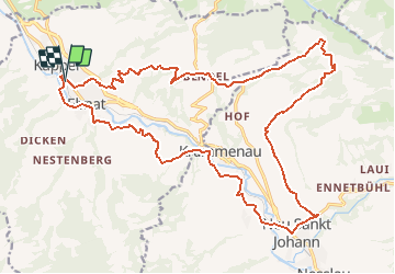
Randonnée V.T.T. de 25 km à découvrir à Saint-Gall, Wahlkreis Toggenburg, Ebnat-Kappel. Cette randonnée est proposée par My Switzerland.


Localisation
Pays :
Suisse
Région :
Saint-Gall
Département/Province :
Wahlkreis Toggenburg
Commune :
Ebnat-Kappel
Localité :
Unknown
Départ:(Dec)
Départ:(UTM)
509147 ; 5234493 (32T) N.
Commentaires