Randonnée Marche Walscheid - 20220313 - rando Walscheid - cimetière galllo-romain, grotte St-Léon - Photo

20220313 - rando Walscheid - cimetière galllo-romain, grotte St-Léon

 nfranche
nfranche

Utilisateur

© OpenStreetMap contributors
Longueur
Longueur
16,4 km
Altitude max
Altitude max
565 m
Dénivelé positif
Dénivelé positif
506 m
Km-Effort
Km-Effort  
23 km
Altitude min
Altitude min
327 m
Dénivelé négatif
Dénivelé négatif
503 m
Boucle
Boucle
Oui
Date de création :
2022-03-27 16:05:09.183
Dernière modification :
2022-03-27 16:16:36.887

(0 Avis)

Marche
Marche
5h16
Difficulté : Très difficile

Scannez ce code QR pour ouvrir la randonnée dans l'application SityTrail

Application GPS de randonnée GRATUITE

Logo SityTrail SityTrail

IGN / Instituts géographiques

Télécharger SityTrail sur l'App Store Télécharger SityTrail sur Google Play

Logo SityTrail SityTrail World

Le monde est à vous

Télécharger SityTrail sur l'App Store Télécharger SityTrail sur Google Play Télécharger SityTrail sur Huawei AppGallery

À propos

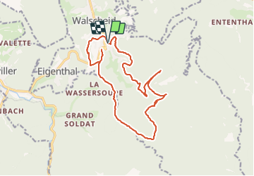
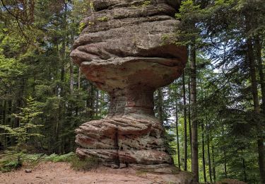
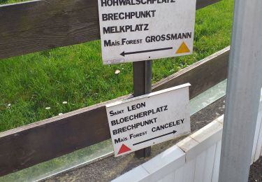
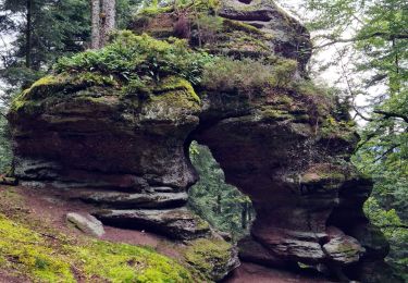
Randonnée Marche de 16,4 km à découvrir à Grand Est, Moselle, Walscheid. Cette randonnée est proposée par nfranche.

Description

File with points/tracks from Locus Map Pro/3.57.1
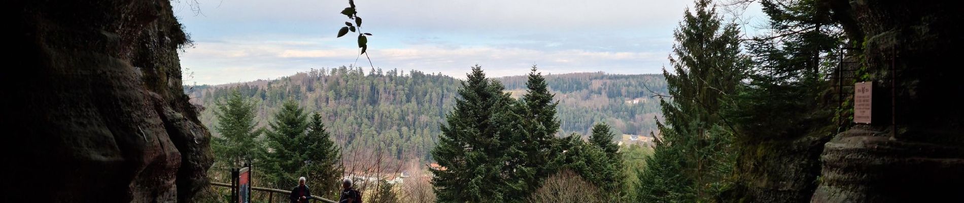
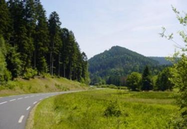
Très belle randonnée sans difficulté particulière.

Profil altimétrique

Photos

Localisation

Pays :
France
Région :
Grand Est
Département/Province :
Moselle
Commune :
Walscheid
Localité :
Unknown
Départ:(Dec)
Départ:(UTM)
364187 ; 5389717 (32U) N.

Randonnées à proximité

Randonnée Vélo Abreschviller - Circuit du Donon - Photo
Vélo
tracegps

Vélo

Très difficile
(1)
Abreschviller, Grand Est, Moselle, France
52 km | 67 km-effort
3h 0min
Oui
Randonnée V.T.T. Abreschviller - sortie VTT du 01092019 Abreschwiller - Photo
V.T.T.
GUIDE
fabwin

V.T.T.

Difficile
Abreschviller, Grand Est, Moselle, France
33 km | 45 km-effort
2h 42min
Oui
Randonnée Marche Haselbourg - De Haselbourg au Rocher de Falkenfels - Photo
Marche
GUIDE
Desrumaux

Marche

Facile
(1)
Haselbourg, Grand Est, Moselle, France
6,4 km | 9,7 km-effort
2h 6min
Oui
Randonnée Marche Abreschviller - Circulaire de la Roche du Diable - Abreschviller - Photo
Marche
xtislair

Marche

Difficile
(1)
Abreschviller, Grand Est, Moselle, France
10,1 km | 14,7 km-effort
3h 20min
Oui
Randonnée A pied Saint-Quirin - 2023-06-18 Le Canceley, le Grd Rommelstein et le Rocher du Calice - Photo
A pied
Mich&Agnès

A pied

Facile
Saint-Quirin, Grand Est, Moselle, France
12,5 km | 19,7 km-effort
4h 29min
Oui
Randonnée Marche Walscheid - walscheid club vosgien - Photo
Marche
Dorlene.mehl

Marche

Moyen
Walscheid, Grand Est, Moselle, France
16,2 km | 22 km-effort
4h 17min
Oui
Randonnée Marche Abreschviller - 20210909_rando_MCA_Abreschwiller_Walscheid - Photo
Marche
nfranche

Marche

Très difficile
Abreschviller, Grand Est, Moselle, France
15,6 km | 24 km-effort
5h 23min
Oui
Randonnée V.T.T. Abreschviller - VTT Abreshwiller 01/09/19 circuit N° 1 avec Fabrice - Photo
V.T.T.
vathi54

V.T.T.

Difficile
Abreschviller, Grand Est, Moselle, France
33 km | 45 km-effort
3h 27min
Oui
Randonnée Marche Walscheid - rando_izzie - Photo
Marche
fredodlageo

Marche

Moyen
Walscheid, Grand Est, Moselle, France
4,6 km | 7,1 km-effort
57min
Oui


Fermer
Mes abonnements