Randonnée Randonnée équestre Rettel - Rettel-Montenach-Hunting - Photo

Rettel-Montenach-Hunting

 claude-aei
claude-aei

Utilisateur

© OpenStreetMap contributors
Longueur
Longueur
20 km
Altitude max
Altitude max
304 m
Dénivelé positif
Dénivelé positif
366 m
Km-Effort
Km-Effort  
25 km
Altitude min
Altitude min
141 m
Dénivelé négatif
Dénivelé négatif
367 m
Boucle
Boucle
Non
Date de création :
2022-04-23 08:30:56.792
Dernière modification :
2022-05-09 20:07:09.933

(0 Avis)

Randonnée équestre
Randonnée équestre
4h19
Difficulté : Moyen

Scannez ce code QR pour ouvrir la randonnée dans l'application SityTrail

Application GPS de randonnée GRATUITE

Logo SityTrail SityTrail

IGN / Instituts géographiques

Télécharger SityTrail sur l'App Store Télécharger SityTrail sur Google Play

Logo SityTrail SityTrail World

Le monde est à vous

Télécharger SityTrail sur l'App Store Télécharger SityTrail sur Google Play Télécharger SityTrail sur Huawei AppGallery

À propos

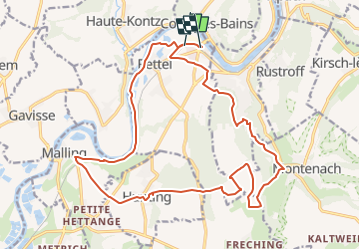
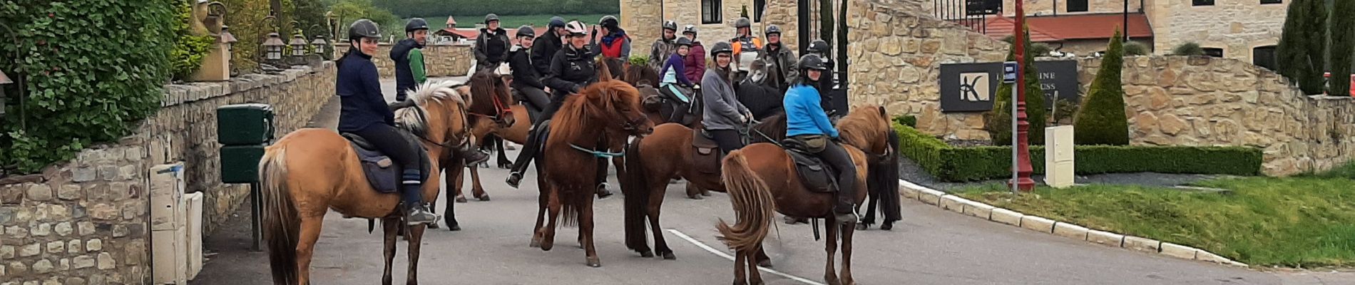
Randonnée Randonnée équestre de 20 km à découvrir à Grand Est, Moselle, Rettel. Cette randonnée est proposée par claude-aei.

Description

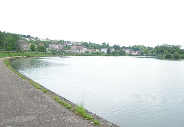
Petite balade vallonnée,
Parking devant l'usine à tubes de Rettel

Profil altimétrique

Photos

Localisation

Pays :
France
Région :
Grand Est
Département/Province :
Moselle
Commune :
Rettel
Localité :
Unknown
Départ:(UTM)
307138 ; 5480638 (32U) N.

Randonnées à proximité

Randonnée A pied Contz-les-Bains - Schengen grenzenlos / sans frontières - Photo
A pied
PRO

A pied

Facile
Contz-les-Bains, Grand Est, Moselle, France
3,3 km | 4,6 km-effort
1h 3min
Non
Randonnée A pied Merschweiller - Circuit Apach-Waldwisse - Photo
A pied
PRO

A pied

Facile
Merschweiller, Grand Est, Moselle, France
7,3 km | 10,5 km-effort
2h 22min
Non
Randonnée A pied Merschweiller - Promenade Circulaire d'Appach - Photo
A pied
PRO

A pied

Facile
Merschweiller, Grand Est, Moselle, France
9,1 km | 13 km-effort
2h 57min
Oui
Randonnée A pied Apach - Saar-Hunsrück Steig Traumschleifen Panoramaweg Perl - Photo
A pied
PRO

A pied

Facile
Apach, Grand Est, Moselle, France
8,2 km | 11,4 km-effort
2h 35min
Oui
Randonnée Marche Sierck-les-Bains - Sierck Montenach - Photo
Marche
bohynm

Marche

Moyen
(1)
Sierck-les-Bains, Grand Est, Moselle, France
15,5 km | 20 km-effort
4h 4min
Oui
Randonnée A pied Beyren-lès-Sierck - Boucle de Gandren - Photo
A pied
PRO

A pied

Facile
Beyren-lès-Sierck, Grand Est, Moselle, France
8,3 km | 10,7 km-effort
2h 25min
Oui
Randonnée A pied Sierck-les-Bains - Sentier Sierck-Apach-Montenach - Photo
A pied
PRO

A pied

Difficile
Sierck-les-Bains, Grand Est, Moselle, France
23 km | 31 km-effort
7h 4min
Oui
Randonnée A pied Sierck-les-Bains - CV SentierKoenigsberg - Photo
A pied
PRO

A pied

Facile
Sierck-les-Bains, Grand Est, Moselle, France
6,2 km | 8 km-effort
1h 49min
Non
Randonnée A pied Puttelange-lès-Thionville - CV Les chemins de l'insolite (Rodemack-Puttelange) - Photo
A pied
PRO

A pied

Facile
Puttelange-lès-Thionville, Grand Est, Moselle, France
6,7 km | 8,3 km-effort
1h 52min
Non


Fermer
Mes abonnements