Randonnée Marche Souligny - Montaigu, BOUILLY - Photo

Montaigu, BOUILLY

 jeannine grandjean
jeannine grandjean

Utilisateur

© OpenStreetMap contributors
Longueur
Longueur
15,7 km
Altitude max
Altitude max
286 m
Dénivelé positif
Dénivelé positif
412 m
Km-Effort
Km-Effort  
21 km
Altitude min
Altitude min
164 m
Dénivelé négatif
Dénivelé négatif
412 m
Boucle
Boucle
Oui
Date de création :
2022-05-01 07:54:37.922
Dernière modification :
2022-05-31 14:11:16.102

(0 Avis)

Marche
Marche
4h14
Difficulté : Difficile

Scannez ce code QR pour ouvrir la randonnée dans l'application SityTrail

Application GPS de randonnée GRATUITE

Logo SityTrail SityTrail

IGN / Instituts géographiques

Télécharger SityTrail sur l'App Store Télécharger SityTrail sur Google Play

Logo SityTrail SityTrail World

Le monde est à vous

Télécharger SityTrail sur l'App Store Télécharger SityTrail sur Google Play Télécharger SityTrail sur Huawei AppGallery

À propos

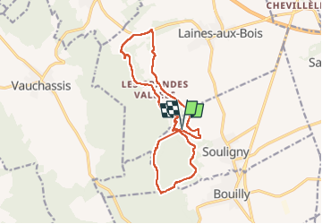
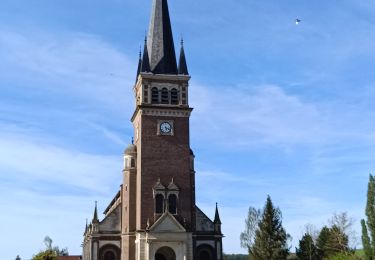
Randonnée Marche de 15,7 km à découvrir à Grand Est, Aube, Souligny. Cette randonnée est proposée par jeannine grandjean.

Description

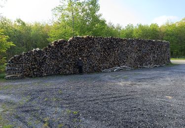
superbe rando à partir du site verdoyant de Montaigu avec son petit ruisseau et sa fontaine ; monter à l'oppidum, d'où l'on a un superbe panorama sur la Plaine de Champagne. Le pittoresque village des Grandes Vallées mérite le détour. Beaucoup de dénivelé, mais des sentiers praticables et très bien entretenus.
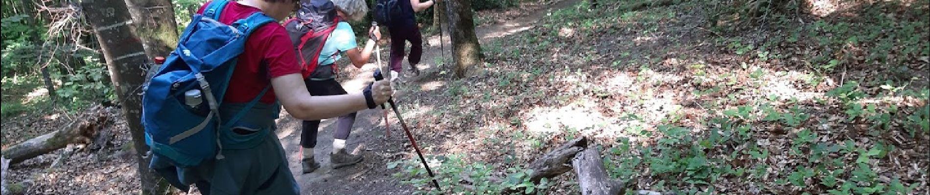
Chemins bien balisés mais il faut être très attentif dans les bois...

Profil altimétrique

Photos

Localisation

Pays :
France
Région :
Grand Est
Département/Province :
Aube
Commune :
Souligny
Localité :
Unknown
Départ:(UTM)
572709 ; 5340085 (31U) N.

Randonnées à proximité

Randonnée Marche Prugny - Montbernange - Photo
Marche
FPortier

Marche

Moyen
(1)
Prugny, Grand Est, Aube, France
9,4 km | 12 km-effort
2h 19min
Oui
Randonnée Marche Bouilly - Bouilly le 30.07.22 (9.6kms) N° 2 - Photo
Marche
COTELEVELYNE

Marche

Moyen
(1)
Bouilly, Grand Est, Aube, France
8,1 km | 10,5 km-effort
2h 23min
Oui
Randonnée Marche Souligny - Souligny 16km le 11/06/2019 - Photo
Marche
francis1952

Marche

Difficile
(1)
Souligny, Grand Est, Aube, France
16 km | 0 m-effort
3h 9min
Oui
Randonnée V.T.T. Laines-aux-Bois - montaigutour toto aout217 - Photo
V.T.T.
Tollard

V.T.T.

Difficile
(1)
Laines-aux-Bois, Grand Est, Aube, France
31 km | 42 km-effort
3h 6min
Oui
Randonnée V.T.T. Laines-aux-Bois - cource xc cwb Laines Aux Bois 2017 - Photo
V.T.T.
Tollard

V.T.T.

Difficile
(3)
Laines-aux-Bois, Grand Est, Aube, France
6,6 km | 9,9 km-effort
38min
Oui
Randonnée V.T.T. Laines-aux-Bois - hors piste phiphi - Photo
V.T.T.
Tollard

V.T.T.

Difficile
(1)
Laines-aux-Bois, Grand Est, Aube, France
26 km | 35 km-effort
3h 11min
Non
Randonnée Marche Vauchassis - Randonnée Bucey 23 04 2024 - Photo
Marche
FPortier

Marche

Difficile
Vauchassis, Grand Est, Aube, France
10,5 km | 13,4 km-effort
3h 5min
Oui
Randonnée Vélo électrique Vauchassis - Balade VAE Pays d Othe - Photo
Vélo électrique
FPortier

Vélo électrique

Très facile
Vauchassis, Grand Est, Aube, France
56 km | 66 km-effort
5h 15min
Oui
Randonnée Marche Vauchassis - Balade Forêt communale de Vauchassis - Photo
Marche
FPortier

Marche

Moyen
Vauchassis, Grand Est, Aube, France
7,5 km | 9,1 km-effort
2h 26min
Oui


Fermer
Mes abonnements