Randonnée Marche Monestier-d'Ambel - croix de la plaigni - Photo
 bailleulherve
bailleulherve

Utilisateur

© OpenStreetMap contributors
Longueur
Longueur
13,2 km
Altitude max
Altitude max
1580 m
Dénivelé positif
Dénivelé positif
847 m
Km-Effort
Km-Effort  
25 km
Altitude min
Altitude min
760 m
Dénivelé négatif
Dénivelé négatif
874 m
Boucle
Boucle
Non
Date de création :
2022-05-29 10:12:12.246
Dernière modification :
2022-05-29 14:30:35.1

(0 Avis)

Marche
Marche
4h02
Difficulté : Facile

Scannez ce code QR pour ouvrir la randonnée dans l'application SityTrail

Application GPS de randonnée GRATUITE

Logo SityTrail SityTrail

IGN / Instituts géographiques

Télécharger SityTrail sur l'App Store Télécharger SityTrail sur Google Play

Logo SityTrail SityTrail World

Le monde est à vous

Télécharger SityTrail sur l'App Store Télécharger SityTrail sur Google Play Télécharger SityTrail sur Huawei AppGallery

À propos

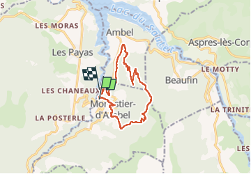
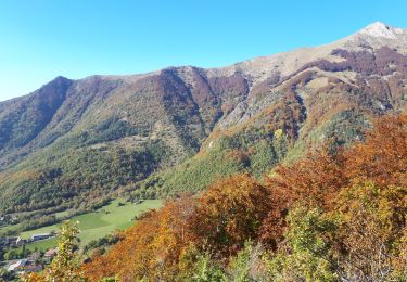
Randonnée Marche de 13,2 km à découvrir à Auvergne-Rhône-Alpes, Isère, Monestier-d'Ambel. Cette randonnée est proposée par bailleulherve.

Description

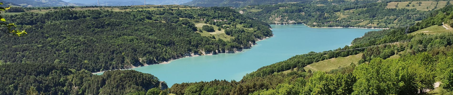
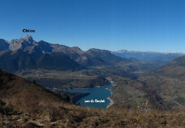
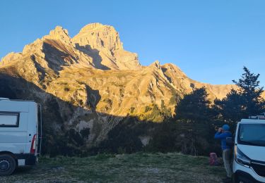
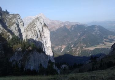
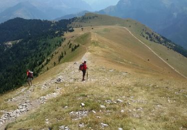
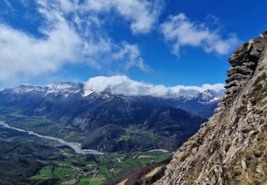
superbe panorama sur l'obiou et le grand ferrand

Profil altimétrique

Photos

Localisation

Pays :
France
Région :
Auvergne-Rhône-Alpes
Département/Province :
Isère
Commune :
Monestier-d'Ambel
Localité :
Unknown
Départ:(UTM)
731031 ; 4962868 (31T) N.

Randonnées à proximité

Randonnée Marche Aspres-lès-Corps - Aspres les corps - Roche Courbe - Photo
Marche
GUIDE
R@ph

Marche

Très difficile
(1)
Aspres-lès-Corps, Provence-Alpes-Côte d'Azur, Hautes-Alpes, France
10,6 km | 24 km-effort
4h 53min
Oui
Randonnée Marche Pellafol - R44 Le Bénitier - Photo
Marche
GUIDE+

Marche

Moyen
(1)
Pellafol, Auvergne-Rhône-Alpes, Isère, France
14 km | 25 km-effort
3h 0min
Oui
Randonnée Marche Pellafol - R43   Les Gillardes et Le Canyon de l'Infernet de Pellafol - Photo
Marche
GUIDE+

Marche

Très facile
(2)
Pellafol, Auvergne-Rhône-Alpes, Isère, France
6,1 km | 8,5 km-effort
1h 48min
Oui
Randonnée Marche Pellafol - la grande tête de l Obiou  - Photo
Marche
tchoua

Marche

Très difficile
Pellafol, Auvergne-Rhône-Alpes, Isère, France
11,3 km | 28 km-effort
3h 50min
Oui
Randonnée Marche Pellafol - 38 source gaillarde internet ch fée - Photo
Marche
himba26100

Marche

Moyen
Pellafol, Auvergne-Rhône-Alpes, Isère, France
13,3 km | 19,9 km-effort
6h 32min
Non
Randonnée Marche Aspres-lès-Corps - Roche Courbe en circuit - Photo
Marche
Emelle

Marche

Moyen
Aspres-lès-Corps, Provence-Alpes-Côte d'Azur, Hautes-Alpes, France
9,9 km | 23 km-effort
5h 57min
Oui
Randonnée Marche Le Dévoluy - Le Faraut. Pic pierroux - Photo
Marche
nadd73

Marche

Moyen
Le Dévoluy, Provence-Alpes-Côte d'Azur, Hautes-Alpes, France
10,3 km | 25 km-effort
7h 10min
Oui
Randonnée Marche Pellafol - Cime de l'Obiou - Photo
Marche
Dervalmarc

Marche

Très difficile
Pellafol, Auvergne-Rhône-Alpes, Isère, France
13,3 km | 31 km-effort
5h 27min
Oui
Randonnée Marche Aspres-lès-Corps - Le Grand Journal - Jonquilles  - Photo
Marche
PapouBertrand

Marche

Très difficile
Aspres-lès-Corps, Provence-Alpes-Côte d'Azur, Hautes-Alpes, France
9,6 km | 22 km-effort
5h 19min
Oui


Fermer
Mes abonnements