Randonnée Vélo électrique Godewaersvelde - Les hauts de Flandres - Les monts - Photo

Les hauts de Flandres - Les monts

 himpececilia
himpececilia

Utilisateur

© OpenStreetMap contributors
Longueur
Longueur
34 km
Altitude max
Altitude max
167 m
Dénivelé positif
Dénivelé positif
622 m
Km-Effort
Km-Effort  
42 km
Altitude min
Altitude min
39 m
Dénivelé négatif
Dénivelé négatif
623 m
Boucle
Boucle
Oui
Date de création :
2022-06-02 07:15:10.615
Dernière modification :
2022-06-02 15:23:57.848

(0 Avis)

Vélo électrique
Vélo électrique
3h15
Difficulté : Très facile

Scannez ce code QR pour ouvrir la randonnée dans l'application SityTrail

Application GPS de randonnée GRATUITE

Logo SityTrail SityTrail

IGN / Instituts géographiques

Télécharger SityTrail sur l'App Store Télécharger SityTrail sur Google Play

Logo SityTrail SityTrail World

Le monde est à vous

Télécharger SityTrail sur l'App Store Télécharger SityTrail sur Google Play Télécharger SityTrail sur Huawei AppGallery

À propos

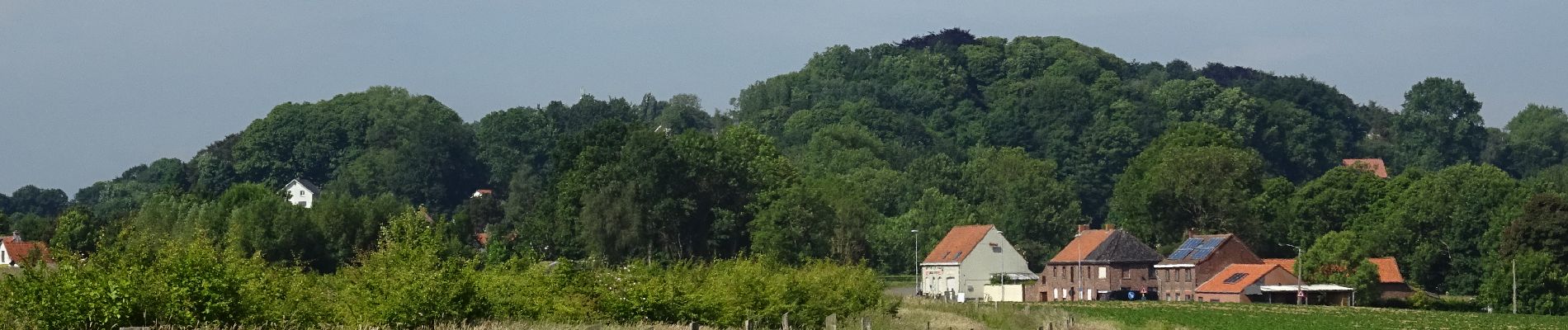
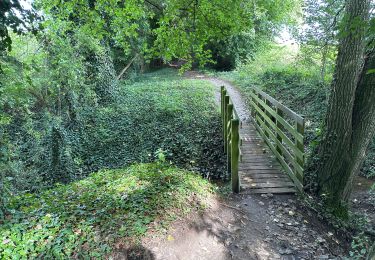
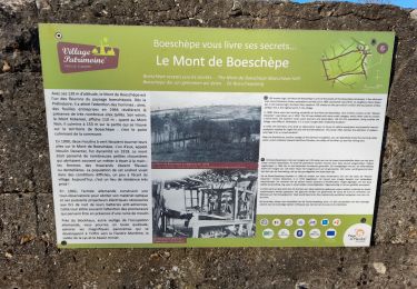
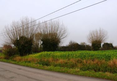
Randonnée Vélo électrique de 34 km à découvrir à Hauts-de-France, Nord, Godewaersvelde. Cette randonnée est proposée par himpececilia.

Profil altimétrique

Photos

Points d'intérêt

Point d'intérêt Godewaersvelde - Depart odewaersvelde - 2 hr de route - Photo
himpececilia
Point d'intérêt Boeschepe - mont de boeschepe - Photo
himpececilia
Point d'intérêt Boeschepe - mont  kokereel - Photo
himpececilia
BOESCHEPE 
Point d'intérêt Berthen - mont des cats - Photo
himpececilia
BERTHEN 
Point d'intérêt Saint-Jans-Cappel - mont noir - Photo
himpececilia
SAINT-JANS-CAPPEL 
Point d'intérêt Heuvelland - rodeberg - Photo
himpececilia
HEUVELLAND 
Point d'intérêt Heuvelland - Sulferberg - Photo
himpececilia
HEUVELLAND 
Point d'intérêt Heuvelland - Scherpenberg - Photo
himpececilia
HEUVELLAND 
Point d'intérêt Heuvelland - Kemmelberg - Photo
himpececilia
HEUVELLAND 
Point d'intérêt Heuvelland - Vidalgne berg - Photo
himpececilia
HEUVELLAND 
Point d'intérêt Heuvelland - Baneberg - Photo
himpececilia
HEUVELLAND 

Localisation

Pays :
France
Région :
Hauts-de-France
Département/Province :
Nord
Commune :
Godewaersvelde
Localité :
Unknown
Départ:(UTM)
474903 ; 5626966 (31U) N.

Randonnées à proximité

Randonnée Marche Eecke - Circuit du Klockhuis (Grande boucle) - Eecke - Photo
Marche
tracegps

Marche

Difficile
(2)
Eecke, Hauts-de-France, Nord, France
15 km | 16,5 km-effort
3h 45min
Oui
Randonnée Marche Berthen - Autour du monastère - Godewaersvelde - Photo
Marche
tracegps

Marche

Difficile
(3)
Berthen, Hauts-de-France, Nord, France
11,8 km | 15,6 km-effort
3h 0min
Oui
Randonnée Marche Steenvoorde - Steenvorde Cassel 17 km - Photo
Marche
GUIDE
rvapeldo

Marche

Très difficile
Steenvoorde, Hauts-de-France, Nord, France
17 km | 19,9 km-effort
4h 31min
Oui
Randonnée Marche Boeschepe - Boeschepe - Photo
Marche
fif59280

Marche

Difficile
Boeschepe, Hauts-de-France, Nord, France
10,6 km | 13 km-effort
2h 26min
Non
Randonnée A pied Poperinge - Helleketelbos - Photo
A pied
PRO

A pied

Facile
Poperinge, Flandre, Flandre-Occidentale, Belgique
10,8 km | 12,5 km-effort
2h 49min
Oui
Randonnée Marche Steenvoorde - Steenvoorde 20 km - Photo
Marche
GUIDE
rvapeldo

Marche

Moyen
Steenvoorde, Hauts-de-France, Nord, France
20 km | 24 km-effort
5h 44min
Oui
Randonnée Marche Boeschepe - Monts des Flandres CAF LILLE week-end des estaminets 2 - Photo
Marche
reneperrin

Marche

Facile
Boeschepe, Hauts-de-France, Nord, France
21 km | 26 km-effort
5h 34min
Oui
Randonnée Marche Boeschepe - Week-end des estaminets CAF1 - Photo
Marche
reneperrin

Marche

Facile
Boeschepe, Hauts-de-France, Nord, France
16,7 km | 21 km-effort
4h 32min
Oui
Randonnée Marche Berthen - Balade des Katts - Photo
Marche

Marche

Très facile
(3)
Berthen, Hauts-de-France, Nord, France
4,8 km | 6,4 km-effort
Inconnu
Oui


Fermer
Mes abonnements