Randonnée Cyclotourisme Nouvelle-Ulm - Ulm Donauworth - Photo
 pierrebourhis
pierrebourhis

Utilisateur

© OpenStreetMap contributors
Longueur
Longueur
96 km
Altitude max
Altitude max
488 m
Dénivelé positif
Dénivelé positif
679 m
Km-Effort
Km-Effort  
105 km
Altitude min
Altitude min
395 m
Dénivelé négatif
Dénivelé négatif
748 m
Boucle
Boucle
Non
Date de création :
2022-06-09 05:57:35.0
Dernière modification :
2022-06-09 17:07:51.835

(0 Avis)

Cyclotourisme
Cyclotourisme
9h20
Difficulté : Moyen

Scannez ce code QR pour ouvrir la randonnée dans l'application SityTrail

Application GPS de randonnée GRATUITE

Logo SityTrail SityTrail

IGN / Instituts géographiques

Télécharger SityTrail sur l'App Store Télécharger SityTrail sur Google Play

Logo SityTrail SityTrail World

Le monde est à vous

Télécharger SityTrail sur l'App Store Télécharger SityTrail sur Google Play Télécharger SityTrail sur Huawei AppGallery

À propos

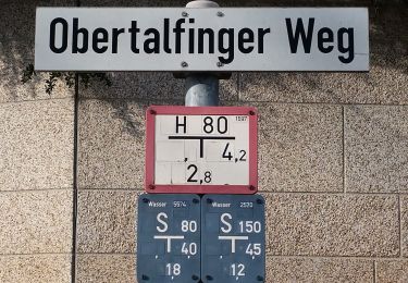
Randonnée Cyclotourisme de 96 km à découvrir à Bavière, Landkreis Neu-Ulm, Nouvelle-Ulm. Cette randonnée est proposée par pierrebourhis.

Profil altimétrique

Localisation

Pays :
Allemagne
Région :
Bavière
Département/Province :
Landkreis Neu-Ulm
Commune :
Nouvelle-Ulm
Localité :
Unknown
Départ:(Dec)
Départ:(UTM)
573163 ; 5360258 (32U) N.

Randonnées à proximité

Randonnée A pied Gomadingen - Ulmer Höhenweg Nebenroute Nord - Photo
A pied
PRO

A pied

Facile
Gomadingen, Bade-Wurtemberg, Landkreis Reutlingen, Allemagne
10,3 km | 13 km-effort
2h 57min
Non
Randonnée A pied Gomadingen - Ulmer Höhenweg - Photo
A pied
PRO

A pied

Moyen
Gomadingen, Bade-Wurtemberg, Landkreis Reutlingen, Allemagne
22 km | 28 km-effort
6h 21min
Oui
Randonnée Marche  - 2022.06.24 Münster de Ulm - Photo
Marche
vado52

Marche

Moyen
, Bade-Wurtemberg, Ulm, Allemagne
4,6 km | 5,4 km-effort
37min
Non
Randonnée Marche  - 2022.06.24 Hochzeit fest - Photo
Marche
vado52

Marche

Facile
, Bade-Wurtemberg, Ulm, Allemagne
1,2 km | 1,3 km-effort
11min
Non


Fermer
Mes abonnements