Randonnée Marche Millau - Au long du Tarn: de Millau à St-Georges de Luzençon - Photo

Au long du Tarn: de Millau à St-Georges de Luzençon

 canardDenis
canardDenis

Utilisateur

© OpenStreetMap contributors
Longueur
Longueur
16,9 km
Altitude max
Altitude max
778 m
Dénivelé positif
Dénivelé positif
633 m
Km-Effort
Km-Effort  
25 km
Altitude min
Altitude min
352 m
Dénivelé négatif
Dénivelé négatif
636 m
Boucle
Boucle
Non
Date de création :
2022-07-01 12:24:49.633
Dernière modification :
2022-07-02 08:22:14.012

(0 Avis)

Marche
Marche
5h45
Difficulté : Difficile

Scannez ce code QR pour ouvrir la randonnée dans l'application SityTrail

Application GPS de randonnée GRATUITE

Logo SityTrail SityTrail

IGN / Instituts géographiques

Télécharger SityTrail sur l'App Store Télécharger SityTrail sur Google Play

Logo SityTrail SityTrail World

Le monde est à vous

Télécharger SityTrail sur l'App Store Télécharger SityTrail sur Google Play Télécharger SityTrail sur Huawei AppGallery

À propos

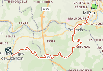
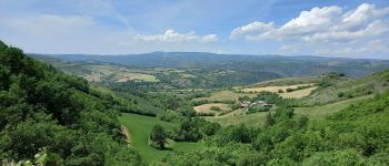
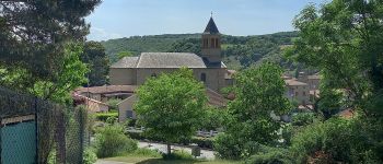
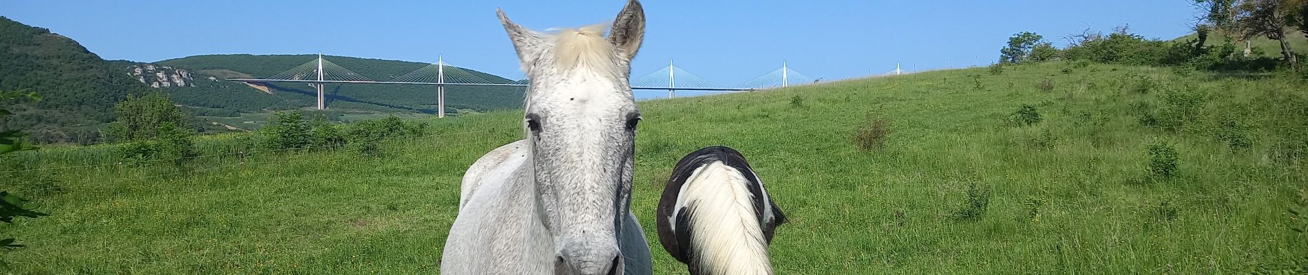
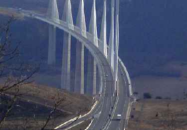
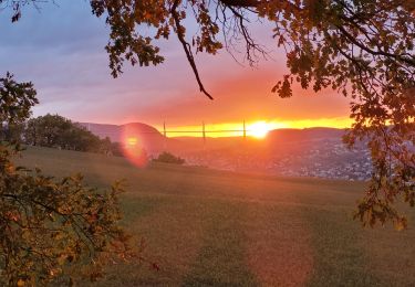
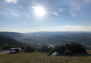
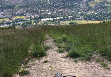
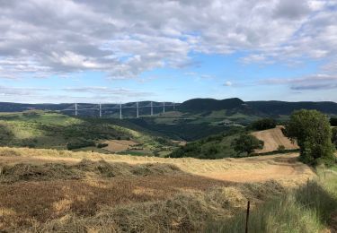
Randonnée Marche de 16,9 km à découvrir à Occitanie, Aveyron, Millau. Cette randonnée est proposée par canardDenis.

Description

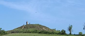
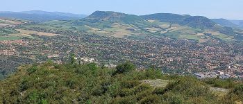
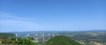
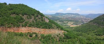
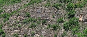
Partir de Millau en rive gauche le long du Tarn, traverser le village historique de Creissels, monter à la hauteur des parapentistes et suivre le viaduc en tournant autour du cirque de Boundoulaou pour aller admirer la cathédrale et venir se reposer à St georges de Luzençon.

Profil altimétrique

Photos

Points d'intérêt

Point d'intérêt Millau - Millau-Pont Lerouge - Photo
canardDenis
Point d'intérêt Creissels - Creissels - Photo
canardDenis
CREISSELS 
Point d'intérêt Creissels - passage sous-route - Photo
canardDenis
Point d'intérêt Creissels - sentier GR - Photo
canardDenis
CREISSELS 
Point d'intérêt Creissels - Patrimoine religieux - Photo
canardDenis
Point d'intérêt Creissels - aire d'aterrissage vol libre Brunas - Photo
canardDenis
Point d'intérêt Creissels - Intersection sentier GR - Photo
canardDenis
Point d'intérêt Creissels - sentier montant-lacet à droite - Photo
canardDenis
Point d'intérêt Creissels - Intersection GR 71D - Photo
canardDenis
Point d'intérêt Creissels - aire de départ parapentes - Photo
canardDenis
Point d'intérêt Creissels - point de vue  - Photo
canardDenis
CREISSELS 
Point d'intérêt Creissels - sentier balisé à droite  - Photo
canardDenis
Point d'intérêt Creissels - Cirque de Boundoulaou  - Photo
canardDenis
Point d'intérêt Creissels - Arche - Photo
canardDenis
CREISSELS 
Point d'intérêt Creissels - Intersection -suivre GR  - Photo
canardDenis
Point d'intérêt Creissels - Intersection sentiers - Photo
canardDenis
Point d'intérêt Creissels - Intersection route - Photo
canardDenis
Point d'intérêt Creissels - Traversée A75 - Photo
canardDenis
CREISSELS 
Point d'intérêt Creissels - tout droit  - Photo
canardDenis
CREISSELS 
Point d'intérêt Creissels - piste à droite - Photo
canardDenis
CREISSELS 
Point d'intérêt Saint-Georges-de-Luzençon - GR à droite  - Photo
canardDenis
SAINT-GEORGES-DE-LUZENÇON 
Point d'intérêt Saint-Georges-de-Luzençon - sentier à gauche - Photo
canardDenis
SAINT-GEORGES-DE-LUZENÇON 
Point d'intérêt Saint-Georges-de-Luzençon - sentier encore à gauche  - Photo
canardDenis
SAINT-GEORGES-DE-LUZENÇON 
Point d'intérêt Saint-Georges-de-Luzençon - descente en lacets - Photo
canardDenis
SAINT-GEORGES-DE-LUZENÇON 
Point d'intérêt Saint-Georges-de-Luzençon - GR à gauche  - Photo
canardDenis
SAINT-GEORGES-DE-LUZENÇON 
Point d'intérêt Saint-Georges-de-Luzençon - Intersection piste - Photo
canardDenis
SAINT-GEORGES-DE-LUZENÇON 
Point d'intérêt Saint-Georges-de-Luzençon - la Cathédrale  - Photo
canardDenis
SAINT-GEORGES-DE-LUZENÇON 
Point d'intérêt Saint-Georges-de-Luzençon - coupé piste VTT descendante - Photo
canardDenis
SAINT-GEORGES-DE-LUZENÇON 
Point d'intérêt Saint-Georges-de-Luzençon - Mayres - Photo
canardDenis
SAINT-GEORGES-DE-LUZENÇON 
Point d'intérêt Saint-Georges-de-Luzençon - Intersection piste - Photo
canardDenis
SAINT-GEORGES-DE-LUZENÇON 
Point d'intérêt Saint-Georges-de-Luzençon - sentier à droite  - Photo
canardDenis
SAINT-GEORGES-DE-LUZENÇON 
Point d'intérêt Saint-Georges-de-Luzençon - St-Georges-de-Luzençon - Photo
canardDenis
SAINT-GEORGES-DE-LUZENÇON 

Localisation

Pays :
France
Région :
Occitanie
Département/Province :
Aveyron
Commune :
Millau
Localité :
Unknown
Départ:(UTM)
506364 ; 4883061 (31T) N.

Randonnées à proximité

Randonnée Marche Millau - les cades - Photo
Marche
colber

Marche

Très facile
(1)
Millau, Occitanie, Aveyron, France
10,3 km | 13,8 km-effort
2h 54min
Oui
Randonnée Marche Millau - Randonnée autour du Viaduc  de Millau - Photo
Marche
tracegps

Marche

Difficile
(2)
Millau, Occitanie, Aveyron, France
18,5 km | 26 km-effort
5h 30min
Oui
Randonnée Marche Millau - le puech d'Andan(Millau) - Photo
Marche
nanie

Marche

Moyen
(1)
Millau, Occitanie, Aveyron, France
11 km | 18 km-effort
3h 45min
Oui
Randonnée Marche Millau - millau. massebiau - Photo
Marche
colber

Marche

Très facile
(2)
Millau, Occitanie, Aveyron, France
15,6 km | 19,8 km-effort
2h 48min
Non
Randonnée Marche Millau - forêt des Cades Millau  - Photo
Marche
nanie

Marche

Difficile
(1)
Millau, Occitanie, Aveyron, France
9,6 km | 13,3 km-effort
3h 1min
Oui
Randonnée Marche Millau - pouncho d'Agast - Photo
Marche
GUIDE
amiral13

Marche

Facile
Millau, Occitanie, Aveyron, France
12 km | 19,7 km-effort
6h 22min
Oui
Randonnée Vélo électrique Millau - Brunel - Photo
Vélo électrique
Damien Restano

Vélo électrique

Millau, Occitanie, Aveyron, France
32 km | 43 km-effort
2h 17min
Oui
Randonnée V.T.T. Millau - Montpellier le vieux - Photo
V.T.T.
Damien Restano

V.T.T.

Très difficile
Millau, Occitanie, Aveyron, France
55 km | 70 km-effort
3h 44min
Oui
Randonnée V.T.T. Millau - Dimanche 6 juin - Photo
V.T.T.
Damien Restano

V.T.T.

Très difficile
Millau, Occitanie, Aveyron, France
46 km | 63 km-effort
3h 26min
Oui


Fermer
Mes abonnements