


Wolhusen Wiggerwald

steger12
Utilisateur
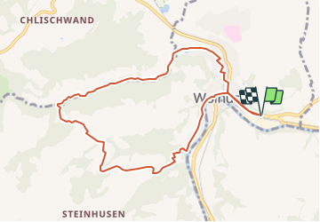

Longueur
9 km

Altitude max
788 m

Dénivelé positif
284 m
Km-Effort
12,8 km

Altitude min
564 m

Dénivelé négatif
286 m
Boucle
Oui
Date de création :
2014-12-10 00:00:00.0
Dernière modification :
2014-12-10 00:00:00.0
--
Difficulté : Inconnu

Application GPS de randonnée GRATUITE
 SityTrail
IGN / Instituts géographiques
SityTrail Plus
Le monde est à vous
À propos
Randonnée Autre activité de 9 km à découvrir à Lucerne, Inconnu, Wolhusen. Cette randonnée est proposée par steger12.
Localisation
Pays :
Suisse
Région :
Lucerne
Département/Province :
Inconnu
Commune :
Wolhusen
Localité :
Unknown
Départ:(Dec)
Départ:(UTM)
430107 ; 5211759 (32T) N.
Commentaires