Randonnée Randonnée équestre Alboussière - Circuit des Châtaignes pour la team - Photo

Circuit des Châtaignes pour la team

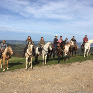
Cheval ,nature apéro et rire et convivialité

© OpenStreetMap contributors
Longueur
Longueur
151 km
Altitude max
Altitude max
1044 m
Dénivelé positif
Dénivelé positif
4573 m
Km-Effort
Km-Effort  
212 km
Altitude min
Altitude min
341 m
Dénivelé négatif
Dénivelé négatif
4572 m
Boucle
Boucle
Oui
Date de création :
2022-07-13 03:12:52.086
Dernière modification :
2022-07-13 03:24:20.351

(0 Avis)

Randonnée équestre
Randonnée équestre
27h56
Difficulté : Très difficile

Scannez ce code QR pour ouvrir la randonnée dans l'application SityTrail

Application GPS de randonnée GRATUITE

Logo SityTrail SityTrail

IGN / Instituts géographiques

Télécharger SityTrail sur l'App Store Télécharger SityTrail sur Google Play

Logo SityTrail SityTrail World

Le monde est à vous

Télécharger SityTrail sur l'App Store Télécharger SityTrail sur Google Play Télécharger SityTrail sur Huawei AppGallery

À propos

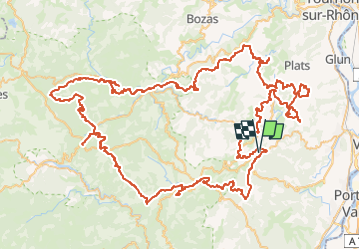
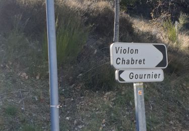
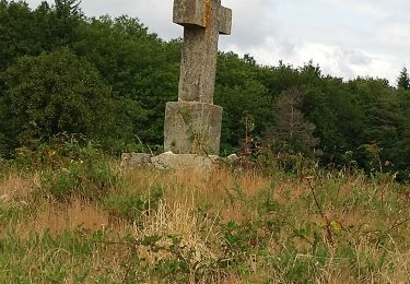
Randonnée Randonnée équestre de 151 km à découvrir à Auvergne-Rhône-Alpes, Ardèche, Alboussière. Cette randonnée est proposée par Team chicanos.

Description

Gpx D’origine du crte Ardèche
Modification gîte et tracé,points d’intérêts juin 2022

Profil altimétrique

Points d'intérêt

Point d'intérêt Saint-Romain-de-Lerps - Bar restaurant du pic - Photo
chevaltaiga
SAINT-ROMAIN-DE-LERPS 
Point d'intérêt Alboussière - Le p’tit bistrot d’Alboussière - Photo
chevaltaiga
Point d'intérêt Vernoux-en-Vivarais - Snack de la base nauti - Photo
chevaltaiga
VERNOUX-EN-VIVARAIS 
Point d'intérêt Belsentes - L’art des chemins - Photo
chevaltaiga
Point d'intérêt Silhac - Le pré d’aunay - Photo
chevaltaiga
Point d'intérêt Alboussière - La ferme des razes - Photo
chevaltaiga
ALBOUSSIÈRE 
Point d'intérêt Colombier-le-Jeune - Ferme de la cartara - Photo
chevaltaiga
COLOMBIER-LE-JEUNE 
Point d'intérêt Champis - La blache  du mazel - Photo
chevaltaiga
Point d'intérêt Champis - La blache  du mazel - Photo
chevaltaiga
Point d'intérêt Désaignes - Le vergier - Photo
chevaltaiga
DÉSAIGNES 

Localisation

Pays :
France
Région :
Auvergne-Rhône-Alpes
Département/Province :
Ardèche
Commune :
Alboussière
Localité :
Unknown
Départ:(Dec)
Départ:(UTM)
636501 ; 4976037 (31T) N.

Randonnées à proximité

Randonnée Marche Boffres - boffre 07 - Photo
Marche
guyzinz

Marche

Très facile
(1)
Boffres, Auvergne-Rhône-Alpes, Ardèche, France
12,5 km | 16,9 km-effort
4h 25min
Oui
Randonnée Moteur Boffres - sortie 3 jours Ardèche  - Photo
Moteur
philou71111

Moteur

Très facile
Boffres, Auvergne-Rhône-Alpes, Ardèche, France
595 km | 769 km-effort
108h 19min
Non
Randonnée Marche Champis - Tour de CHAMPIS - Photo
Marche
anonsdessources

Marche

Très difficile
Champis, Auvergne-Rhône-Alpes, Ardèche, France
25 km | 35 km-effort
7h 55min
Oui
Randonnée Marche Boffres - Boffres - Photo
Marche
Ann Matagrin

Marche

Très facile
Boffres, Auvergne-Rhône-Alpes, Ardèche, France
12,7 km | 17,1 km-effort
4h 15min
Oui
Randonnée Marche Boffres - Lierre Toulaud - Photo
Marche
friulana

Marche

Très facile
Boffres, Auvergne-Rhône-Alpes, Ardèche, France
5,9 km | 8,1 km-effort
2h 21min
Oui
Randonnée Randonnée équestre Champis - Jpn enfant  - Photo
Randonnée équestre
emma jung

Randonnée équestre

Champis, Auvergne-Rhône-Alpes, Ardèche, France
14,3 km | 18,1 km-effort
5h 38min
Oui
Randonnée Marche Toulaud - MN 3 LeTracol - Photo
Marche
grillojean

Marche

Très facile
Toulaud, Auvergne-Rhône-Alpes, Ardèche, France
6,2 km | 8,3 km-effort
1h 33min
Oui
Randonnée Marche Boffres - moulin à vent/le gratol - Photo
Marche
Plantier francis

Marche

Facile
Boffres, Auvergne-Rhône-Alpes, Ardèche, France
13 km | 18,5 km-effort
3h 45min
Oui
Randonnée Marche Boffres - marelles - Photo
Marche
berlan2

Marche

Très facile
Boffres, Auvergne-Rhône-Alpes, Ardèche, France
3,1 km | 4,3 km-effort
43min
Non


Fermer
Mes abonnements