Randonnée Cyclotourisme Cherbourg-en-Cotentin - D'un port à l'autre 2021/07 - Photo

D'un port à l'autre 2021/07

 BureauChris
BureauChris

Utilisateur

© OpenStreetMap contributors
Longueur
Longueur
858 km
Altitude max
Altitude max
347 m
Dénivelé positif
Dénivelé positif
7978 m
Km-Effort
Km-Effort  
964 km
Altitude min
Altitude min
-5 m
Dénivelé négatif
Dénivelé négatif
7983 m
Boucle
Boucle
Non
Date de création :
2022-07-25 19:42:34.516
Dernière modification :
2023-05-19 14:53:39.94

(0 Avis)

Cyclotourisme
Cyclotourisme
0m
Difficulté : Très difficile

Scannez ce code QR pour ouvrir la randonnée dans l'application SityTrail

Application GPS de randonnée GRATUITE

Logo SityTrail SityTrail

IGN / Instituts géographiques

Télécharger SityTrail sur l'App Store Télécharger SityTrail sur Google Play

Logo SityTrail SityTrail World

Le monde est à vous

Télécharger SityTrail sur l'App Store Télécharger SityTrail sur Google Play Télécharger SityTrail sur Huawei AppGallery

À propos

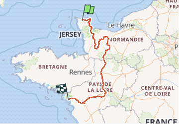
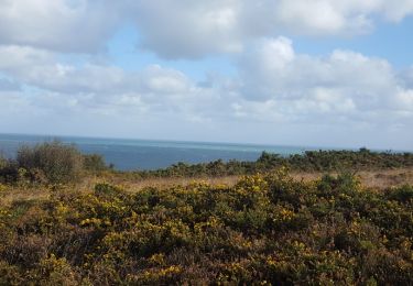
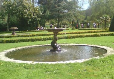
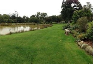
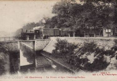
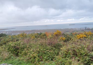
Randonnée Cyclotourisme de 858 km à découvrir à Normandie, Manche, Cherbourg-en-Cotentin. Cette randonnée est proposée par BureauChris.

Description

Cherbourg - Saint-Nazaire 870 km

Profil altimétrique

Photos

Localisation

Pays :
France
Région :
Normandie
Département/Province :
Manche
Commune :
Cherbourg-en-Cotentin
Localité :
Cherbourg-Octeville
Départ:(UTM)
599541 ; 5498800 (30U) N.

Randonnées à proximité

Randonnée Marche Cherbourg-en-Cotentin - La Glacerie  - Photo
Marche
PatRando

Marche

Facile
Cherbourg-en-Cotentin, Normandie, Manche, France
6,6 km | 8,7 km-effort
1h 26min
Oui
Randonnée Vélo de route Cherbourg-en-Cotentin - Autour de Cherbourg en vélo  - Photo
Vélo de route
FOUCAULT

Vélo de route

Très facile
Cherbourg-en-Cotentin, Normandie, Manche, France
24 km | 26 km-effort
2h 12min
Oui
Randonnée Marche Cherbourg-en-Cotentin - Tourlaville : 22 octobre 2017 - Photo
Marche
PatRando

Marche

Facile
Cherbourg-en-Cotentin, Normandie, Manche, France
6,2 km | 7,5 km-effort
1h 2min
Oui
Randonnée V.T.T. Cherbourg-en-Cotentin - Relais des 4 châteaux 2013 - Tourlaville  - Photo
V.T.T.
tracegps

V.T.T.

Difficile
Cherbourg-en-Cotentin, Normandie, Manche, France
30 km | 38 km-effort
3h 0min
Oui
Randonnée V.T.T. Cherbourg-en-Cotentin - La Printanière 2013  - Equeurdreville Hainneville - Photo
V.T.T.
tracegps

V.T.T.

Moyen
Cherbourg-en-Cotentin, Normandie, Manche, France
52 km | 62 km-effort
3h 0min
Oui
Randonnée Marche Cherbourg-en-Cotentin - Le colignon - Photo
Marche
yoyodutheil

Marche

Très facile
(1)
Cherbourg-en-Cotentin, Normandie, Manche, France
5,8 km | 7,2 km-effort
1h 34min
Oui
Randonnée Marche Cherbourg-en-Cotentin - Les chemins de Saint- Michel - Cherbourg - Lessay - Photo
Marche
tracegps

Marche

Moyen
Cherbourg-en-Cotentin, Normandie, Manche, France
91 km | 103 km-effort
Inconnu
Non
Randonnée Marche Cherbourg-en-Cotentin - GR 223 - de Cherbourg à Flamanville - Photo
Marche
tracegps

Marche

Moyen
(1)
Cherbourg-en-Cotentin, Normandie, Manche, France
70 km | 87 km-effort
16h 0min
Non
Randonnée Marche Cherbourg-en-Cotentin - Tourlaville - Collignon - Photo
Marche
PatRando

Marche

Moyen
Cherbourg-en-Cotentin, Normandie, Manche, France
9,8 km | 11,5 km-effort
2h 4min
Oui


Fermer
Mes abonnements