


TMB6 AN

reneperrin
Utilisateur
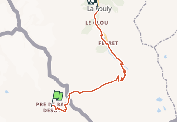

Longueur
12,6 km

Altitude max
2532 m

Dénivelé positif
507 m
Km-Effort
21 km

Altitude min
1601 m

Dénivelé négatif
951 m
Boucle
Non
Date de création :
2022-09-08 06:01:21.467
Dernière modification :
2022-09-08 12:38:46.174
4h05
Difficulté : Facile

Application GPS de randonnée GRATUITE
 SityTrail
IGN / Instituts géographiques
SityTrail Plus
Le monde est à vous
À propos
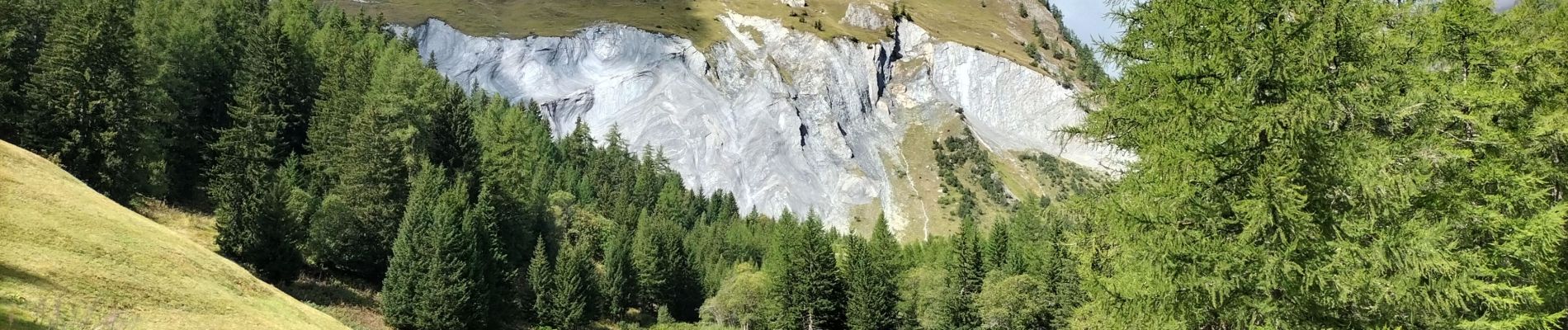
Randonnée Marche de 12,6 km à découvrir à Vallée d'Aoste, Inconnu, Courmayeur. Cette randonnée est proposée par reneperrin.
Photos


Localisation
Pays :
Italie
Région :
Vallée d'Aoste
Département/Province :
Inconnu
Commune :
Courmayeur
Localité :
Unknown
Départ:(Dec)
Départ:(UTM)
349901 ; 5083086 (32T) N.
Commentaires