Randonnée Marche Espeluche - Le Huit d'Espeluche 7km4 - Photo
 chancha
chancha

Utilisateur

© OpenStreetMap contributors
Longueur
Longueur
8 km
Altitude max
Altitude max
252 m
Dénivelé positif
Dénivelé positif
166 m
Km-Effort
Km-Effort  
10,2 km
Altitude min
Altitude min
147 m
Dénivelé négatif
Dénivelé négatif
170 m
Boucle
Boucle
Oui
Date de création :
2022-10-10 09:19:57.64
Dernière modification :
2022-10-13 09:52:05.314

(0 Avis)

Marche
Marche
2h09
Difficulté : Moyen

Scannez ce code QR pour ouvrir la randonnée dans l'application SityTrail

Application GPS de randonnée GRATUITE

Logo SityTrail SityTrail

IGN / Instituts géographiques

Télécharger SityTrail sur l'App Store Télécharger SityTrail sur Google Play

Logo SityTrail SityTrail World

Le monde est à vous

Télécharger SityTrail sur l'App Store Télécharger SityTrail sur Google Play Télécharger SityTrail sur Huawei AppGallery

À propos

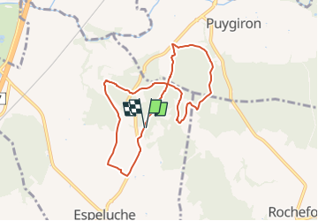
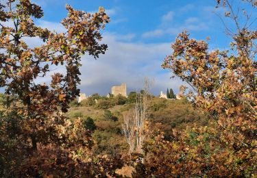
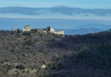
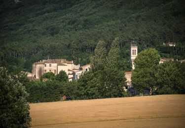
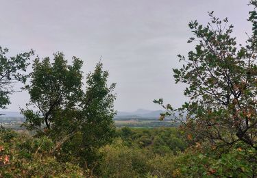
Randonnée Marche de 8 km à découvrir à Auvergne-Rhône-Alpes, Drôme, Espeluche. Cette randonnée est proposée par chancha.

Description

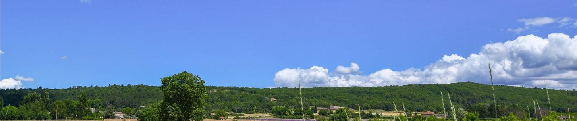
Cette balade au départ d'Espeluche vous en fait decouvrir les alentours avec ses petites routes bordèes de champs de lavandes et ses chemins forestiers.

Profil altimétrique

Photos

Localisation

Pays :
France
Région :
Auvergne-Rhône-Alpes
Département/Province :
Drôme
Commune :
Espeluche
Localité :
Unknown
Départ:(UTM)
645499 ; 4932207 (31T) N.

Randonnées à proximité

Randonnée Marche Allan - allan transclavienne rac - Photo
Marche
micheleuvrard

Marche

Très facile
(1)
Allan, Auvergne-Rhône-Alpes, Drôme, France
19,1 km | 26 km-effort
5h 11min
Oui
Randonnée V.T.T. Puygiron - Puygiron VTT n°5 - Photo
V.T.T.
tracegps

V.T.T.

Très difficile
(1)
Puygiron, Auvergne-Rhône-Alpes, Drôme, France
47 km | 60 km-effort
3h 0min
Oui
Randonnée Marche La Touche - Citelles hameau et ruisseaux 10km - Photo
Marche
GUIDE
thonyc

Marche

Facile
(2)
La Touche, Auvergne-Rhône-Alpes, Drôme, France
9,6 km | 12,6 km-effort
3h 7min
Oui
Randonnée sport Allan - SityTrail - Les Villages Perchés. - Photo
sport
collot

sport

Très facile
(1)
Allan, Auvergne-Rhône-Alpes, Drôme, France
19,5 km | 27 km-effort
Inconnu
Oui
Randonnée Marche Montboucher-sur-Jabron - 20240428 Rando vieux  - Photo
Marche
Havani

Marche

Très facile
Montboucher-sur-Jabron, Auvergne-Rhône-Alpes, Drôme, France
6,1 km | 6,5 km-effort
5h 17min
Oui
Randonnée Marche Rochefort-en-Valdaine - Rochefort en Valdaine 7,5km - Photo
Marche
GUIDE
thonyc

Marche

Facile
Rochefort-en-Valdaine, Auvergne-Rhône-Alpes, Drôme, France
7,3 km | 10,3 km-effort
2h 30min
Oui
Randonnée Marche Allan - Allan Château de Rochefort en Valdaine - Photo
Marche
TOULAUDIN

Marche

Facile
Allan, Auvergne-Rhône-Alpes, Drôme, France
17,7 km | 26 km-effort
6h 6min
Oui
Randonnée Marche La Touche - La Touche : Les Citelles et Serre Pointu 12km - Photo
Marche
chancha

Marche

Difficile
La Touche, Auvergne-Rhône-Alpes, Drôme, France
12 km | 16,6 km-effort
4h 3min
Oui
Randonnée Marche La Touche - La Touche Mastaize 9km - Photo
Marche
chancha

Marche

Difficile
La Touche, Auvergne-Rhône-Alpes, Drôme, France
8,6 km | 10,7 km-effort
3h 24min
Oui


Fermer
Mes abonnements