Randonnée Marche Épannes - Epannes_fougerit_2 - Photo
 olaze
olaze

Utilisateur

© OpenStreetMap contributors
Longueur
Longueur
8,8 km
Altitude max
Altitude max
28 m
Dénivelé positif
Dénivelé positif
41 m
Km-Effort
Km-Effort  
9,3 km
Altitude min
Altitude min
15 m
Dénivelé négatif
Dénivelé négatif
40 m
Boucle
Boucle
Oui
Date de création :
2014-12-10 00:00:00.0
Dernière modification :
2014-12-10 00:00:00.0

(0 Avis)

Marche
Marche
2h05
Difficulté : Facile

Scannez ce code QR pour ouvrir la randonnée dans l'application SityTrail

Application GPS de randonnée GRATUITE

Logo SityTrail SityTrail

IGN / Instituts géographiques

Télécharger SityTrail sur l'App Store Télécharger SityTrail sur Google Play

Logo SityTrail SityTrail World

Le monde est à vous

Télécharger SityTrail sur l'App Store Télécharger SityTrail sur Google Play Télécharger SityTrail sur Huawei AppGallery

À propos

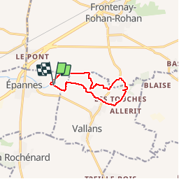
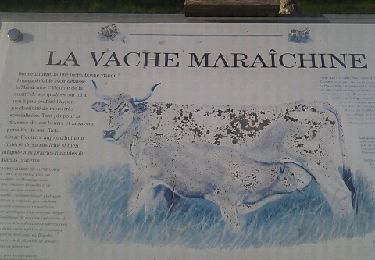
Randonnée Marche de 8,8 km à découvrir à Nouvelle-Aquitaine, Deux-Sèvres, Épannes. Cette randonnée est proposée par olaze.

Description

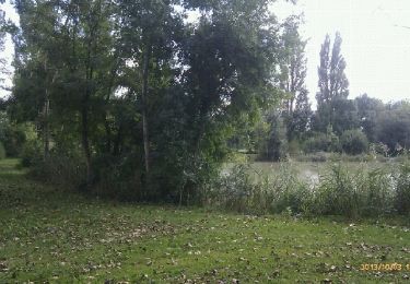
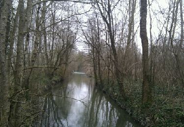
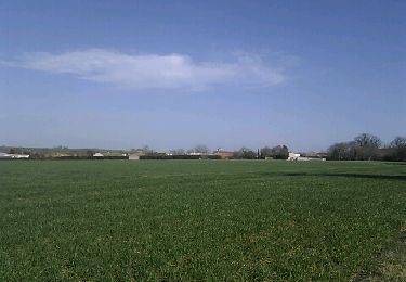
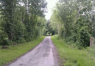
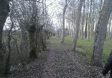
Départ & retour du plan d'eau d'Epannes.Dans le marais , la campagne . 09/2014

Profil altimétrique

Localisation

Pays :
France
Région :
Nouvelle-Aquitaine
Département/Province :
Deux-Sèvres
Commune :
Épannes
Localité :
Unknown
Départ:(Dec)
Départ:(UTM)
687402 ; 5122448 (30T) N.

Randonnées à proximité

Randonnée Marche Épannes - Epannes. plan d'eau .(9km) - Photo
Marche
olaze

Marche

Très facile
Épannes, Nouvelle-Aquitaine, Deux-Sèvres, France
10,2 km | 10,9 km-effort
2h 12min
Oui
Randonnée Marche Épannes - Epannes . (fougerit) - Photo
Marche
olaze

Marche

Facile
Épannes, Nouvelle-Aquitaine, Deux-Sèvres, France
9,7 km | 10,3 km-effort
2h 18min
Oui
Randonnée Marche Sansais - Sansais (9,6km) - Photo
Marche
olaze

Marche

Facile
Sansais, Nouvelle-Aquitaine, Deux-Sèvres, France
9,6 km | 10,5 km-effort
2h 25min
Oui
Randonnée Marche La Rochénard - La Rochenard - Photo
Marche
olaze

Marche

Très facile
La Rochénard, Nouvelle-Aquitaine, Deux-Sèvres, France
3 km | 3,3 km-effort
1h 18min
Oui
Randonnée Marche Le Bourdet - Le Bourdet - 10km - Photo
Marche
olaze

Marche

Facile
Le Bourdet, Nouvelle-Aquitaine, Deux-Sèvres, France
10,5 km | 11,1 km-effort
2h 28min
Oui
Randonnée Marche Épannes - Epannes (plan d'eau). 6,8km - Photo
Marche
olaze

Marche

Facile
Épannes, Nouvelle-Aquitaine, Deux-Sèvres, France
6,8 km | 7,2 km-effort
1h 49min
Oui
Randonnée Marche Épannes - Epannes (Le Bourdet). 9,3km - Photo
Marche
olaze

Marche

Facile
Épannes, Nouvelle-Aquitaine, Deux-Sèvres, France
9,3 km | 9,8 km-effort
2h 22min
Oui
Randonnée Marche La Foye-Monjault - La Foye Montjault 2018 - Photo
Marche
olaze

Marche

Facile
La Foye-Monjault, Nouvelle-Aquitaine, Deux-Sèvres, France
8 km | 8,9 km-effort
1h 45min
Oui
Randonnée Marche Amuré - Amuré 7.4 km - Photo
Marche
GOELERANDO2

Marche

Facile
Amuré, Nouvelle-Aquitaine, Deux-Sèvres, France
7,4 km | 7,8 km-effort
1h 46min
Oui


Fermer
Mes abonnements