Randonnée Marche Éloyes - jarmenil geocaches - Photo

jarmenil geocaches

 michelbauby
michelbauby

Utilisateur

© OpenStreetMap contributors
Longueur
Longueur
5,3 km
Altitude max
Altitude max
613 m
Dénivelé positif
Dénivelé positif
160 m
Km-Effort
Km-Effort  
7,5 km
Altitude min
Altitude min
455 m
Dénivelé négatif
Dénivelé négatif
159 m
Boucle
Boucle
Oui
Date de création :
2014-12-10 00:00:00.0
Dernière modification :
2014-12-10 00:00:00.0

(1 Avis)

Marche
Marche
2h07
Difficulté : Facile

Scannez ce code QR pour ouvrir la randonnée dans l'application SityTrail

Application GPS de randonnée GRATUITE

Logo SityTrail SityTrail

IGN / Instituts géographiques

Télécharger SityTrail sur l'App Store Télécharger SityTrail sur Google Play

Logo SityTrail SityTrail World

Le monde est à vous

Télécharger SityTrail sur l'App Store Télécharger SityTrail sur Google Play Télécharger SityTrail sur Huawei AppGallery

À propos

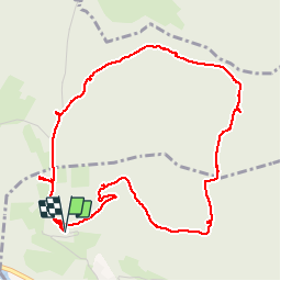
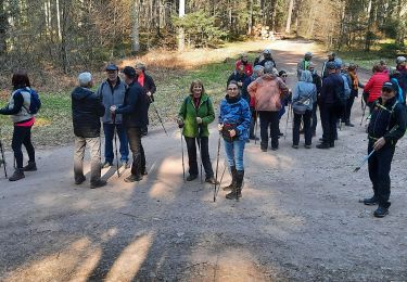
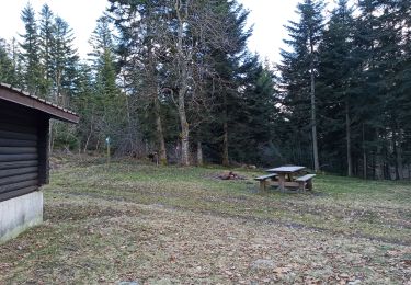
Randonnée Marche de 5,3 km à découvrir à Grand Est, Vosges, Éloyes. Cette randonnée est proposée par michelbauby.

Description

geocaching

Profil altimétrique

Localisation

Pays :
France
Région :
Grand Est
Département/Province :
Vosges
Commune :
Éloyes
Localité :
Unknown
Départ:(Dec)
Départ:(UTM)
321416 ; 5330935 (32U) N.

Commentaires

Veuillez vous connecter pour laisser un commentaire ou une note


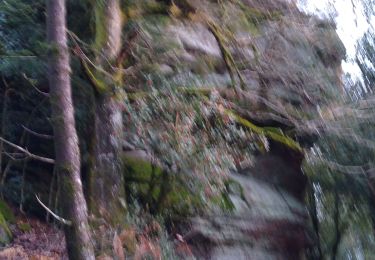
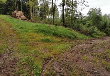
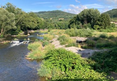
Merci pour cette randonnée bien ombragées, attention à la moitié sur un petit Km le chemin semble un peut a l'abandon et se referme.


Randonnées à proximité

Randonnée Marche Éloyes - eloyes champ dolant - Photo
Marche
lacote

Marche

Moyen
(2)
Éloyes, Grand Est, Vosges, France
8,2 km | 12,4 km-effort
2h 26min
Oui
Randonnée Marche Saint-Étienne-lès-Remiremont - Les cuveaux à Eloyes - Photo
Marche
regish54

Marche

Facile
Saint-Étienne-lès-Remiremont, Grand Est, Vosges, France
4,5 km | 5,6 km-effort
1h 23min
Non
Randonnée Marche Jarménil - haut jarmenil 2 - Photo
Marche
lacote

Marche

Moyen
(1)
Jarménil, Grand Est, Vosges, France
12,3 km | 16,8 km-effort
2h 39min
Oui
Randonnée Marche Saint-Étienne-lès-Remiremont - Vers la Tête des Cuveaux - Photo
Marche
jeanclaude12

Marche

Facile
(1)
Saint-Étienne-lès-Remiremont, Grand Est, Vosges, France
9 km | 12,4 km-effort
2h 30min
Oui
Randonnée Marche Éloyes - Belvédère et Tête des Cuveaux - Photo
Marche
jpblimond

Marche

Facile
Éloyes, Grand Est, Vosges, France
3,7 km | 5,7 km-effort
1h 24min
Oui
Randonnée Marche Éloyes - Éloyes - Photo
Marche
jpblimond

Marche

Moyen
Éloyes, Grand Est, Vosges, France
12,3 km | 17,2 km-effort
3h 12min
Oui
Randonnée Marche Pouxeux - Pouxeux  - Photo
Marche
STjmd300945

Marche

Difficile
Pouxeux, Grand Est, Vosges, France
11,9 km | 15,7 km-effort
2h 57min
Oui
Randonnée Marche Pouxeux - St Nabord Malaide - Photo
Marche
STjmd300945

Marche

Difficile
Pouxeux, Grand Est, Vosges, France
11,2 km | 15 km-effort
3h 32min
Oui
Randonnée Marche Éloyes - 18-02-22 tête des cuveaux - Photo
Marche
annefrance70

Marche

Facile
(1)
Éloyes, Grand Est, Vosges, France
5,3 km | 8,6 km-effort
1h 26min
Oui


Fermer
Mes abonnements