Randonnée Marche Andlau - Andlau - château d'Andlau - château du Spesbourg - Photo

Andlau - château d'Andlau - château du Spesbourg

 Bart2015
Bart2015

Utilisateur

© OpenStreetMap contributors
Longueur
Longueur
8,6 km
Altitude max
Altitude max
479 m
Dénivelé positif
Dénivelé positif
320 m
Km-Effort
Km-Effort  
12,8 km
Altitude min
Altitude min
229 m
Dénivelé négatif
Dénivelé négatif
325 m
Boucle
Boucle
Oui
Date de création :
2023-01-29 10:12:12.716
Dernière modification :
2023-01-30 18:25:17.512

(0 Avis)

Marche
Marche
1h54
Difficulté : Facile

Scannez ce code QR pour ouvrir la randonnée dans l'application SityTrail

Application GPS de randonnée GRATUITE

Logo SityTrail SityTrail

IGN / Instituts géographiques

Télécharger SityTrail sur l'App Store Télécharger SityTrail sur Google Play

Logo SityTrail SityTrail World

Le monde est à vous

Télécharger SityTrail sur l'App Store Télécharger SityTrail sur Google Play Télécharger SityTrail sur Huawei AppGallery

À propos

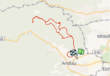
Randonnée Marche de 8,6 km à découvrir à Grand Est, Bas-Rhin, Andlau. Cette randonnée est proposée par Bart2015.

Description

Petite rando pour découvrir les beaux châteaux d'Andlau et du Spesbourg.
Bonne rando ...

Profil altimétrique

Photos

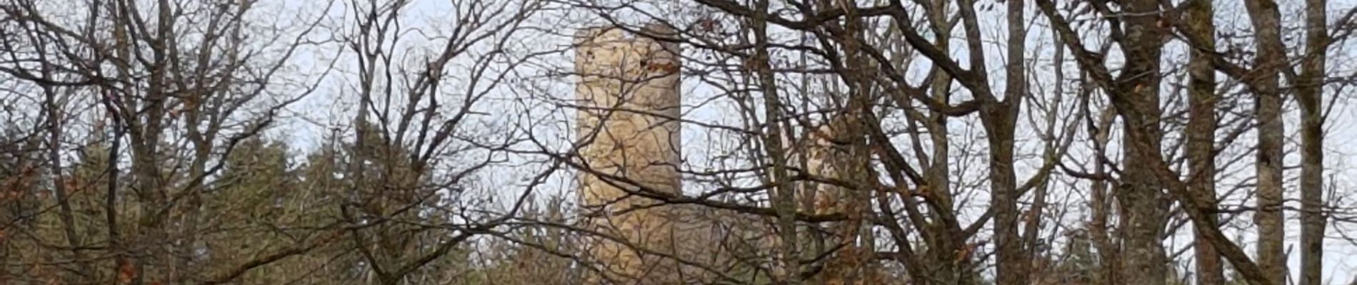
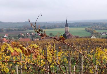
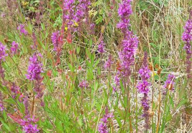
25 photos au total. Cliquez sur une photo pour les afficher toutes dans la galerie.

Localisation

Pays :
France
Région :
Grand Est
Département/Province :
Bas-Rhin
Commune :
Andlau
Localité :
Unknown
Départ:(UTM)
383188 ; 5360659 (32U) N.

Randonnées à proximité

Randonnée Marche Ottrott - Le circuit nord du Mur Païen - Photo
Marche
VacheKiri67

Marche

Facile
(1)
Ottrott, Grand Est, Bas-Rhin, France
5,9 km | 8,5 km-effort
2h 4min
Non
Randonnée Marche Andlau - Depuis Andlau vers le village viticole de Mittelbergheim - Photo
Marche
VacheKiri67

Marche

Moyen
(1)
Andlau, Grand Est, Bas-Rhin, France
11,9 km | 15,9 km-effort
4h 3min
Oui
Randonnée Marche Ottrott - Le mur païen - Photo
Marche
VacheKiri67

Marche

Moyen
(4)
Ottrott, Grand Est, Bas-Rhin, France
10,5 km | 14,5 km-effort
4h 36min
Oui
Randonnée V.T.T. Barr - Circuit des 3 Petits Ponts - Photo
V.T.T.
tracegps

V.T.T.

Difficile
(1)
Barr, Grand Est, Bas-Rhin, France
15,9 km | 22 km-effort
1h 19min
Oui
Randonnée Randonnée équestre Epfig - 2022-11-11 Journee Epfig Nothalten Dambach - Photo
Randonnée équestre
GUIDE
holtzv

Randonnée équestre

Moyen
Epfig, Grand Est, Bas-Rhin, France
22 km | 27 km-effort
3h 48min
Oui
Randonnée Marche Reichsfeld - 2019-12-28 Marche Reichsfeld Ungersberg Gruckert - Photo
Marche
GUIDE
holtzv

Marche

Très facile
Reichsfeld, Grand Est, Bas-Rhin, France
12,2 km | 20 km-effort
3h 5min
Oui
Randonnée Marche Nothalten - nothalten - Photo
Marche
rensmusic

Marche

Très facile
(1)
Nothalten, Grand Est, Bas-Rhin, France
9,6 km | 13 km-effort
2h 13min
Non
Randonnée Marche Mittelbergheim - Mittelbergheim - Château du Landsberg - Photo
Marche
tracegps

Marche

Moyen
(3)
Mittelbergheim, Grand Est, Bas-Rhin, France
15,4 km | 23 km-effort
5h 0min
Oui
Randonnée Marche Epfig - ittswiller un jour de pluie  - Photo
Marche
grandville

Marche

Moyen
Epfig, Grand Est, Bas-Rhin, France
6,9 km | 9,1 km-effort
1h 52min
Oui


Fermer
Mes abonnements