Randonnée Marche Pommerol - Pommerol - Col du Prieur-Col du Faux - Pommerol  - Photo

Pommerol - Col du Prieur-Col du Faux - Pommerol

 Pierre Jongen
Pierre Jongen

Utilisateur

© OpenStreetMap contributors
Longueur
Longueur
3,9 km
Altitude max
Altitude max
1120 m
Dénivelé positif
Dénivelé positif
278 m
Km-Effort
Km-Effort  
7,7 km
Altitude min
Altitude min
875 m
Dénivelé négatif
Dénivelé négatif
277 m
Boucle
Boucle
Oui
Date de création :
2023-03-01 11:00:02.0
Dernière modification :
2023-03-04 10:42:25.92

(0 Avis)

Marche
Marche
1h25
Difficulté : Facile

Scannez ce code QR pour ouvrir la randonnée dans l'application SityTrail

Application GPS de randonnée GRATUITE

Logo SityTrail SityTrail

IGN / Instituts géographiques

Télécharger SityTrail sur l'App Store Télécharger SityTrail sur Google Play

Logo SityTrail SityTrail World

Le monde est à vous

Télécharger SityTrail sur l'App Store Télécharger SityTrail sur Google Play Télécharger SityTrail sur Huawei AppGallery

À propos

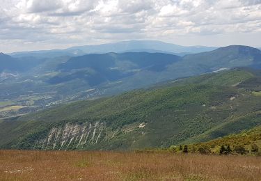
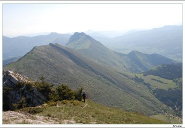
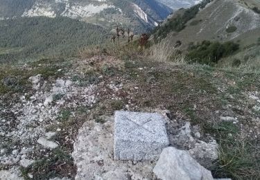
Randonnée Marche de 3,9 km à découvrir à Auvergne-Rhône-Alpes, Drôme, Pommerol. Cette randonnée est proposée par Pierre Jongen.

Description

Montée col du Prieur inconfortable

Profil altimétrique

Localisation

Pays :
France
Région :
Auvergne-Rhône-Alpes
Département/Province :
Drôme
Commune :
Pommerol
Localité :
Unknown
Départ:(UTM)
695131 ; 4924422 (31T) N.

Randonnées à proximité

Randonnée Marche Rosans - 7km Fourchat AR par chemin du facteur (partie) - Photo
Marche
Pierre Jongen

Marche

Difficile
Rosans, Provence-Alpes-Côte d'Azur, Hautes-Alpes, France
6,8 km | 13,2 km-effort
3h 30min
Oui
Randonnée Vélo de route La Charce - 75km VC La Charce Montmorin Serres Carabès Valdrôme La Chance - Photo
Vélo de route
Pierre Jongen

Vélo de route

Très difficile
(1)
La Charce, Auvergne-Rhône-Alpes, Drôme, France
75 km | 97 km-effort
6h 2min
Oui
Randonnée Marche Rosans - Montagne de Raton au départ du col de Pommerol ou de la Fromagère - Photo
Marche
jean-marie.parachini

Marche

Moyen
Rosans, Provence-Alpes-Côte d'Azur, Hautes-Alpes, France
6,8 km | 12,1 km-effort
7h 29min
Oui
Randonnée Marche Rosans - POMMEROL - LA MONTAGNE DE RATON - Photo
Marche
jean-marie.parachini

Marche

Difficile
Rosans, Provence-Alpes-Côte d'Azur, Hautes-Alpes, France
7,1 km | 12,4 km-effort
6h 49min
Oui
Randonnée Cheval La Motte-Chalancon - DIOIS 3J J2 1605 - Photo
Cheval
azipat

Cheval

Moyen
(1)
La Motte-Chalancon, Auvergne-Rhône-Alpes, Drôme, France
28 km | 45 km-effort
5h 24min
Non
Randonnée Marche Pommerol -  Col de La Fromagère - Le Fourchat - Photo
Marche
tracegps

Marche

Difficile
Pommerol, Auvergne-Rhône-Alpes, Drôme, France
4,5 km | 10,6 km-effort
2h 30min
Oui
Randonnée Marche Rosans - Le Fourchat par le col de Pommerol - Photo
Marche
nadd73

Marche

Moyen
Rosans, Provence-Alpes-Côte d'Azur, Hautes-Alpes, France
2,6 km | 7,3 km-effort
57min
Non
Randonnée Marche Pommerol - fourcha - Photo
Marche
lucberghmans49@gmail.com

Marche

Moyen
Pommerol, Auvergne-Rhône-Alpes, Drôme, France
4,5 km | 10,6 km-effort
3h 34min
Oui
Randonnée Marche La Charce - La Charce - Le Peyssias (1187m) - La Charce - Photo
Marche
Pierre Jongen

Marche

Difficile
La Charce, Auvergne-Rhône-Alpes, Drôme, France
8,2 km | 15,5 km-effort
2h 42min
Oui


Fermer
Mes abonnements