Randonnée Marche Plougastel-Daoulas - circuit des chapelles à Plougastel - Photo

circuit des chapelles à Plougastel

 elianette
elianette

Utilisateur

© OpenStreetMap contributors
Longueur
Longueur
24 km
Altitude max
Altitude max
98 m
Dénivelé positif
Dénivelé positif
424 m
Km-Effort
Km-Effort  
30 km
Altitude min
Altitude min
2 m
Dénivelé négatif
Dénivelé négatif
424 m
Boucle
Boucle
Oui
Date de création :
2023-03-20 08:17:17.039
Dernière modification :
2023-03-20 15:44:09.405

(0 Avis)

Marche
Marche
5h37
Difficulté : Moyen

Scannez ce code QR pour ouvrir la randonnée dans l'application SityTrail

Application GPS de randonnée GRATUITE

Logo SityTrail SityTrail

IGN / Instituts géographiques

Télécharger SityTrail sur l'App Store Télécharger SityTrail sur Google Play

Logo SityTrail SityTrail World

Le monde est à vous

Télécharger SityTrail sur l'App Store Télécharger SityTrail sur Google Play Télécharger SityTrail sur Huawei AppGallery

À propos

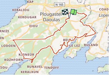
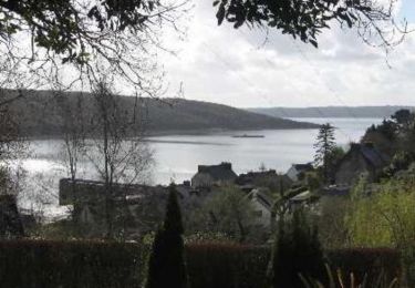
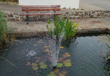
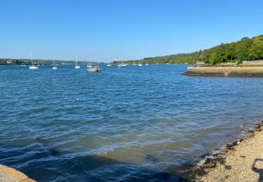
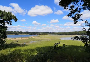
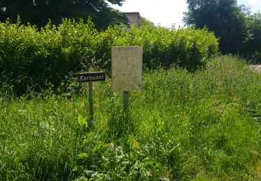
Randonnée Marche de 24 km à découvrir à Bretagne, Finistère, Plougastel-Daoulas. Cette randonnée est proposée par elianette.

Description

kilomètres exact 27km300 avec des petites erreurs de parcours beaucoup de boue

Profil altimétrique

Photos

Localisation

Pays :
France
Région :
Bretagne
Département/Province :
Finistère
Commune :
Plougastel-Daoulas
Localité :
Unknown
Départ:(UTM)
400071 ; 5358605 (30U) N.

Randonnées à proximité

Randonnée Marche Plougastel-Daoulas - Tour du passage par la chapelle St Jean - Photo
Marche

Marche

Moyen
(2)
Plougastel-Daoulas, Bretagne, Finistère, France
11,4 km | 14,8 km-effort
3h 4min
Oui
Randonnée V.T.T. Le Relecq-Kerhuon - Le Tour de Plougastel par Daoulas - Photo
V.T.T.
tracegps

V.T.T.

Difficile
(1)
Le Relecq-Kerhuon, Bretagne, Finistère, France
49 km | 61 km-effort
3h 30min
Oui
Randonnée Marche Le Relecq-Kerhuon - De Brest à Landerneau le long de l'Elorn - Photo
Marche
tracegps

Marche

Difficile
(1)
Le Relecq-Kerhuon, Bretagne, Finistère, France
21 km | 25 km-effort
5h 0min
Non
Randonnée Marche Plougastel-Daoulas - Du Port de Lauberlac'h au Port du Caro - Photo
Marche
tracegps

Marche

Moyen
(1)
Plougastel-Daoulas, Bretagne, Finistère, France
14,6 km | 18,6 km-effort
3h 19min
Oui
Randonnée Marche Loperhet - LOPERHET  - Photo
Marche
RonanDAGORN

Marche

Moyen
Loperhet, Bretagne, Finistère, France
22 km | 26 km-effort
5h 20min
Oui
Randonnée Course à pied Plougastel-Daoulas - Course Plougastel  - Photo
Course à pied
choubaka77

Course à pied

Facile
Plougastel-Daoulas, Bretagne, Finistère, France
8,4 km | 11,1 km-effort
1h 6min
Oui
Randonnée Marche Plougastel-Daoulas - LOPERHET  - Photo
Marche
RonanDAGORN

Marche

Moyen
Plougastel-Daoulas, Bretagne, Finistère, France
14,3 km | 16,8 km-effort
3h 33min
Oui
Randonnée Marche Logonna-Daoulas - Circuit de l'anse de Pen Foul. Logona. 06/07/20 - Photo
Marche
Dervalmarc

Marche

Très facile
(1)
Logonna-Daoulas, Bretagne, Finistère, France
5,6 km | 7 km-effort
1h 33min
Non
Randonnée Marche Dirinon - Kerouant - Photo
Marche
terminio

Marche

Très facile
(1)
Dirinon, Bretagne, Finistère, France
9,7 km | 11,4 km-effort
3h 20min
Oui


Fermer
Mes abonnements