Randonnée Marche Bayonne - Eté 2023 / Jour 12 - Photo
© OpenStreetMap contributors
Longueur
Longueur
14,4 km
Altitude max
Altitude max
49 m
Dénivelé positif
Dénivelé positif
123 m
Km-Effort
Km-Effort  
16 km
Altitude min
Altitude min
-1 m
Dénivelé négatif
Dénivelé négatif
123 m
Boucle
Boucle
Non
Date de création :
2023-04-29 20:21:54.889
Dernière modification :
2023-04-29 20:22:22.813

(0 Avis)

Marche
Marche
3h38
Difficulté : Difficile

Scannez ce code QR pour ouvrir la randonnée dans l'application SityTrail

Application GPS de randonnée GRATUITE

Logo SityTrail SityTrail

IGN / Instituts géographiques

Télécharger SityTrail sur l'App Store Télécharger SityTrail sur Google Play

Logo SityTrail SityTrail World

Le monde est à vous

Télécharger SityTrail sur l'App Store Télécharger SityTrail sur Google Play Télécharger SityTrail sur Huawei AppGallery

À propos

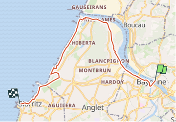
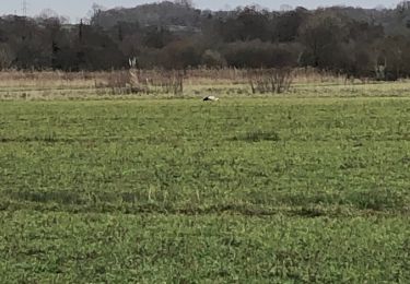
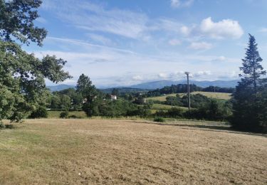
Randonnée Marche de 14,4 km à découvrir à Nouvelle-Aquitaine, Pyrénées-Atlantiques, Bayonne. Cette randonnée est proposée par Céline Charbonnieras.
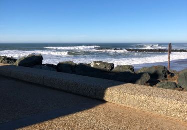
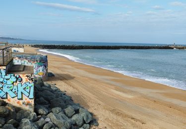
Description

Bayonne - Biarritz
Jour 12 d'une randonnée sur la côte Atlantique du Bassin d'Arcachon à Biarritz
D : IBIS STYLES BAYONNE, 1 Place de la republique BAYONNE
A : La Grande Plage, Biarritz

Profil altimétrique

Points d'intérêt

Point d'intérêt Bayonne - IBIS STYLES BAYONNE - Photo
Céline Charbonnieras
Point d'intérêt Biarritz - La Grande Plage, Biarritz - Photo
Céline Charbonnieras

Localisation

Pays :
France
Région :
Nouvelle-Aquitaine
Département/Province :
Pyrénées-Atlantiques
Commune :
Bayonne
Localité :
Unknown
Départ:(UTM)
623623 ; 4816954 (30T) N.

Randonnées à proximité

Randonnée Marche Anglet - Forêts de Pignada et Chiberta - Anglet - Photo
Marche
tracegps

Marche

Moyen
(2)
Anglet, Nouvelle-Aquitaine, Pyrénées-Atlantiques, France
8,1 km | 9,6 km-effort
2h 0min
Oui
Randonnée Marche Mouguerre - La croix de Mouguerre  - Photo
Marche
tracegps

Marche

Facile
(2)
Mouguerre, Nouvelle-Aquitaine, Pyrénées-Atlantiques, France
6,5 km | 8,8 km-effort
1h 45min
Oui
Randonnée Vélo Tarnos - Piste cyclable de Tarnos et Ondres - Photo
Vélo
tracegps

Vélo

Moyen
(1)
Tarnos, Nouvelle-Aquitaine, Landes, France
21 km | 23 km-effort
2h 0min
Non
Randonnée Marche Bayonne - Plaine d'ANSOT Bayonne - Photo
Marche
jaja64

Marche

Facile
Bayonne, Nouvelle-Aquitaine, Pyrénées-Atlantiques, France
8,4 km | 9 km-effort
2h 13min
Oui
Randonnée Marche Anglet - Promenade Victor Mendiboure Anglet - Photo
Marche
jaja64

Marche

Facile
Anglet, Nouvelle-Aquitaine, Pyrénées-Atlantiques, France
9,1 km | 9,7 km-effort
1h 43min
Oui
Randonnée Marche Saint-Pierre-d'Irube - balade decouverte Mouguerre - Photo
Marche
alex12r

Marche

Difficile
Saint-Pierre-d'Irube, Nouvelle-Aquitaine, Pyrénées-Atlantiques, France
5,7 km | 7,6 km-effort
1h 56min
Oui
Randonnée Marche Bayonne - jour 12, le 06/07/2023 - Photo
Marche
Céline Charbonnieras

Marche

Difficile
Bayonne, Nouvelle-Aquitaine, Pyrénées-Atlantiques, France
14,8 km | 16,8 km-effort
3h 26min
Non
Randonnée Marche Bayonne - Manif 1er Mai 2023 Bayonne  - Photo
Marche
Maikel bazar

Marche

Moyen
Bayonne, Nouvelle-Aquitaine, Pyrénées-Atlantiques, France
6 km | 6,9 km-effort
2h 3min
Oui
Randonnée V.T.T. Anglet - Anglet Biarritz Anglet Bayonne - Photo
V.T.T.
Pat_83200

V.T.T.

Très facile
Anglet, Nouvelle-Aquitaine, Pyrénées-Atlantiques, France
24 km | 26 km-effort
2h 31min
Oui


Fermer
Mes abonnements