


28 km | 36 km-effort


Utilisateur GUIDE


Application GPS de randonnée GRATUITE
 SityTrail
IGN / Instituts géographiques
SityTrail World
Le monde est à vous
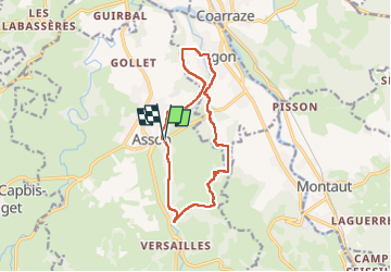
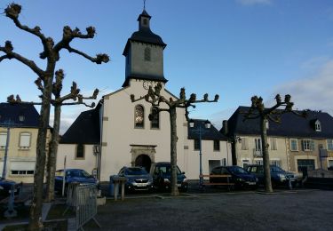
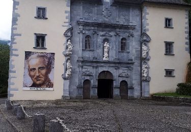
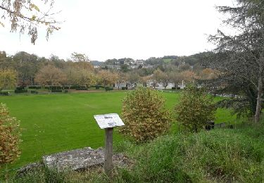
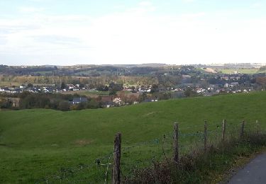
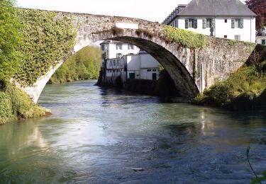
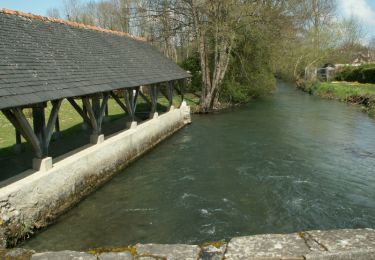
Randonnée Marche de 13 km à découvrir à Nouvelle-Aquitaine, Pyrénées-Atlantiques, Asson. Cette randonnée est proposée par marmotte65.
 "
data-pinterest-text="Pin it"
data-tweet-text="share on twitter"
data-facebook-share-url="https://www.sitytrail.com/fr/trails/3648175-asson--asson-igon-touyas-de-capsus-x3648175x/?photo=1#lg=1&slide=1"
data-twitter-share-url="https://www.sitytrail.com/fr/trails/3648175-asson--asson-igon-touyas-de-capsus-x3648175x/?photo=1#lg=1&slide=1"
data-googleplus-share-url="https://www.sitytrail.com/fr/trails/3648175-asson--asson-igon-touyas-de-capsus-x3648175x/?photo=1#lg=1&slide=1"
data-pinterest-share-url="https://www.sitytrail.com/fr/trails/3648175-asson--asson-igon-touyas-de-capsus-x3648175x/?photo=1#lg=1&slide=1">
"
data-pinterest-text="Pin it"
data-tweet-text="share on twitter"
data-facebook-share-url="https://www.sitytrail.com/fr/trails/3648175-asson--asson-igon-touyas-de-capsus-x3648175x/?photo=1#lg=1&slide=1"
data-twitter-share-url="https://www.sitytrail.com/fr/trails/3648175-asson--asson-igon-touyas-de-capsus-x3648175x/?photo=1#lg=1&slide=1"
data-googleplus-share-url="https://www.sitytrail.com/fr/trails/3648175-asson--asson-igon-touyas-de-capsus-x3648175x/?photo=1#lg=1&slide=1"
data-pinterest-share-url="https://www.sitytrail.com/fr/trails/3648175-asson--asson-igon-touyas-de-capsus-x3648175x/?photo=1#lg=1&slide=1">
 "
data-pinterest-text="Pin it"
data-tweet-text="share on twitter"
data-facebook-share-url="https://www.sitytrail.com/fr/trails/3648175-asson--asson-igon-touyas-de-capsus-x3648175x/?photo=2#lg=1&slide=2"
data-twitter-share-url="https://www.sitytrail.com/fr/trails/3648175-asson--asson-igon-touyas-de-capsus-x3648175x/?photo=2#lg=1&slide=2"
data-googleplus-share-url="https://www.sitytrail.com/fr/trails/3648175-asson--asson-igon-touyas-de-capsus-x3648175x/?photo=2#lg=1&slide=2"
data-pinterest-share-url="https://www.sitytrail.com/fr/trails/3648175-asson--asson-igon-touyas-de-capsus-x3648175x/?photo=2#lg=1&slide=2">
"
data-pinterest-text="Pin it"
data-tweet-text="share on twitter"
data-facebook-share-url="https://www.sitytrail.com/fr/trails/3648175-asson--asson-igon-touyas-de-capsus-x3648175x/?photo=2#lg=1&slide=2"
data-twitter-share-url="https://www.sitytrail.com/fr/trails/3648175-asson--asson-igon-touyas-de-capsus-x3648175x/?photo=2#lg=1&slide=2"
data-googleplus-share-url="https://www.sitytrail.com/fr/trails/3648175-asson--asson-igon-touyas-de-capsus-x3648175x/?photo=2#lg=1&slide=2"
data-pinterest-share-url="https://www.sitytrail.com/fr/trails/3648175-asson--asson-igon-touyas-de-capsus-x3648175x/?photo=2#lg=1&slide=2">
 "
data-pinterest-text="Pin it"
data-tweet-text="share on twitter"
data-facebook-share-url="https://www.sitytrail.com/fr/trails/3648175-asson--asson-igon-touyas-de-capsus-x3648175x/?photo=3#lg=1&slide=3"
data-twitter-share-url="https://www.sitytrail.com/fr/trails/3648175-asson--asson-igon-touyas-de-capsus-x3648175x/?photo=3#lg=1&slide=3"
data-googleplus-share-url="https://www.sitytrail.com/fr/trails/3648175-asson--asson-igon-touyas-de-capsus-x3648175x/?photo=3#lg=1&slide=3"
data-pinterest-share-url="https://www.sitytrail.com/fr/trails/3648175-asson--asson-igon-touyas-de-capsus-x3648175x/?photo=3#lg=1&slide=3">
"
data-pinterest-text="Pin it"
data-tweet-text="share on twitter"
data-facebook-share-url="https://www.sitytrail.com/fr/trails/3648175-asson--asson-igon-touyas-de-capsus-x3648175x/?photo=3#lg=1&slide=3"
data-twitter-share-url="https://www.sitytrail.com/fr/trails/3648175-asson--asson-igon-touyas-de-capsus-x3648175x/?photo=3#lg=1&slide=3"
data-googleplus-share-url="https://www.sitytrail.com/fr/trails/3648175-asson--asson-igon-touyas-de-capsus-x3648175x/?photo=3#lg=1&slide=3"
data-pinterest-share-url="https://www.sitytrail.com/fr/trails/3648175-asson--asson-igon-touyas-de-capsus-x3648175x/?photo=3#lg=1&slide=3">
 "
data-pinterest-text="Pin it"
data-tweet-text="share on twitter"
data-facebook-share-url="https://www.sitytrail.com/fr/trails/3648175-asson--asson-igon-touyas-de-capsus-x3648175x/?photo=4#lg=1&slide=4"
data-twitter-share-url="https://www.sitytrail.com/fr/trails/3648175-asson--asson-igon-touyas-de-capsus-x3648175x/?photo=4#lg=1&slide=4"
data-googleplus-share-url="https://www.sitytrail.com/fr/trails/3648175-asson--asson-igon-touyas-de-capsus-x3648175x/?photo=4#lg=1&slide=4"
data-pinterest-share-url="https://www.sitytrail.com/fr/trails/3648175-asson--asson-igon-touyas-de-capsus-x3648175x/?photo=4#lg=1&slide=4">
"
data-pinterest-text="Pin it"
data-tweet-text="share on twitter"
data-facebook-share-url="https://www.sitytrail.com/fr/trails/3648175-asson--asson-igon-touyas-de-capsus-x3648175x/?photo=4#lg=1&slide=4"
data-twitter-share-url="https://www.sitytrail.com/fr/trails/3648175-asson--asson-igon-touyas-de-capsus-x3648175x/?photo=4#lg=1&slide=4"
data-googleplus-share-url="https://www.sitytrail.com/fr/trails/3648175-asson--asson-igon-touyas-de-capsus-x3648175x/?photo=4#lg=1&slide=4"
data-pinterest-share-url="https://www.sitytrail.com/fr/trails/3648175-asson--asson-igon-touyas-de-capsus-x3648175x/?photo=4#lg=1&slide=4">
 "
data-pinterest-text="Pin it"
data-tweet-text="share on twitter"
data-facebook-share-url="https://www.sitytrail.com/fr/trails/3648175-asson--asson-igon-touyas-de-capsus-x3648175x/?photo=5#lg=1&slide=5"
data-twitter-share-url="https://www.sitytrail.com/fr/trails/3648175-asson--asson-igon-touyas-de-capsus-x3648175x/?photo=5#lg=1&slide=5"
data-googleplus-share-url="https://www.sitytrail.com/fr/trails/3648175-asson--asson-igon-touyas-de-capsus-x3648175x/?photo=5#lg=1&slide=5"
data-pinterest-share-url="https://www.sitytrail.com/fr/trails/3648175-asson--asson-igon-touyas-de-capsus-x3648175x/?photo=5#lg=1&slide=5">
"
data-pinterest-text="Pin it"
data-tweet-text="share on twitter"
data-facebook-share-url="https://www.sitytrail.com/fr/trails/3648175-asson--asson-igon-touyas-de-capsus-x3648175x/?photo=5#lg=1&slide=5"
data-twitter-share-url="https://www.sitytrail.com/fr/trails/3648175-asson--asson-igon-touyas-de-capsus-x3648175x/?photo=5#lg=1&slide=5"
data-googleplus-share-url="https://www.sitytrail.com/fr/trails/3648175-asson--asson-igon-touyas-de-capsus-x3648175x/?photo=5#lg=1&slide=5"
data-pinterest-share-url="https://www.sitytrail.com/fr/trails/3648175-asson--asson-igon-touyas-de-capsus-x3648175x/?photo=5#lg=1&slide=5">
 "
data-pinterest-text="Pin it"
data-tweet-text="share on twitter"
data-facebook-share-url="https://www.sitytrail.com/fr/trails/3648175-asson--asson-igon-touyas-de-capsus-x3648175x/?photo=6#lg=1&slide=6"
data-twitter-share-url="https://www.sitytrail.com/fr/trails/3648175-asson--asson-igon-touyas-de-capsus-x3648175x/?photo=6#lg=1&slide=6"
data-googleplus-share-url="https://www.sitytrail.com/fr/trails/3648175-asson--asson-igon-touyas-de-capsus-x3648175x/?photo=6#lg=1&slide=6"
data-pinterest-share-url="https://www.sitytrail.com/fr/trails/3648175-asson--asson-igon-touyas-de-capsus-x3648175x/?photo=6#lg=1&slide=6">
"
data-pinterest-text="Pin it"
data-tweet-text="share on twitter"
data-facebook-share-url="https://www.sitytrail.com/fr/trails/3648175-asson--asson-igon-touyas-de-capsus-x3648175x/?photo=6#lg=1&slide=6"
data-twitter-share-url="https://www.sitytrail.com/fr/trails/3648175-asson--asson-igon-touyas-de-capsus-x3648175x/?photo=6#lg=1&slide=6"
data-googleplus-share-url="https://www.sitytrail.com/fr/trails/3648175-asson--asson-igon-touyas-de-capsus-x3648175x/?photo=6#lg=1&slide=6"
data-pinterest-share-url="https://www.sitytrail.com/fr/trails/3648175-asson--asson-igon-touyas-de-capsus-x3648175x/?photo=6#lg=1&slide=6">
 "
data-pinterest-text="Pin it"
data-tweet-text="share on twitter"
data-facebook-share-url="https://www.sitytrail.com/fr/trails/3648175-asson--asson-igon-touyas-de-capsus-x3648175x/?photo=7#lg=1&slide=7"
data-twitter-share-url="https://www.sitytrail.com/fr/trails/3648175-asson--asson-igon-touyas-de-capsus-x3648175x/?photo=7#lg=1&slide=7"
data-googleplus-share-url="https://www.sitytrail.com/fr/trails/3648175-asson--asson-igon-touyas-de-capsus-x3648175x/?photo=7#lg=1&slide=7"
data-pinterest-share-url="https://www.sitytrail.com/fr/trails/3648175-asson--asson-igon-touyas-de-capsus-x3648175x/?photo=7#lg=1&slide=7">
"
data-pinterest-text="Pin it"
data-tweet-text="share on twitter"
data-facebook-share-url="https://www.sitytrail.com/fr/trails/3648175-asson--asson-igon-touyas-de-capsus-x3648175x/?photo=7#lg=1&slide=7"
data-twitter-share-url="https://www.sitytrail.com/fr/trails/3648175-asson--asson-igon-touyas-de-capsus-x3648175x/?photo=7#lg=1&slide=7"
data-googleplus-share-url="https://www.sitytrail.com/fr/trails/3648175-asson--asson-igon-touyas-de-capsus-x3648175x/?photo=7#lg=1&slide=7"
data-pinterest-share-url="https://www.sitytrail.com/fr/trails/3648175-asson--asson-igon-touyas-de-capsus-x3648175x/?photo=7#lg=1&slide=7">
 "
data-pinterest-text="Pin it"
data-tweet-text="share on twitter"
data-facebook-share-url="https://www.sitytrail.com/fr/trails/3648175-asson--asson-igon-touyas-de-capsus-x3648175x/?photo=8#lg=1&slide=8"
data-twitter-share-url="https://www.sitytrail.com/fr/trails/3648175-asson--asson-igon-touyas-de-capsus-x3648175x/?photo=8#lg=1&slide=8"
data-googleplus-share-url="https://www.sitytrail.com/fr/trails/3648175-asson--asson-igon-touyas-de-capsus-x3648175x/?photo=8#lg=1&slide=8"
data-pinterest-share-url="https://www.sitytrail.com/fr/trails/3648175-asson--asson-igon-touyas-de-capsus-x3648175x/?photo=8#lg=1&slide=8">
"
data-pinterest-text="Pin it"
data-tweet-text="share on twitter"
data-facebook-share-url="https://www.sitytrail.com/fr/trails/3648175-asson--asson-igon-touyas-de-capsus-x3648175x/?photo=8#lg=1&slide=8"
data-twitter-share-url="https://www.sitytrail.com/fr/trails/3648175-asson--asson-igon-touyas-de-capsus-x3648175x/?photo=8#lg=1&slide=8"
data-googleplus-share-url="https://www.sitytrail.com/fr/trails/3648175-asson--asson-igon-touyas-de-capsus-x3648175x/?photo=8#lg=1&slide=8"
data-pinterest-share-url="https://www.sitytrail.com/fr/trails/3648175-asson--asson-igon-touyas-de-capsus-x3648175x/?photo=8#lg=1&slide=8">
 "
data-pinterest-text="Pin it"
data-tweet-text="share on twitter"
data-facebook-share-url="https://www.sitytrail.com/fr/trails/3648175-asson--asson-igon-touyas-de-capsus-x3648175x/?photo=9#lg=1&slide=9"
data-twitter-share-url="https://www.sitytrail.com/fr/trails/3648175-asson--asson-igon-touyas-de-capsus-x3648175x/?photo=9#lg=1&slide=9"
data-googleplus-share-url="https://www.sitytrail.com/fr/trails/3648175-asson--asson-igon-touyas-de-capsus-x3648175x/?photo=9#lg=1&slide=9"
data-pinterest-share-url="https://www.sitytrail.com/fr/trails/3648175-asson--asson-igon-touyas-de-capsus-x3648175x/?photo=9#lg=1&slide=9">
"
data-pinterest-text="Pin it"
data-tweet-text="share on twitter"
data-facebook-share-url="https://www.sitytrail.com/fr/trails/3648175-asson--asson-igon-touyas-de-capsus-x3648175x/?photo=9#lg=1&slide=9"
data-twitter-share-url="https://www.sitytrail.com/fr/trails/3648175-asson--asson-igon-touyas-de-capsus-x3648175x/?photo=9#lg=1&slide=9"
data-googleplus-share-url="https://www.sitytrail.com/fr/trails/3648175-asson--asson-igon-touyas-de-capsus-x3648175x/?photo=9#lg=1&slide=9"
data-pinterest-share-url="https://www.sitytrail.com/fr/trails/3648175-asson--asson-igon-touyas-de-capsus-x3648175x/?photo=9#lg=1&slide=9">

Marche
A pied
Marche
Marche
Marche
Marche
Marche
Marche
Marche