Randonnée Marche Rognes - Rognes virée dans les vignes sur le sentier des vignerons - Photo

Rognes virée dans les vignes sur le sentier des vignerons

 jll7513
jll7513

Utilisateur

© OpenStreetMap contributors
Longueur
Longueur
11,1 km
Altitude max
Altitude max
334 m
Dénivelé positif
Dénivelé positif
226 m
Km-Effort
Km-Effort  
14,1 km
Altitude min
Altitude min
208 m
Dénivelé négatif
Dénivelé négatif
226 m
Boucle
Boucle
Oui
Date de création :
2023-05-07 06:32:34.0
Dernière modification :
2023-05-07 16:34:09.548

(0 Avis)

Marche
Marche
3h12
Difficulté : Facile
Marche nordique
Marche nordique
2h30
Difficulté : Facile

Scannez ce code QR pour ouvrir la randonnée dans l'application SityTrail

Application GPS de randonnée GRATUITE

Logo SityTrail SityTrail

IGN / Instituts géographiques

Télécharger SityTrail sur l'App Store Télécharger SityTrail sur Google Play

Logo SityTrail SityTrail World

Le monde est à vous

Télécharger SityTrail sur l'App Store Télécharger SityTrail sur Google Play Télécharger SityTrail sur Huawei AppGallery

À propos

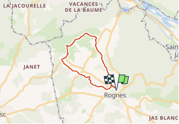
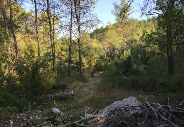
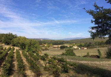
Randonnée Marche de 11,1 km à découvrir à Provence-Alpes-Côte d'Azur, Bouches-du-Rhône, Rognes. Cette randonnée est proposée par jll7513.

Description

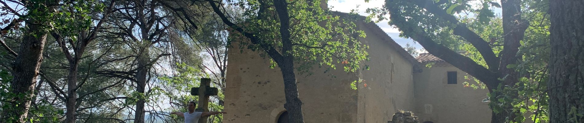
Stationnement dans Rognes sur un petit parking. 500 m de route pour rejoindre le sentier globalement bien ombragé.On passe par La Chapelle Saint Marcellin et on marche sur le contrefort des Costes.

Profil altimétrique

Photos

Localisation

Pays :
France
Région :
Provence-Alpes-Côte d'Azur
Département/Province :
Bouches-du-Rhône
Commune :
Rognes
Localité :
Unknown
Départ:(Dec)
Départ:(UTM)
689294 ; 4837476 (31T) N.

Randonnées à proximité

Randonnée Marche Saint-Cannat - PF-Saint-Cannat - Fontaine de Doudonne - PR  - Photo
Marche
MicDul

Marche

Moyen
(1)
Saint-Cannat, Provence-Alpes-Côte d'Azur, Bouches-du-Rhône, France
6,9 km | 8,5 km-effort
2h 10min
Oui
Randonnée Marche Lambesc - GB LES JARDINS  - Photo
Marche
Ghislaine Blanchet

Marche

Moyen
(3)
Lambesc, Provence-Alpes-Côte d'Azur, Bouches-du-Rhône, France
5,7 km | 6,6 km-effort
1h 30min
Oui
Randonnée Marche Rognes - Caire Val- les Costes -St Marcellin - Photo
Marche
Berpav

Marche

Moyen
(1)
Rognes, Provence-Alpes-Côte d'Azur, Bouches-du-Rhône, France
8,6 km | 10,7 km-effort
2h 26min
Oui
Randonnée Marche La Roque-d'Anthéron - GB DURANCE+ CHÂTEAU DE JANSON  - Photo
Marche
Ghislaine Blanchet

Marche

Moyen
La Roque-d'Anthéron, Provence-Alpes-Côte d'Azur, Bouches-du-Rhône, France
5,5 km | 6 km-effort
1h 22min
Oui
Randonnée Marche Rognes - St Christophe-La Durance-Ponserot - Photo
Marche

Marche

Difficile
(3)
Rognes, Provence-Alpes-Côte d'Azur, Bouches-du-Rhône, France
12,2 km | 14,4 km-effort
3h 14min
Oui
Randonnée Marche La Roque-d'Anthéron - PF-La Roque-d'Anthéron - Vallon de la Baume - Roques Menoures - Photo
Marche
MicDul

Marche

Facile
La Roque-d'Anthéron, Provence-Alpes-Côte d'Azur, Bouches-du-Rhône, France
7,8 km | 10,4 km-effort
1h 47min
Non
Randonnée A pied Rognes - Rognes : Bassin de Saint Christol - Chateau de Janson - Photo
A pied
ARPF1

A pied

Moyen
(1)
Rognes, Provence-Alpes-Côte d'Azur, Bouches-du-Rhône, France
16,4 km | 21 km-effort
Inconnu
Oui
Randonnée A pied Saint-Cannat - Saint Cannat : autour de l'Etape - Photo
A pied
gabyschmidt

A pied

Facile
(1)
Saint-Cannat, Provence-Alpes-Côte d'Azur, Bouches-du-Rhône, France
11,1 km | 13,1 km-effort
Inconnu
Oui
Randonnée Marche Rognes - mini sentier des vignerons  - Photo
Marche
patrickmays3

Marche

Facile
Rognes, Provence-Alpes-Côte d'Azur, Bouches-du-Rhône, France
10,5 km | 13,1 km-effort
2h 34min
Oui


Fermer
Mes abonnements