Randonnée Marche Doische - Doische-Mazee Etape2 SJC - Photo

Doische-Mazee Etape2 SJC

 thomarche
thomarche

Utilisateur

© OpenStreetMap contributors
Longueur
Longueur
9,9 km
Altitude max
Altitude max
233 m
Dénivelé positif
Dénivelé positif
254 m
Km-Effort
Km-Effort  
13,4 km
Altitude min
Altitude min
134 m
Dénivelé négatif
Dénivelé négatif
269 m
Boucle
Boucle
Non
Date de création :
2023-05-09 07:08:01.0
Dernière modification :
2023-05-09 11:18:19.716

(0 Avis)

Marche
Marche
2h39
Difficulté : Inconnu

Scannez ce code QR pour ouvrir la randonnée dans l'application SityTrail

Application GPS de randonnée GRATUITE

Logo SityTrail SityTrail

IGN / Instituts géographiques

Télécharger SityTrail sur l'App Store Télécharger SityTrail sur Google Play

Logo SityTrail SityTrail World

Le monde est à vous

Télécharger SityTrail sur l'App Store Télécharger SityTrail sur Google Play Télécharger SityTrail sur Huawei AppGallery

À propos

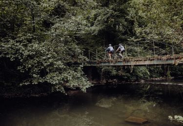
Randonnée Marche de 9,9 km à découvrir à Wallonie, Namur, Doische. Cette randonnée est proposée par thomarche.

Description

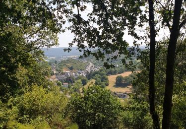
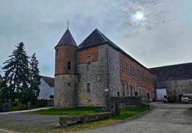
Magnifique arrivée sur Hierge, avec un château très impressionnant. Étape écourtée par pluie non stop…

Profil altimétrique

Localisation

Pays :
Belgique
Région :
Wallonie
Département/Province :
Namur
Commune :
Doische
Localité :
Unknown
Départ:(Dec)
Départ:(UTM)
624832 ; 5555185 (31U) N.

Randonnées à proximité

Randonnée Marche Viroinval - Mazée, sur le sentier des Douaniers - Photo
Marche
GUIDE
Desrumaux

Marche

Très facile
(1)
Viroinval, Wallonie, Namur, Belgique
7,6 km | 10,5 km-effort
4h 2min
Oui
Randonnée Marche Doische - Promenade à Vodelée - Photo
Marche
GUIDE
Desrumaux

Marche

Facile
(1)
Doische, Wallonie, Namur, Belgique
9,3 km | 11,4 km-effort
2h 15min
Oui
Randonnée Marche Doische - Balade de Doische à Foisches - Photo
Marche
GUIDE
Desrumaux

Marche

Difficile
Doische, Wallonie, Namur, Belgique
9,9 km | 12,5 km-effort
2h 49min
Oui
Randonnée Marche Doische - De Vaucelles à Hierges par la montagne de le carrière - Photo
Marche
GUIDE
Desrumaux

Marche

Moyen
Doische, Wallonie, Namur, Belgique
6,7 km | 8,7 km-effort
1h 58min
Oui
Randonnée A pied Viroinval - Les Bornes Frontières - Photo
A pied
PRO

A pied

Facile
Viroinval, Wallonie, Namur, Belgique
7 km | 9,8 km-effort
2h 13min
Oui
Randonnée A pied Viroinval - Les Cretes - Photo
A pied
PRO

A pied

Facile
Viroinval, Wallonie, Namur, Belgique
6,3 km | 8,4 km-effort
1h 54min
Non
Randonnée A pied Viroinval - Bornes Frontières - Photo
A pied
GUIDE+

A pied

Facile
Viroinval, Wallonie, Namur, Belgique
7 km | 9,5 km-effort
2h 9min
Oui
Randonnée V.T.T. Philippeville - Boucle de l'Hermeton - Photo
V.T.T.
GUIDE+

V.T.T.

Moyen
Philippeville, Wallonie, Namur, Belgique
21 km | 25 km-effort
1h 46min
Oui
Randonnée A pied Doische - Balade de Doische àVaucelles - Photo
A pied
GUIDE
Desrumaux

A pied

Très facile
Doische, Wallonie, Namur, Belgique
10,1 km | 12,3 km-effort
Inconnu
Oui


Fermer
Mes abonnements