Randonnée Marche Guidel - RANDO GUIDEL 19KMS - Photo

RANDO GUIDEL 19KMS

 JEAN06910
JEAN06910

Utilisateur

© OpenStreetMap contributors
Longueur
Longueur
18,6 km
Altitude max
Altitude max
62 m
Dénivelé positif
Dénivelé positif
255 m
Km-Effort
Km-Effort  
22 km
Altitude min
Altitude min
0 m
Dénivelé négatif
Dénivelé négatif
249 m
Boucle
Boucle
Oui
Date de création :
2023-05-14 06:38:23.374
Dernière modification :
2023-05-14 09:50:12.599

(0 Avis)

Marche
Marche
3h10
Difficulté : Facile

Scannez ce code QR pour ouvrir la randonnée dans l'application SityTrail

Application GPS de randonnée GRATUITE

Logo SityTrail SityTrail

IGN / Instituts géographiques

Télécharger SityTrail sur l'App Store Télécharger SityTrail sur Google Play

Logo SityTrail SityTrail World

Le monde est à vous

Télécharger SityTrail sur l'App Store Télécharger SityTrail sur Google Play Télécharger SityTrail sur Huawei AppGallery

À propos

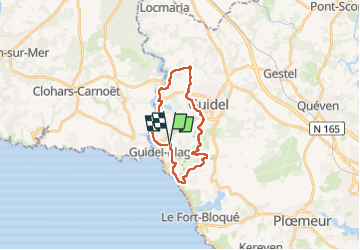
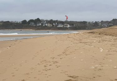
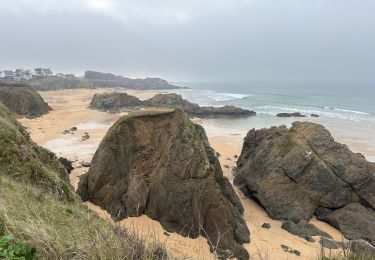
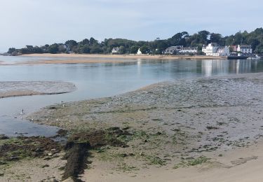
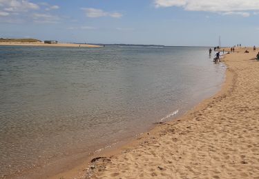
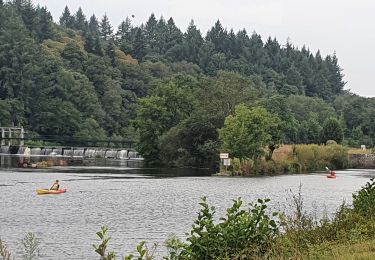
Randonnée Marche de 18,6 km à découvrir à Bretagne, Morbihan, Guidel. Cette randonnée est proposée par JEAN06910.

Description

Belle organisation et parcours bien balisé.
Sportive mais facile.

Profil altimétrique

Localisation

Pays :
France
Région :
Bretagne
Département/Province :
Morbihan
Commune :
Guidel
Localité :
Unknown
Départ:(UTM)
461156 ; 5290913 (30T) N.

Randonnées à proximité

Randonnée A pied Plœmeur - De la côte bleue aux collines blanches - Photo
A pied
PRO

A pied

Facile
Plœmeur, Bretagne, Morbihan, France
9,1 km | 10 km-effort
2h 16min
Non
Randonnée Marche Clohars-Carnoët - Le Pouldu - Photo
Marche
FOUCAULT

Marche

Clohars-Carnoët, Bretagne, Finistère, France
8,1 km | 8,9 km-effort
2h 35min
Oui
Randonnée Marche Guidel - PR_56_Guidel_CA_03_Circuit3a_Autour-De-L-Etang-De-Lannenec_20240428 - Photo
Marche
patrickdanilo

Marche

Facile
Guidel, Bretagne, Morbihan, France
10,2 km | 11,7 km-effort
2h 39min
Non
Randonnée Marche Guidel - Guidel plage 7,6 km - Photo
Marche
GUIDE
rvapeldo

Marche

Facile
Guidel, Bretagne, Morbihan, France
7,6 km | 8,5 km-effort
2h 11min
Oui
Randonnée Marche Clohars-Carnoët - Pouldu port peintres 6,3 km - Photo
Marche
GUIDE
rvapeldo

Marche

Facile
Clohars-Carnoët, Bretagne, Finistère, France
6,3 km | 7,2 km-effort
2h 12min
Oui
Randonnée Marche Clohars-Carnoët - Pouldu Roche Percée et retour 9,5 km - Photo
Marche
GUIDE
rvapeldo

Marche

Moyen
Clohars-Carnoët, Bretagne, Finistère, France
9,5 km | 10,7 km-effort
2h 46min
Oui
Randonnée Marche Guidel - PR_56_Guidel_BA_02_Circuit3b_Entre-Loch-Et-Laita_20231004 - Photo
Marche
patrickdanilo

Marche

Facile
Guidel, Bretagne, Morbihan, France
13,4 km | 15,7 km-effort
3h 34min
Oui
Randonnée Marche Guidel - laita - Photo
Marche
dcharbonnier

Marche

Moyen
Guidel, Bretagne, Morbihan, France
9,8 km | 12 km-effort
3h 58min
Oui
Randonnée Vélo électrique Clohars-Carnoët - Moelans Pontivy par les berges du Blavet - Photo
Vélo électrique
ilefebvre

Vélo électrique

Très facile
Clohars-Carnoët, Bretagne, Finistère, France
81 km | 94 km-effort
4h 43min
Non


Fermer
Mes abonnements