Randonnée Marche Saint-Nabord - Double boucle près du Rond-Caillou - Saint-Nabord - Photo

Double boucle près du Rond-Caillou - Saint-Nabord

 jeanclaude12
jeanclaude12

Utilisateur

© OpenStreetMap contributors
Longueur
Longueur
10,2 km
Altitude max
Altitude max
598 m
Dénivelé positif
Dénivelé positif
340 m
Km-Effort
Km-Effort  
14,7 km
Altitude min
Altitude min
417 m
Dénivelé négatif
Dénivelé négatif
336 m
Boucle
Boucle
Oui
Date de création :
2014-12-10 00:00:00.0
Dernière modification :
2014-12-10 00:00:00.0

(0 Avis)

Marche
Marche
2h55
Difficulté : Facile

Scannez ce code QR pour ouvrir la randonnée dans l'application SityTrail

Application GPS de randonnée GRATUITE

Logo SityTrail SityTrail

IGN / Instituts géographiques

Télécharger SityTrail sur l'App Store Télécharger SityTrail sur Google Play

Logo SityTrail SityTrail World

Le monde est à vous

Télécharger SityTrail sur l'App Store Télécharger SityTrail sur Google Play Télécharger SityTrail sur Huawei AppGallery

À propos

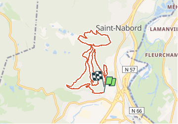
Randonnée Marche de 10,2 km à découvrir à Grand Est, Vosges, Saint-Nabord. Cette randonnée est proposée par jeanclaude12.

Description

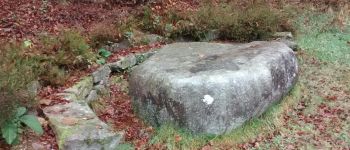
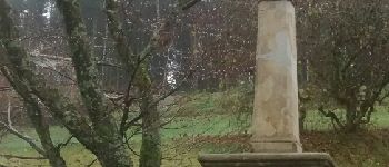
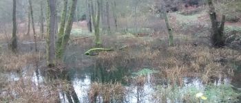
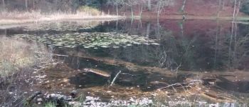
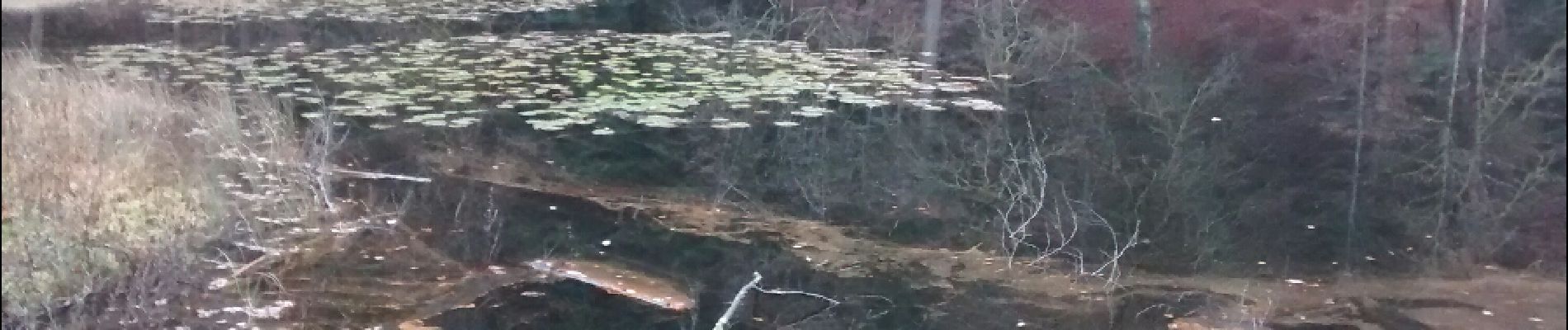
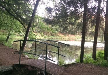
Randonnée sympathique au départ de Ranfaing, passant par le Bois de Montiroche et le Rond-Caillou, puis, en boucle, la Croix des Pestiférés, Bellerouveroye et retour par l'étang de La Huchère.

Profil altimétrique

Photos

Points d'intérêt

Point d'intérêt Saint-Nabord - Le Rond-Caillou - Photo
jeanclaude12
SAINT-NABORD 
Point d'intérêt Saint-Nabord - Derrière Chaumont - Photo
jeanclaude12
SAINT-NABORD 
Point d'intérêt Saint-Nabord - Roches de Montiroche - Photo
jeanclaude12
SAINT-NABORD 
Point d'intérêt Saint-Nabord - Etang de La Huchère - Photo
jeanclaude12
SAINT-NABORD 

Localisation

Pays :
France
Région :
Grand Est
Département/Province :
Vosges
Commune :
Saint-Nabord
Localité :
Unknown
Départ:(Dec)
Départ:(UTM)
319071 ; 5322760 (32U) N.

Randonnées à proximité

Randonnée A pied Raon-aux-Bois - Sentier
A pied
PRO

A pied

Moyen
Raon-aux-Bois, Grand Est, Vosges, France
15,1 km | 21 km-effort
4h 42min
Oui
Randonnée A pied Raon-aux-Bois - Raon-aux-Bois - Circuit 2 - Photo
A pied
PRO

A pied

Facile
Raon-aux-Bois, Grand Est, Vosges, France
11,1 km | 14,4 km-effort
3h 16min
Oui
Randonnée A pied Raon-aux-Bois - Raon-aux-Bois - Circuit 1 - Photo
A pied
PRO

A pied

Facile
Raon-aux-Bois, Grand Est, Vosges, France
14,2 km | 19,8 km-effort
4h 30min
Oui
Randonnée Marche Remiremont - Remiremont (Girmont-Val-d'Ajol) 22 880m +729m - Photo
Marche
DanielROLLET

Marche

Très difficile
(1)
Remiremont, Grand Est, Vosges, France
23 km | 33 km-effort
7h 24min
Oui
Randonnée Marche Saint-Étienne-lès-Remiremont - rando chanoinesses 2024 - Photo
Marche
Le grand Claude

Marche

Moyen
Saint-Étienne-lès-Remiremont, Grand Est, Vosges, France
12,5 km | 18 km-effort
2h 32min
Non
Randonnée Marche Saint-Étienne-lès-Remiremont - 20220324_rando_ST-ETIENNE-LES-REMIREMONT_N_Sur_les_pas_de_St_Romary - Photo
Marche
nfranche

Marche

Très difficile
Saint-Étienne-lès-Remiremont, Grand Est, Vosges, France
15,8 km | 25 km-effort
5h 36min
Oui
Randonnée A pied Raon-aux-Bois - Sentier
A pied
PRO

A pied

Facile
Raon-aux-Bois, Grand Est, Vosges, France
4,6 km | 7,3 km-effort
1h 39min
Non
Randonnée A pied Saint-Nabord - Sentier
A pied
PRO

A pied

Facile
Saint-Nabord, Grand Est, Vosges, France
8,6 km | 11,4 km-effort
2h 35min
Oui
Randonnée Marche Raon-aux-Bois - teleton  - Photo
Marche
lacote

Marche

Moyen
(1)
Raon-aux-Bois, Grand Est, Vosges, France
10,9 km | 14,7 km-effort
2h 44min
Oui


Fermer
Mes abonnements