Randonnée Vélo de route Villeneuve-de-Rivière - boucle commingeoise - Photo
 martoche
martoche

Utilisateur

© OpenStreetMap contributors
Longueur
Longueur
61 km
Altitude max
Altitude max
626 m
Dénivelé positif
Dénivelé positif
798 m
Km-Effort
Km-Effort  
71 km
Altitude min
Altitude min
362 m
Dénivelé négatif
Dénivelé négatif
798 m
Boucle
Boucle
Oui
Date de création :
2023-05-23 10:49:55.43
Dernière modification :
2023-05-23 14:30:41.648

(0 Avis)

Vélo de route
Vélo de route
3h09
Difficulté : Moyen

Scannez ce code QR pour ouvrir la randonnée dans l'application SityTrail

Application GPS de randonnée GRATUITE

Logo SityTrail SityTrail

IGN / Instituts géographiques

Télécharger SityTrail sur l'App Store Télécharger SityTrail sur Google Play

Logo SityTrail SityTrail World

Le monde est à vous

Télécharger SityTrail sur l'App Store Télécharger SityTrail sur Google Play Télécharger SityTrail sur Huawei AppGallery

À propos

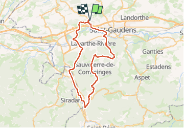
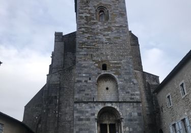
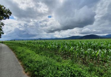
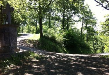
Randonnée Vélo de route de 61 km à découvrir à Occitanie, Haute-Garonne, Villeneuve-de-Rivière. Cette randonnée est proposée par martoche.

Description

depart de Villeneuve de riviere. Boucle classique sauf variante par Regade et un bon casse patte après ce village.

Profil altimétrique

Localisation

Pays :
France
Région :
Occitanie
Département/Province :
Haute-Garonne
Commune :
Villeneuve-de-Rivière
Localité :
Unknown
Départ:(Dec)
Départ:(UTM)
309927 ; 4777419 (31T) N.

Randonnées à proximité

Randonnée Marche Saint-Gaudens - Via Garonna - Photo
Marche
jlmauriz

Marche

Moyen
Saint-Gaudens, Occitanie, Haute-Garonne, France
25 km | 30 km-effort
6h 23min
Non
Randonnée Marche Labarthe-Rivière - Camon - Photo
Marche
jloger

Marche

Facile
Labarthe-Rivière, Occitanie, Haute-Garonne, France
7,5 km | 8 km-effort
1h 40min
Oui
Randonnée Marche Valentine - bout du puy  - Photo
Marche
yoyo31

Marche

Facile
Valentine, Occitanie, Haute-Garonne, France
4,3 km | 6,8 km-effort
1h 7min
Oui
Randonnée Marche Valentine - bout du puy  - Photo
Marche
yoyo31

Marche

Facile
Valentine, Occitanie, Haute-Garonne, France
4,3 km | 6,8 km-effort
1h 7min
Oui
Randonnée Marche Le Cuing - boucle forêt de Cardeilhac  - Photo
Marche
GUIDE
lhomme.ph

Marche

Facile
Le Cuing, Occitanie, Haute-Garonne, France
10,3 km | 12,1 km-effort
3h 37min
Oui
Randonnée Vélo de route Villeneuve-de-Rivière - boucle dans le Comminges - Photo
Vélo de route
martoche

Vélo de route

Moyen
Villeneuve-de-Rivière, Occitanie, Haute-Garonne, France
68 km | 80 km-effort
3h 58min
Non
Randonnée sport Bordes-de-Rivière - 2021-10-31_09h01m59_Cirkwi-Bordes_de_Rivière_Plaine__Les_canaux_d_irrigation_ - Photo
sport
jojo1412

sport

Très facile
Bordes-de-Rivière, Occitanie, Haute-Garonne, France
3,6 km | 3,9 km-effort
Inconnu
Oui
Randonnée Autre activité Valentine - 2017-07-29 bout du puy -fontaine valentine - Photo
Autre activité
jacq58

Autre activité

Très facile
Valentine, Occitanie, Haute-Garonne, France
3,6 km | 5,6 km-effort
2h 13min
Oui
Randonnée Moteur Valentine - Valentine a juzet d'izeau  - Photo
Moteur
yoyo31

Moteur

Difficile
(1)
Valentine, Occitanie, Haute-Garonne, France
67 km | 98 km-effort
2h 16min
Non


Fermer
Mes abonnements