Randonnée Marche Saint-Martin-d'Arrossa - 2023-05-31_09h58m49_st-martin-d-arrossa-larla-sentier-des-mines - Photo

2023-05-31_09h58m49_st-martin-d-arrossa-larla-sentier-des-mines

 Geo40 caching
Geo40 caching

Utilisateur

© OpenStreetMap contributors
Longueur
Longueur
9,7 km
Altitude max
Altitude max
645 m
Dénivelé positif
Dénivelé positif
474 m
Km-Effort
Km-Effort  
16 km
Altitude min
Altitude min
302 m
Dénivelé négatif
Dénivelé négatif
474 m
Boucle
Boucle
Oui
Date de création :
2023-05-31 07:58:49.684
Dernière modification :
2024-01-10 15:56:26.345

(1 Avis)

Marche
Marche
3h38
Difficulté : Difficile

Scannez ce code QR pour ouvrir la randonnée dans l'application SityTrail

Application GPS de randonnée GRATUITE

Logo SityTrail SityTrail

IGN / Instituts géographiques

Télécharger SityTrail sur l'App Store Télécharger SityTrail sur Google Play

Logo SityTrail SityTrail World

Le monde est à vous

Télécharger SityTrail sur l'App Store Télécharger SityTrail sur Google Play Télécharger SityTrail sur Huawei AppGallery

À propos

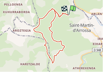
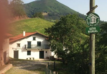
Randonnée Marche de 9,7 km à découvrir à Nouvelle-Aquitaine, Pyrénées-Atlantiques, Saint-Martin-d'Arrossa. Cette randonnée est proposée par Geo40 caching.

Description

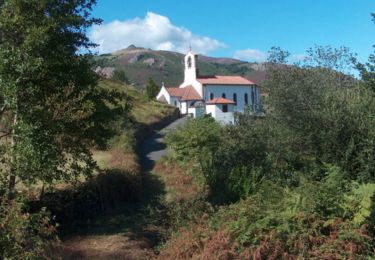
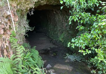
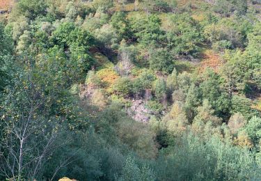
Petite randonnée sur le PR du Larla sentier des Mines  ( commune de St Martin d'Arrossa).
Ce PR nous fera faire le tour du Larla  en mettant à profit pistes et sentiers .  Des panneaux d'interprétation sont placés sur le parcours, et au final, on passera devant l'entrée de mines récentes.
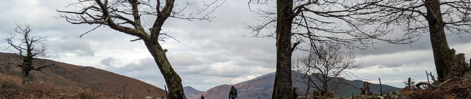
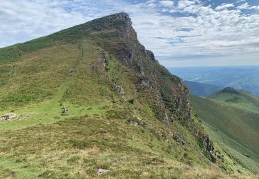
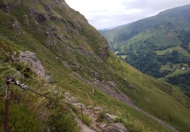
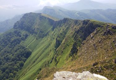
Parcours très panoramique avec vues sur toutes les montagnes voisines.
Parcours balisé en rouge   logo spécifique .

Profil altimétrique

Photos

Localisation

Pays :
France
Région :
Nouvelle-Aquitaine
Département/Province :
Pyrénées-Atlantiques
Commune :
Saint-Martin-d'Arrossa
Localité :
Unknown
Départ:(Dec)
Départ:(UTM)
636261 ; 4789202 (30T) N.

Commentaires

Veuillez vous connecter pour laisser un commentaire ou une note


une superbe balade et découverte 👍😊


Randonnées à proximité

Randonnée Marche Ossès - haltzamendi - Photo
Marche
jcaudron

Marche

Très facile
(1)
Ossès, Nouvelle-Aquitaine, Pyrénées-Atlantiques, France
14,5 km | 26 km-effort
5h 13min
Oui
Randonnée Marche Saint-Martin-d'Arrossa - Sommet de Larla en boucle de Saint Martin d'Arrossa - Photo
Marche
tracegps

Marche

Difficile
(2)
Saint-Martin-d'Arrossa, Nouvelle-Aquitaine, Pyrénées-Atlantiques, France
9,5 km | 15,9 km-effort
4h 0min
Oui
Randonnée Marche Saint-Étienne-de-Baïgorry - iparla - Photo
Marche
jcaudron

Marche

Très facile
(1)
Saint-Étienne-de-Baïgorry, Nouvelle-Aquitaine, Pyrénées-Atlantiques, France
13,5 km | 25 km-effort
4h 45min
Oui
Randonnée Marche Saint-Martin-d'Arrossa - Chemin des mineurs  - Photo
Marche
RVMASSON

Marche

Moyen
(1)
Saint-Martin-d'Arrossa, Nouvelle-Aquitaine, Pyrénées-Atlantiques, France
9,7 km | 16 km-effort
3h 23min
Oui
Randonnée Marche Bidarray - GR 10 - 4ème étape : Bidarray - St Etienne de Baigorryg - Photo
Marche
LEGUE

Marche

Très difficile
Bidarray, Nouvelle-Aquitaine, Pyrénées-Atlantiques, France
18,1 km | 34 km-effort
4h 58min
Non
Randonnée Marche Bidarray - col de mehatse - Photo
Marche
gamille67

Marche

Facile
Bidarray, Nouvelle-Aquitaine, Pyrénées-Atlantiques, France
17,7 km | 29 km-effort
4h 32min
Oui
Randonnée Marche Bidarray - bidarray Iparla - Photo
Marche
gamille67

Marche

Difficile
Bidarray, Nouvelle-Aquitaine, Pyrénées-Atlantiques, France
25 km | 44 km-effort
6h 49min
Oui
Randonnée Marche Bidarray - Bidarray harrihandi aritzakun - Photo
Marche
GUIDE
antignacs

Marche

Difficile
Bidarray, Nouvelle-Aquitaine, Pyrénées-Atlantiques, France
23 km | 34 km-effort
7h 4min
Oui
Randonnée Marche Bidarray - Arrisondo - Photo
Marche
RVMASSON

Marche

Très difficile
Bidarray, Nouvelle-Aquitaine, Pyrénées-Atlantiques, France
8,9 km | 16,1 km-effort
3h 26min
Oui


Fermer
Mes abonnements