Randonnée V.T.T. Launay - Launay Beaumont le Roger  - Photo

Launay Beaumont le Roger

 7217Lionel
7217Lionel

Utilisateur

© OpenStreetMap contributors
Longueur
Longueur
35 km
Altitude max
Altitude max
165 m
Dénivelé positif
Dénivelé positif
429 m
Km-Effort
Km-Effort  
40 km
Altitude min
Altitude min
71 m
Dénivelé négatif
Dénivelé négatif
434 m
Boucle
Boucle
Oui
Date de création :
2023-06-04 13:34:43.232
Dernière modification :
2023-06-04 13:34:43.941

(0 Avis)

V.T.T.
V.T.T.
2h47
Difficulté : Difficile

Scannez ce code QR pour ouvrir la randonnée dans l'application SityTrail

Application GPS de randonnée GRATUITE

Logo SityTrail SityTrail

IGN / Instituts géographiques

Télécharger SityTrail sur l'App Store Télécharger SityTrail sur Google Play

Logo SityTrail SityTrail World

Le monde est à vous

Télécharger SityTrail sur l'App Store Télécharger SityTrail sur Google Play Télécharger SityTrail sur Huawei AppGallery

À propos

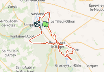
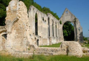
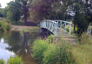
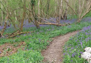
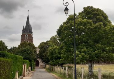
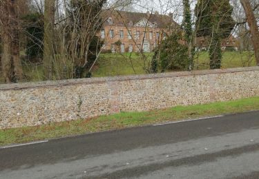
Randonnée V.T.T. de 35 km à découvrir à Normandie, Eure, Launay. Cette randonnée est proposée par 7217Lionel.

Profil altimétrique

Localisation

Pays :
France
Région :
Normandie
Département/Province :
Eure
Commune :
Launay
Localité :
Unknown
Départ:(UTM)
334869 ; 5441064 (31U) N.

Randonnées à proximité

Randonnée Marche Serquigny - serquigny maubuisson - Photo
Marche
werth

Marche

Facile
(1)
Serquigny, Normandie, Eure, France
8,4 km | 10,7 km-effort
2h 26min
Oui
Randonnée Marche nordique Beaumont-le-Roger - CIRCUIT DU HOM - Photo
Marche nordique
7217Lionel

Marche nordique

Très facile
(1)
Beaumont-le-Roger, Normandie, Eure, France
8,6 km | 10,2 km-effort
2h 0min
Oui
Randonnée Marche Beaumont-le-Roger - Beaumont le roger - manoir du hom - Photo
Marche
serleb

Marche

Moyen
Beaumont-le-Roger, Normandie, Eure, France
10,8 km | 12,6 km-effort
3h 2min
Oui
Randonnée Marche Beaumontel - Rando et histoire de Beaumont le Roger - Photo
Marche
serleb

Marche

Moyen
Beaumontel, Normandie, Eure, France
9,5 km | 11,5 km-effort
2h 56min
Oui
Randonnée Marche Beaumontel - Circuit Parissot - Beaumontel - Photo
Marche
tracegps

Marche

Moyen
Beaumontel, Normandie, Eure, France
9,1 km | 10,9 km-effort
2h 15min
Oui
Randonnée V.T.T. Beaumont-le-Roger - La Balad Eure - Photo
V.T.T.
tracegps

V.T.T.

Difficile
(1)
Beaumont-le-Roger, Normandie, Eure, France
34 km | 40 km-effort
2h 30min
Oui
Randonnée Marche Nassandres sur Risle - Nassandres - Photo
Marche
werth

Marche

Moyen
Nassandres sur Risle, Normandie, Eure, France
7,1 km | 8,7 km-effort
2h 9min
Oui
Randonnée Marche Fontaine-l'Abbé - Fontaine l'abbé 3 - Photo
Marche
werth

Marche

Moyen
Fontaine-l'Abbé, Normandie, Eure, France
8,4 km | 10,4 km-effort
2h 35min
Oui
Randonnée Marche Fontaine-l'Abbé - autour de Fontaine l abbe - Photo
Marche
ymarvin

Marche

Facile
Fontaine-l'Abbé, Normandie, Eure, France
7,1 km | 8,6 km-effort
1h 32min
Oui


Fermer
Mes abonnements