Randonnée Marche Huldenberg - #190426 - Merveilleux parcours au départ de Sint-Agatha-Rode**** - Photo

#190426 - Merveilleux parcours au départ de Sint-Agatha-Rode****

 Randos Ouvertes
Randos Ouvertes

Utilisateur

© OpenStreetMap contributors
Longueur
Longueur
6,1 km
Altitude max
Altitude max
96 m
Dénivelé positif
Dénivelé positif
105 m
Km-Effort
Km-Effort  
7,5 km
Altitude min
Altitude min
28 m
Dénivelé négatif
Dénivelé négatif
105 m
Boucle
Boucle
Oui
Date de création :
2023-06-15 17:18:07.299
Dernière modification :
2023-06-15 17:19:33.651

(1 Avis)

Marche
Marche
1h41
Difficulté : Moyen

Scannez ce code QR pour ouvrir la randonnée dans l'application SityTrail

Application GPS de randonnée GRATUITE

Logo SityTrail SityTrail

IGN / Instituts géographiques

Télécharger SityTrail sur l'App Store Télécharger SityTrail sur Google Play

Logo SityTrail SityTrail World

Le monde est à vous

Télécharger SityTrail sur l'App Store Télécharger SityTrail sur Google Play Télécharger SityTrail sur Huawei AppGallery

À propos

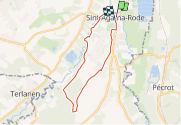
Randonnée Marche de 6,1 km à découvrir à Flandre, Brabant flamand, Huldenberg. Cette randonnée est proposée par Randos Ouvertes.

Description

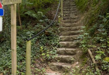
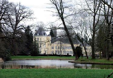
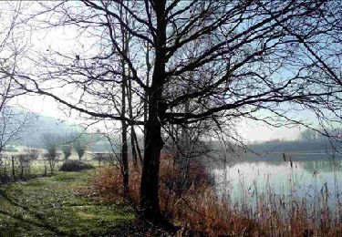
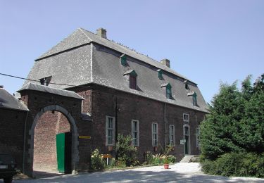
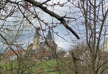
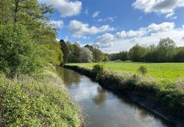
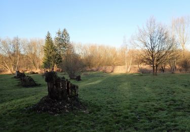
Parcours bucolique commençant le long de la Lane**** qui fait de sinueux méandres à cet endroit. Successions de superbes écrins de verdure dans des cuvettes, de côteaux. Arbres remarquables. La deuxième partie revient par les bois et les champs. Superbe vue à 360° avant de redescendre sur l'Église**** et son gigantesque platane****.

Profil altimétrique

Points d'intérêt

Point d'intérêt Huldenberg - Platane remarquable en face de l'église Sint-Agatha - Photo
Randos Ouvertes
Point d'intérêt Huldenberg - Église Sint-Agatha - Photo
Randos Ouvertes
Point d'intérêt Huldenberg - Au bord de la Lane - Photo
Randos Ouvertes
HULDENBERG 
Point d'intérêt Huldenberg - Molenveld - Photo
Randos Ouvertes
HULDENBERG 
Point d'intérêt Huldenberg - Zavel 1 - Photo
Randos Ouvertes
HULDENBERG 
Point d'intérêt Huldenberg - Zavel 2 - Photo
Randos Ouvertes
HULDENBERG 
Point d'intérêt Huldenberg - Zavel 3 - Photo
Randos Ouvertes
HULDENBERG 
Point d'intérêt Huldenberg - En lisière du sint-Agatha-Rodebos - Photo
Randos Ouvertes
Point d'intérêt Huldenberg - Chemin bucolique au sud de Sint-Agatha-Rode - Photo
Randos Ouvertes

Localisation

Pays :
Belgique
Région :
Flandre
Département/Province :
Brabant flamand
Commune :
Huldenberg
Localité :
Rhode-Sainte-Agathe
Départ:(Dec)
Départ:(UTM)
615187 ; 5627407 (31U) N.

Commentaires

Veuillez vous connecter pour laisser un commentaire ou une note


Randonnées à proximité

Randonnée Marche Grez-Doiceau - RL-GG-01_Archennes_Wavre - Photo
Marche
PRO

Marche

Très difficile
(5)
Grez-Doiceau, Wallonie, Brabant wallon, Belgique
23 km | 28 km-effort
5h 59min
Non
Randonnée Marche Grez-Doiceau - RB-Bw-06_Pécrot_Via-raccourci-1 - Photo
Marche
PRO

Marche

Facile
(5)
Grez-Doiceau, Wallonie, Brabant wallon, Belgique
7 km | 8,4 km-effort
1h 49min
Oui
Randonnée Marche Grez-Doiceau - RB-Bw-06_Pécrot_Via-raccourci-2 - Photo
Marche
PRO

Marche

Facile
(10)
Grez-Doiceau, Wallonie, Brabant wallon, Belgique
14,6 km | 17,1 km-effort
3h 52min
Oui
Randonnée Marche Grez-Doiceau - RB-BW-06-Pécro - Photo
Marche
PRO

Marche

Facile
(8)
Grez-Doiceau, Wallonie, Brabant wallon, Belgique
24 km | 28 km-effort
5h 29min
Oui
Randonnée Marche Grez-Doiceau - RL-GG-21_Pécrot_Genval - Photo
Marche
PRO

Marche

Très difficile
(3)
Grez-Doiceau, Wallonie, Brabant wallon, Belgique
26 km | 31 km-effort
7h 0min
Non
Randonnée Marche Huldenberg - #230710 - Neerijse, nature idyllique dans la réserve naturelle de Doode Bemde**** - Photo
Marche
Randos Ouvertes

Marche

Moyen
(1)
Huldenberg, Flandre, Brabant flamand, Belgique
5,9 km | 6,7 km-effort
1h 30min
Oui
Randonnée Marche Overijse - #230220 - Terlanen, Schaatbroekbos, GR579**** - Photo
Marche
Randos Ouvertes

Marche

Moyen
(1)
Overijse, Flandre, Brabant flamand, Belgique
7,2 km | 8,4 km-effort
1h 55min
Oui
Randonnée Marche Grez-Doiceau - #221104 - Florival > Pécrot, GRP127 - Photo
Marche
Randos Ouvertes

Marche

Moyen
(2)
Grez-Doiceau, Wallonie, Brabant wallon, Belgique
7 km | 8,4 km-effort
1h 55min
Oui
Randonnée Marche Grez-Doiceau - #210224 - Rés. nat. Florival, étang de Pécrot, Sept Bonniers*** - Photo
Marche
Randos Ouvertes

Marche

Moyen
(3)
Grez-Doiceau, Wallonie, Brabant wallon, Belgique
7,1 km | 8,4 km-effort
1h 54min
Oui


Fermer
Mes abonnements