Randonnée Marche Ooststellingwerf - Le Stellingenpad - Photo
 mumu.larandonneuse
mumu.larandonneuse

Utilisateur GUIDE

© OpenStreetMap contributors
Longueur
Longueur
225 km
Altitude max
Altitude max
28 m
Dénivelé positif
Dénivelé positif
1141 m
Km-Effort
Km-Effort  
240 km
Altitude min
Altitude min
-6 m
Dénivelé négatif
Dénivelé négatif
1141 m
Boucle
Boucle
Oui
Date de création :
2023-06-29 06:34:24.789
Dernière modification :
2023-06-29 11:55:14.528

(0 Avis)

Marche
Marche
54h33
Difficulté : Très difficile

Scannez ce code QR pour ouvrir la randonnée dans l'application SityTrail

Application GPS de randonnée GRATUITE

Logo SityTrail SityTrail

IGN / Instituts géographiques

Télécharger SityTrail sur l'App Store Télécharger SityTrail sur Google Play

Logo SityTrail SityTrail World

Le monde est à vous

Télécharger SityTrail sur l'App Store Télécharger SityTrail sur Google Play Télécharger SityTrail sur Huawei AppGallery

À propos

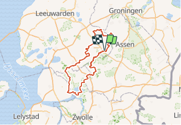
Randonnée Marche de 225 km à découvrir à Frise, Inconnu, Ooststellingwerf. Cette randonnée est proposée par mumu.larandonneuse.

Description

ℹ️ Long d’environ 260 km, le Stellingenpad vous emmènera dans de superbes endroits méconnus et féériques de la région des Stellingwerven. L’itinéraire passe par la Frise du sud-est, l’ouest de la Drenthe et les hauteurs de l’Overijssel. La randonnée compte 15 étapes de 12 à 28 km et traverse le réseau de points-nœuds du pays. Vous pourrez profiter de paysages variés, tels que des landes, des forêts et des abords de rivière. La nature vous fera vivre des aventures essentielles : se détendre et profiter de la nature.

Profil altimétrique

Localisation

Pays :
Pays-Bas
Région :
Frise
Département/Province :
Inconnu
Commune :
Ooststellingwerf
Localité :
Unknown
Départ:(Dec)
Départ:(UTM)
321540 ; 5870218 (32U) N.

Randonnées à proximité

Randonnée Marche Ooststellingwerf - Friesland - Wandeling Doorsteek Aekingerzand - Photo
Marche
gpstracks

Marche

Très facile
(1)
Ooststellingwerf, Frise, Inconnu, Pays-Bas
7,7 km | 8,4 km-effort
Inconnu
Oui
Randonnée Moteur Ooststellingwerf - a-friesland-rondje-frl-gn-dr - Photo
Moteur
gpstracks

Moteur

Très facile
Ooststellingwerf, Frise, Inconnu, Pays-Bas
136 km | 145 km-effort
Inconnu
Oui
Randonnée Moteur Ooststellingwerf - a-friesland-gemeente-ooststellingwerf-2008 - Photo
Moteur
gpstracks

Moteur

Très facile
Ooststellingwerf, Frise, Inconnu, Pays-Bas
156 km | 165 km-effort
Inconnu
Non
Randonnée Vélo Ooststellingwerf - Friesland - Fiets-op de grens van Friesland en Drenthe - Photo
Vélo
gpstracks

Vélo

Très facile
Ooststellingwerf, Frise, Inconnu, Pays-Bas
203 km | 217 km-effort
Inconnu
Oui
Randonnée Vélo Ooststellingwerf - f-friesland-woldenroute - Photo
Vélo
gpstracks

Vélo

Très facile
Ooststellingwerf, Frise, Inconnu, Pays-Bas
32 km | 35 km-effort
Inconnu
Oui
Randonnée Vélo Ooststellingwerf - f-friesland-veenroute - Photo
Vélo
gpstracks

Vélo

Très facile
Ooststellingwerf, Frise, Inconnu, Pays-Bas
32 km | 34 km-effort
Inconnu
Oui
Randonnée V.T.T. Ooststellingwerf - m-friesland-klamer-mtb-appelscha-2010 - Photo
V.T.T.
gpstracks

V.T.T.

Très facile
Ooststellingwerf, Frise, Inconnu, Pays-Bas
92 km | 100 km-effort
Inconnu
Oui
Randonnée V.T.T. Ooststellingwerf - m-friesland-atbtocht-appelscha - Photo
V.T.T.
gpstracks

V.T.T.

Très facile
Ooststellingwerf, Frise, Inconnu, Pays-Bas
77 km | 84 km-effort
Inconnu
Oui
Randonnée V.T.T. Ooststellingwerf - Friesland - Mountainbikeroute Appelscha - Photo
V.T.T.
gpstracks

V.T.T.

Très facile
Ooststellingwerf, Frise, Inconnu, Pays-Bas
19,8 km | 22 km-effort
Inconnu
Oui


Fermer
Mes abonnements