


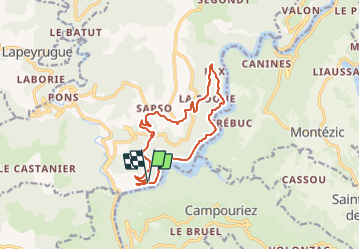

19,1 km | 30 km-effort


Utilisateur


Application GPS de randonnée GRATUITE
 SityTrail
IGN / Instituts géographiques
SityTrail World
Le monde est à vous
Randonnée Marche de 13,7 km à découvrir à Occitanie, Aveyron, Saint-Hippolyte. Cette randonnée est proposée par neoroll44.
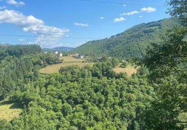
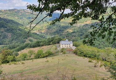
Tout en surplombant le lac de Couesques, une randonnée hors du temps où l’on rencontre une nature et un habitat encore protégés.
Marche


Marche
Marche
Marche

Course à pied
V.T.T.
Marche