


Refuge des anges vers l'archeboc

Stéphane Ruchet
Utilisateur
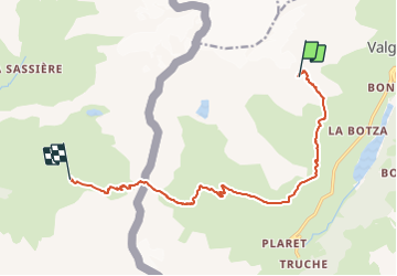

Longueur
12,4 km

Altitude max
2899 m

Dénivelé positif
695 m
Km-Effort
25 km

Altitude min
2028 m

Dénivelé négatif
1551 m
Boucle
Non
Date de création :
2023-08-02 08:10:24.476
Dernière modification :
2023-08-02 08:11:36.632
5h34
Difficulté : Très difficile

Application GPS de randonnée GRATUITE
 SityTrail
IGN / Instituts géographiques
SityTrail Plus
Le monde est à vous
À propos
Randonnée Marche de 12,4 km à découvrir à Vallée d'Aoste, Inconnu, Valgrisenche. Cette randonnée est proposée par Stéphane Ruchet.
Localisation
Pays :
Italie
Région :
Vallée d'Aoste
Département/Province :
Inconnu
Commune :
Valgrisenche
Localité :
Unknown
Départ:(Dec)
Départ:(UTM)
346428 ; 5054224 (32T) N.
Commentaires