Randonnée Marche Lampaul-Plouarzel - 09.09.23  Lampaul- Plouarzel  -- Le Conquet - Photo

09.09.23 Lampaul- Plouarzel -- Le Conquet

 donda
donda

Utilisateur

© OpenStreetMap contributors
Longueur
Longueur
21 km
Altitude max
Altitude max
42 m
Dénivelé positif
Dénivelé positif
338 m
Km-Effort
Km-Effort  
26 km
Altitude min
Altitude min
0 m
Dénivelé négatif
Dénivelé négatif
313 m
Boucle
Boucle
Non
Date de création :
2023-09-09 08:11:35.293
Dernière modification :
2023-10-05 08:37:22.26

(0 Avis)

Marche
Marche
5h49
Difficulté : Très difficile

Scannez ce code QR pour ouvrir la randonnée dans l'application SityTrail

Application GPS de randonnée GRATUITE

Logo SityTrail SityTrail

IGN / Instituts géographiques

Télécharger SityTrail sur l'App Store Télécharger SityTrail sur Google Play

Logo SityTrail SityTrail World

Le monde est à vous

Télécharger SityTrail sur l'App Store Télécharger SityTrail sur Google Play Télécharger SityTrail sur Huawei AppGallery

À propos

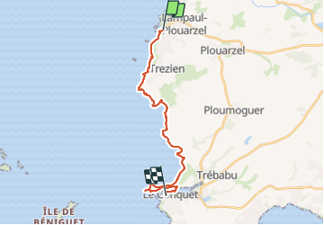
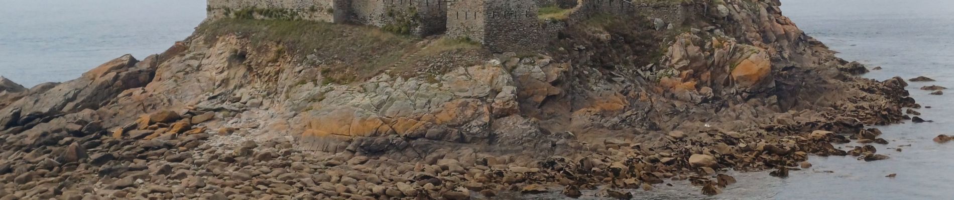
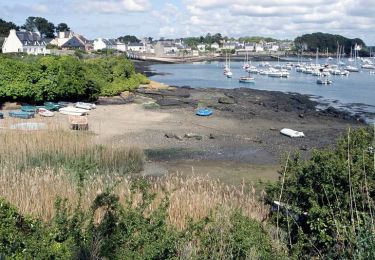
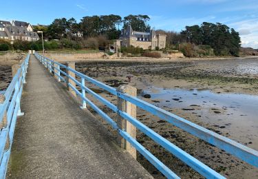
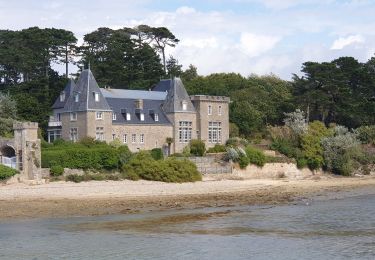
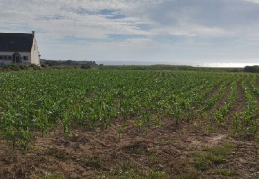
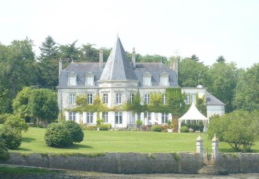
Randonnée Marche de 21 km à découvrir à Bretagne, Finistère, Lampaul-Plouarzel. Cette randonnée est proposée par donda.

Description

GR34 ( on a pris le taxi du camping du Tromeur à Lampaul- Plouarzel 20.00€ 4 Pers)

Profil altimétrique

Photos

Localisation

Pays :
France
Région :
Bretagne
Département/Province :
Finistère
Commune :
Lampaul-Plouarzel
Localité :
Unknown
Départ:(UTM)
368636 ; 5367217 (30U) N.

Randonnées à proximité

Randonnée Marche Lanildut - Autour de Lanildut  - Photo
Marche
tracegps

Marche

Facile
(2)
Lanildut, Bretagne, Finistère, France
7 km | 8 km-effort
1h 45min
Oui
Randonnée Marche Ploumoguer - Blanc sablons - Photo
Marche
jybe

Marche

(1)
Ploumoguer, Bretagne, Finistère, France
15,5 km | 18,9 km-effort
4h 31min
Oui
Randonnée Marche Lampaul-Plouarzel - Lanpaul - Lochrist - Photo
Marche
swp648

Marche

Moyen
Lampaul-Plouarzel, Bretagne, Finistère, France
19,8 km | 24 km-effort
5h 7min
Non
Randonnée Marche Lanildut - Aber Ildut - Tremazan - Photo
Marche
med88

Marche

Facile
Lanildut, Bretagne, Finistère, France
19,5 km | 22 km-effort
4h 42min
Non
Randonnée Marche Porspoder - Circuit de la pointe Garchine par les terres. - Photo
Marche
Dervalmarc

Marche

Très facile
(1)
Porspoder, Bretagne, Finistère, France
9,3 km | 10,5 km-effort
2h 57min
Oui
Randonnée Marche Lanildut - Lanildut Porspoder - Photo
Marche
cron

Marche

Moyen
(1)
Lanildut, Bretagne, Finistère, France
18,3 km | 21 km-effort
4h 34min
Oui
Randonnée V.T.T. Ploumoguer - Rando de Noël au nord de Brest - Ploumoguer - Photo
V.T.T.
tracegps

V.T.T.

Très difficile
Ploumoguer, Bretagne, Finistère, France
85 km | 96 km-effort
7h 0min
Oui
Randonnée V.T.T. Ploumoguer - 73 km autour de Ploumoguer - Photo
V.T.T.
tracegps

V.T.T.

Très difficile
Ploumoguer, Bretagne, Finistère, France
73 km | 87 km-effort
7h 0min
Oui
Randonnée V.T.T. Ploumoguer - De Ploumoguer à la pointe St-Mathieu - Photo
V.T.T.
tracegps

V.T.T.

Difficile
Ploumoguer, Bretagne, Finistère, France
47 km | 55 km-effort
3h 15min
Oui


Fermer
Mes abonnements