


weiterswiller auberge imbsthal

anniston
Utilisateur
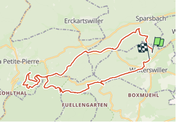

Longueur
22 km

Altitude max
395 m

Dénivelé positif
642 m
Km-Effort
31 km

Altitude min
219 m

Dénivelé négatif
653 m
Boucle
Non
Date de création :
2023-09-24 08:19:49.084
Dernière modification :
2023-09-30 18:35:56.291
4h32
Difficulté : Difficile

Application GPS de randonnée GRATUITE
 SityTrail
IGN / Instituts géographiques
SityTrail Plus
Le monde est à vous
À propos
Randonnée Randonnée équestre de 22 km à découvrir à Grand Est, Bas-Rhin, Weiterswiller. Cette randonnée est proposée par anniston.
Localisation
Pays :
France
Région :
Grand Est
Département/Province :
Bas-Rhin
Commune :
Weiterswiller
Localité :
Unknown
Départ:(Dec)
Départ:(UTM)
383790 ; 5413298 (32U) N.
Commentaires